TopoQuest Logo
Do you find TopoQuest useful?
Help keep TopoQuest running and adding new maps/features by donating!
Bitcoin:  19c7KJd3qBynnjoSw5npx9KScwjBe4ifkT
Litecoin:  LXs6TkuXGGXo1vDsWCkWVdjQX94eUKd6ui
Home View Maps Find Maps Find Places Resources & Links


Uncompahgre Peak, Colorado Topographic Map

USGS Map Title: Uncompahgre Peak, CO
USGS Map MRC: 38107A4
DRG (GeoTIFF) Download: o38107a4.tif


Neighboring USGS Topographic Map Quads:


  Courthouse Mountain, CO  
38107B5
 

  Sheep Mountain, CO  
38107B4
 

  Alpine Plateau, CO  
38107B3
 

  Wetterhorn Peak, CO  
38107A5
 

  Uncompahgre Peak, CO  
38107A4
 

  Lake City, CO  
38107A3
 

  Handies Peak, CO  
37107H5
 

  Redcloud Peak, CO  
37107H4
 

  Lake San Cristobal, CO  
37107H3


Map MRC Location:

N39°
W108°
N39°
W107°
H8 H7 H6 H5 H4 H3 H2 H1
G8 G7 G6 G5 G4 G3 G2 G1
F8 F7 F6 F5 F4 F3 F2 F1
E8 E7 E6 E5 E4 E3 E2 E1
D8 D7 D6 D5 D4 D3 D2 D1
C8 C7 C6 C5 C4 C3 C2 C1
B8 B7 B6 B5 B4 B3 B2 B1
A8 A7 A6 A5 A4 A3 A2 A1
N38°
W108°
N38°
W107°

Uncompahgre Peak, CO USGS 1:24K Topographic Map Preview:
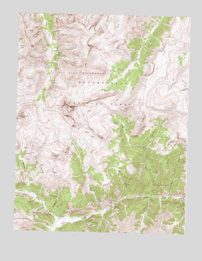
Uncompahgre Peak, CO USGS Topographic Map
Click on map above to begin viewing in our Map Viewer.

This topographic map contains these locations and features:
Feature Name Type Latitude Longitude GNIS ID View Map
Ajax Number Two MineMineN38.0078°W107.4664°1745628View Map
Bess MineMineN38.0078°W107.4664°1745629View Map
Beth Number One MineMineN38.0472°W107.4742°1745630View Map
Big Blue TrailTrailN38.0956°W107.4373°188689View Map
Big Blue WildernessReserveN38.1083°W107.4589°197601View Map
Big Casino GulchValleyN38.0163°W107.4288°188682View Map
Broken HillSummitN38.0428°W107.4717°188676View Map
Capitol City (historical)Populated PlaceN38.0072°W107.4667°203896View Map
Capitol City MineMineN38.0078°W107.4656°1745631View Map
Copper GulchValleyN38.0111°W107.4385°187413View Map
Czar MineMineN38.0150°W107.4648°188672View Map
Czarina MineMineN38.0144°W107.4676°188671View Map
El Paso CreekStreamN38.0122°W107.4348°188680View Map
Excelsior MineMineN38.0056°W107.4756°1735441View Map
Gallic-Vulcan MineMineN38.0222°W107.4756°1745627View Map
HensonPopulated PlaceN38.0208°W107.3770°188690View Map
Iron BedsCliffN38.0383°W107.4831°188679View Map
Lee Smelter GulchValleyN38.0087°W107.4484°187412View Map
Matterhorn CreekStreamN38.0233°W107.4937°188675View Map
Matterhorn PeakSummitN38.0650°W107.4959°188677View Map
Modoc CreekStreamN38.0206°W107.3856°188684View Map
Nellie CreekStreamN38.0203°W107.4012°188685View Map
North Fork Henson CreekStreamN38.0072°W107.4589°188670View Map
Owl GulchValleyN38.0208°W107.4021°187414View Map
Pole CreekStreamN38.0200°W107.4151°188681View Map
Pride of America MineMineN38.0139°W107.4276°188683View Map
Resorgimento MineMineN38.0139°W107.4276°1745634View Map
Saint Louis MineMineN38.0092°W107.4723°1745635View Map
Silver CreekStreamN38.1030°W107.4751°188687View Map
Silver Jack MineMineN38.1025°W107.4714°188688View Map
Silver MountainSummitN38.1069°W107.4495°188686View Map
Uncompahgre PeakSummitN38.0717°W107.4620°188678View Map
Uncompahgre WildernessReserveN38.1001°W107.4878°2035331View Map
Ute and Ulay Group MineMineN38.0192°W107.3770°1745626View Map
Ute CreekStreamN38.0203°W107.3778°188692View Map
Vermont MineMineN38.0044°W107.4720°1745636View Map
Woodstock MineMineN38.0208°W107.4714°1745625View Map
Yellow Medicine MineMineN38.0197°W107.4712°1745637View Map
Yellowstone GulchValleyN38.0102°W107.4738°188673View Map
Young America MineMineN38.0044°W107.4720°1745638View Map

Note: Coordinates in the location and feature list above are referenced to NAD83 datum.


Copyright (C) 2008-2024 Ryan Niemi / Sunset Dynamics ... All Rights Reserved