TopoQuest Logo
Do you find TopoQuest useful?
Help keep TopoQuest running and adding new maps/features by donating!
Bitcoin:  19c7KJd3qBynnjoSw5npx9KScwjBe4ifkT
Litecoin:  LXs6TkuXGGXo1vDsWCkWVdjQX94eUKd6ui
Home View Maps Find Maps Find Places Resources & Links


Tonieville, Kentucky Topographic Map

USGS Map Title: Tonieville, KY
USGS Map MRC: 37085E7
DRG (GeoTIFF) Download: o37085e7.tif


Neighboring USGS Topographic Map Quads:


  Cecilia, KY  
37085F8
 

  Elizabethtown, KY  
37085F7
 

  Nelsonville, KY  
37085F6
 

  Sonora, KY  
37085E8
 

  Tonieville, KY  
37085E7
 

  Hodgenville, KY  
37085E6
 

  Upton, KY  
37085D8
 

  Hammonville, KY  
37085D7
 

  Magnolia, KY  
37085D6


Map MRC Location:

N38°
W86°
N38°
W85°
H8 H7 H6 H5 H4 H3 H2 H1
G8 G7 G6 G5 G4 G3 G2 G1
F8 F7 F6 F5 F4 F3 F2 F1
E8 E7 E6 E5 E4 E3 E2 E1
D8 D7 D6 D5 D4 D3 D2 D1
C8 C7 C6 C5 C4 C3 C2 C1
B8 B7 B6 B5 B4 B3 B2 B1
A8 A7 A6 A5 A4 A3 A2 A1
N37°
W86°
N37°
W85°

Tonieville, KY USGS 1:24K Topographic Map Preview:
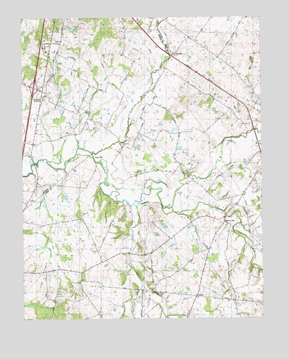
Tonieville, KY USGS Topographic Map
Click on map above to begin viewing in our Map Viewer.

This topographic map contains these locations and features:
Feature Name Type Latitude Longitude GNIS ID View Map
Barren RunStreamN37.5476°W85.8169°486430View Map
Barren Run Baptist ChurchChurchN37.5104°W85.8045°486431View Map
Big Spring CemeteryCemeteryN37.5720°W85.8227°487267View Map
Chestnut ForkStreamN37.5139°W85.8127°489430View Map
Clear RunStreamN37.5706°W85.8430°489642View Map
Eagle MillsLocaleN37.5659°W85.8350°491410View Map
First Union ChurchChurchN37.6145°W85.8569°492101View Map
Glendale JunctionPopulated PlaceN37.5914°W85.8636°492895View Map
Heady Spring (historical)SpringN37.5745°W85.8189°509880View Map
Hornback AirportAirportN37.6204°W85.7914°517403View Map
Jackson BranchStreamN37.5662°W85.8622°495100View Map
Mathers MillPopulated PlaceN37.5403°W85.7691°508557View Map
Middle CreekStreamN37.5687°W85.8385°498104View Map
Morrison BranchStreamN37.5442°W85.7950°498627View Map
Nolynn Baptist ChurchChurchN37.5603°W85.7897°499513View Map
North Fork Nolin RiverStreamN37.5464°W85.7975°499559View Map
Pup RunStreamN37.5709°W85.8458°501458View Map
Saint Anthonys Church (historical)ChurchN37.5759°W85.8550°509849View Map
Siberia ChurchChurchN37.5434°W85.8439°503482View Map
South Fork Nolin RiverStreamN37.5462°W85.7972°503938View Map
TannerPopulated PlaceN37.5095°W85.7850°509184View Map
TonievillePopulated PlaceN37.6095°W85.7961°509221View Map
Williams CemeteryCemeteryN37.6198°W85.8088°506803View Map
WRZI-FM (Buffalo)TowerN37.5853°W85.8389°517927View Map
WRZI-FM (Buffalo)TowerN37.6059°W85.7719°517928View Map

Note: Coordinates in the location and feature list above are referenced to NAD83 datum.


Copyright (C) 2008-2024 Ryan Niemi / Sunset Dynamics ... All Rights Reserved