TopoQuest Logo
Do you find TopoQuest useful?
Help keep TopoQuest running and adding new maps/features by donating!
Bitcoin:  19c7KJd3qBynnjoSw5npx9KScwjBe4ifkT
Litecoin:  LXs6TkuXGGXo1vDsWCkWVdjQX94eUKd6ui
Home View Maps Find Maps Find Places Resources & Links


Tison, Georgia Topographic Map

USGS Map Title: Tison, GA
USGS Map MRC: 31082H1
DRG (GeoTIFF) Download: o31082h1.tif


Neighboring USGS Topographic Map Quads:


  Reidsville West, GA  
32082A2
 

  Reidsville East, GA  
32082A1
 

  Deans Crossing, GA  
32081A8
 

  Altamaha, GA  
31082H2
 

  Tison, GA  
31082H1
 

  Glennville, GA  
31081H8
 

  Altamaha SW, GA  
31082G2
 

  Altamaha SE, GA  
31082G1
 

  Glennville SW, GA  
31081G8


Map MRC Location:

N32°
W83°
N32°
W82°
H8 H7 H6 H5 H4 H3 H2 H1
G8 G7 G6 G5 G4 G3 G2 G1
F8 F7 F6 F5 F4 F3 F2 F1
E8 E7 E6 E5 E4 E3 E2 E1
D8 D7 D6 D5 D4 D3 D2 D1
C8 C7 C6 C5 C4 C3 C2 C1
B8 B7 B6 B5 B4 B3 B2 B1
A8 A7 A6 A5 A4 A3 A2 A1
N31°
W83°
N31°
W82°

Tison, GA USGS 1:24K Topographic Map Preview:
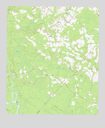
Tison, GA USGS Topographic Map
Click on map above to begin viewing in our Map Viewer.

This topographic map contains these locations and features:
Feature Name Type Latitude Longitude GNIS ID View Map
Battle Creek ChurchChurchN31.9935°W82.0423°310865View Map
Cow Ford BridgeBridgeN31.9202°W82.1129°347396View Map
Cow Ford School (historical)SchoolN31.9246°W82.0921°347397View Map
Dinkins BaySwampN31.9291°W82.0498°313475View Map
Dinner Branch School (historical)SchoolN31.9121°W82.0498°347399View Map
Dukes PondSwampN31.9474°W82.1087°313718View Map
Five PointsPopulated PlaceN31.9221°W82.0340°326283View Map
Four Acre CreekStreamN31.9238°W82.1207°314315View Map
Hopewell ChurchChurchN31.8966°W82.0304°315647View Map
Mount Zion ChurchChurchN31.9419°W82.0312°318963View Map
Oak Grove Missionary Baptist ChurchChurchN31.9208°W82.0710°319783View Map
Ohoopee RiverStreamN31.9016°W82.1151°319929View Map
Padgett BaySwampN31.9185°W82.0193°320150View Map
Pine View ChurchChurchN31.9999°W82.0712°320654View Map
Roberts Chapel (historical)ChurchN31.9488°W82.0871°347435View Map
Sand Hill CemeteryCemeteryN31.9496°W82.0868°322418View Map
Stanfield CemeteryCemeteryN31.8985°W82.0632°347441View Map
Stony Hill ChurchChurchN31.9819°W82.0546°323654View Map
Sugar BaySwampN31.9588°W82.1079°347443View Map
Surrencys PondReservoirN31.9429°W82.0113°341380View Map
Surrencys Pond DamDamN31.9419°W82.0115°341379View Map
TisonPopulated PlaceN31.9385°W82.0207°333238View Map
Watermelon ChurchChurchN31.9277°W82.0207°324901View Map

Note: Coordinates in the location and feature list above are referenced to NAD83 datum.


Copyright (C) 2008-2024 Ryan Niemi / Sunset Dynamics ... All Rights Reserved