TopoQuest Logo
Do you find TopoQuest useful?
Help keep TopoQuest running and adding new maps/features by donating!
Bitcoin:  19c7KJd3qBynnjoSw5npx9KScwjBe4ifkT
Litecoin:  LXs6TkuXGGXo1vDsWCkWVdjQX94eUKd6ui
Home View Maps Find Maps Find Places Resources & Links


Three Rivers East, Michigan Topographic Map

USGS Map Title: Three Rivers East, MI
USGS Map MRC: 41085H5
DRG (GeoTIFF) Download: o41085h5.tif


Neighboring USGS Topographic Map Quads:


  Schoolcraft, MI  
42085A6
 

  Vicksburg, MI  
42085A5
 

  Mendon, MI  
42085A4
 

  Three Rivers West, MI  
41085H6
 

  Three Rivers East, MI  
41085H5
 

  Nottawa, MI  
41085H4
 

  Constantine, MI  
41085G6
 

  Klinger Lake, MI  
41085G5
 

  Sturgis, MI  
41085G4


Map MRC Location:

N42°
W86°
N42°
W85°
H8 H7 H6 H5 H4 H3 H2 H1
G8 G7 G6 G5 G4 G3 G2 G1
F8 F7 F6 F5 F4 F3 F2 F1
E8 E7 E6 E5 E4 E3 E2 E1
D8 D7 D6 D5 D4 D3 D2 D1
C8 C7 C6 C5 C4 C3 C2 C1
B8 B7 B6 B5 B4 B3 B2 B1
A8 A7 A6 A5 A4 A3 A2 A1
N41°
W86°
N41°
W85°

Three Rivers East, MI USGS 1:24K Topographic Map Preview:
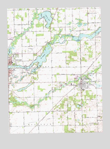
Three Rivers East, MI USGS Topographic Map
Click on map above to begin viewing in our Map Viewer.

This topographic map contains these locations and features:
Feature Name Type Latitude Longitude GNIS ID View Map
Adams ParkParkN41.9197°W85.5303°2401173View Map
Amish CemeteryCemeteryN41.9255°W85.5153°2401164View Map
Barrows SchoolSchoolN41.9459°W85.6236°1624371View Map
Bethel Baptist ChurchChurchN41.9406°W85.6083°2417874View Map
Bullhead LakeLakeN41.9016°W85.5326°1624424View Map
Burr Oak Methodist ChurchChurchN41.9211°W85.5233°2401054View Map
Centre Chateaux Mobile Home ParkPopulated PlaceN41.9258°W85.5308°2401073View Map
CentrevillePopulated PlaceN41.9234°W85.5283°1624448View Map
Centreville Baptist ChurchChurchN41.9228°W85.5225°2401055View Map
Centreville Fire DepartmentBuildingN41.9240°W85.5287°2401071View Map
Centreville High SchoolSchoolN41.9181°W85.5250°2401130View Map
Centreville Police DepartmentBuildingN41.9240°W85.5287°2401069View Map
Centreville Post OfficePost OfficeN41.9228°W85.5283°2401063View Map
Centreville Station (historical)LocaleN41.9325°W85.5286°2401061View Map
Centreville United Methodist ChurchChurchN41.9239°W85.5231°2401056View Map
Centreville Village CemeteryCemeteryN41.9264°W85.5092°2401174View Map
County Training SchoolSchoolN41.8909°W85.5061°1624479View Map
Covered Bridge ParkParkN41.9689°W85.5383°2418192View Map
Culberson CemeteryCemeteryN41.9764°W85.5283°1624483View Map
Davis BridgeBridgeN41.9653°W85.5694°1624487View Map
Fairview Living CenterHospitalN41.9244°W85.5197°2401089View Map
Fishers LakeLakeN41.9904°W85.5728°1624536View Map
George Washington Carver Community CenterBuildingN41.9461°W85.6203°2418176View Map
Golden Prairie FarmLocaleN41.8845°W85.5879°2743263View Map
Grant ChapelChurchN41.9456°W85.6219°2417869View Map
Hoffman PondReservoirN41.9582°W85.6216°1624607View Map
Hoshel Canoe ParkParkN41.9111°W85.5753°2417891View Map
Huss SchoolSchoolN41.9323°W85.6242°1624621View Map
Langley Covered BridgeBridgeN41.9673°W85.5289°1624667View Map
Langley Covered Bridge Historical MarkerParkN41.9669°W85.5286°2401311View Map
Meadow Lane Village Mobile Home ParkPopulated PlaceN41.9372°W85.6172°2418181View Map
New Hope Assembly of God ChurchChurchN41.9747°W85.6169°2417876View Map
New Jerusalem Baptist ChurchChurchN41.9344°W85.6247°2417300View Map
Ninth Street United Methodist ChurchChurchN41.9383°W85.6231°2417299View Map
Noah LakeLakeN41.9377°W85.5905°1624781View Map
Nottowa Township HallBuildingN41.9239°W85.5294°2401070View Map
Nottowa Township LibraryBuildingN41.9231°W85.5283°2401062View Map
Pahl Point ParkParkN41.9708°W85.5319°2418191View Map
Prairie River CemeteryCemeteryN41.9306°W85.5236°1624845View Map
Riverside CemeteryCemeteryN41.9445°W85.6164°1624862View Map
Riverside Grange HallBuildingN41.9656°W85.5717°1625570View Map
Saint John's Lutheran ChurchChurchN41.9828°W85.6161°2417302View Map
Saint Joseph CountyCivilN41.9144°W85.5277°1625034View Map
Saint Joseph County CourthouseBuildingN41.9231°W85.5272°2401129View Map
Saint Joseph County Courthouse Historical Marker (historical)ParkN41.9236°W85.5267°2401320View Map
Saint Joseph County FairgroundsLocaleN41.9194°W85.5208°2401109View Map
Saint Joseph County Sheriff's OfficeBuildingN41.9228°W85.5148°2401072View Map
Saint Paul's Lutheran ChurchChurchN41.9217°W85.5414°2401057View Map
South Park CemeteryCemeteryN41.9980°W85.5569°2401163View Map
Spring CreekStreamN41.9317°W85.5222°1624951View Map
Stewart House Historical Marker (historical)ParkN41.9278°W85.5656°2401319View Map
Sturgis DamDamN41.9706°W85.5386°1624966View Map
Three Rivers High SchoolSchoolN41.9492°W85.6125°2418184View Map
Three Rivers Middle SchoolSchoolN41.9528°W85.6175°2418185View Map
Three Rivers Municipal Airport Dr HainesAirportN41.9570°W85.5903°1624333View Map
Township of LockportCivilN41.9399°W85.5820°1626635View Map
Village of CentrevilleCivilN41.9213°W85.5259°2397592View Map

Note: Coordinates in the location and feature list above are referenced to NAD83 datum.


Copyright (C) 2008-2024 Ryan Niemi / Sunset Dynamics ... All Rights Reserved