TopoQuest Logo
Do you find TopoQuest useful?
Help keep TopoQuest running and adding new maps/features by donating!
Bitcoin:  19c7KJd3qBynnjoSw5npx9KScwjBe4ifkT
Litecoin:  LXs6TkuXGGXo1vDsWCkWVdjQX94eUKd6ui
Home View Maps Find Maps Find Places Resources & Links


Vicksburg, Michigan Topographic Map

USGS Map Title: Vicksburg, MI
USGS Map MRC: 42085A5
DRG (GeoTIFF) Download: o42085a5.tif


Neighboring USGS Topographic Map Quads:


  Schoolcraft NW, MI  
42085B6
 

  Portage, MI  
42085B5
 

  Adams Park, MI  
42085B4
 

  Schoolcraft, MI  
42085A6
 

  Vicksburg, MI  
42085A5
 

  Mendon, MI  
42085A4
 

  Three Rivers West, MI  
41085H6
 

  Three Rivers East, MI  
41085H5
 

  Nottawa, MI  
41085H4


Map MRC Location:

N43°
W86°
N43°
W85°
H8 H7 H6 H5 H4 H3 H2 H1
G8 G7 G6 G5 G4 G3 G2 G1
F8 F7 F6 F5 F4 F3 F2 F1
E8 E7 E6 E5 E4 E3 E2 E1
D8 D7 D6 D5 D4 D3 D2 D1
C8 C7 C6 C5 C4 C3 C2 C1
B8 B7 B6 B5 B4 B3 B2 B1
A8 A7 A6 A5 A4 A3 A2 A1
N42°
W86°
N42°
W85°

Vicksburg, MI USGS 1:24K Topographic Map Preview:
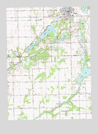
Vicksburg, MI USGS Topographic Map
Click on map above to begin viewing in our Map Viewer.

This topographic map contains these locations and features:
Feature Name Type Latitude Longitude GNIS ID View Map
All Nations TempleChurchN42.0134°W85.5705°1624345View Map
Angels Crossing Golf ClubLocaleN42.1097°W85.5417°2627821View Map
Barton LakeLakeN42.0971°W85.5624°620665View Map
Bethel Apostolic ChurchChurchN42.1200°W85.5292°2627837View Map
Black LakeLakeN42.0856°W85.5814°621504View Map
Center Park CemeteryCemeteryN42.0128°W85.5936°2401167View Map
Center Park ChurchChurchN42.0131°W85.5936°1624446View Map
Charles Clark Memorial ParkParkN42.1194°W85.5347°2627819View Map
Clement CemeteryCemeteryN42.0781°W85.5292°623443View Map
Community Baptist ChurchChurchN42.1178°W85.5314°2627836View Map
Crossroads Community ChurchChurchN42.0917°W85.5769°2627833View Map
Crossroads Missionary ChurchChurchN42.0061°W85.5181°2401140View Map
Fanny M Bair Library Historical MarkerParkN42.1176°W85.5332°2611954View Map
Goose LakeLakeN42.0712°W85.5816°1624569View Map
Goose Lake DrainCanalN42.0237°W85.6003°1624570View Map
Howard LakeLakeN42.0803°W85.5905°628694View Map
Jehovah's Witnesses HallChurchN42.1000°W85.5294°2627823View Map
Kimble LakeLakeN42.0908°W85.5407°629681View Map
Kline's Resort Trailer ParkPopulated PlaceN42.0489°W85.5225°2418180View Map
Mint CemeteryCemeteryN42.0642°W85.5686°1624746View Map
Mint Post Office (historical)Post OfficeN42.0644°W85.5675°2417259View Map
Mud LakeLakeN42.0918°W85.5151°632898View Map
Park Post Office (historical)Post OfficeN42.0658°W85.5286°2417252View Map
ParkvillePopulated PlaceN42.0159°W85.5478°1624812View Map
Parkville CemeteryCemeteryN42.0128°W85.5569°1624813View Map
Parkville Post Office (historical)Post OfficeN42.0158°W85.5478°2417253View Map
Portage CreekStreamN42.0614°W85.5100°1624841View Map
Portage LakeLakeN42.0495°W85.5098°1624842View Map
Prairie Grove SchoolSchoolN42.0914°W85.5786°635392View Map
Saint Martin of Tours ChurchChurchN42.1153°W85.5136°636856View Map
Schoolcraft Township CemeteryCemeteryN42.1144°W85.5403°2627919View Map
Schoolcraft Upper Elementary SchoolSchoolN42.1180°W85.6013°2627851View Map
Scott CemeteryCemeteryN42.0209°W85.5205°1624920View Map
South Kalamazoo County Fire Authority Station 2 Administrative OfficeBuildingN42.1196°W85.5326°2627829View Map
States Golf ClubLocaleN42.1145°W85.5886°1623650View Map
Sunset Lake Elementary SchoolSchoolN42.1233°W85.5411°2627832View Map
Sunset Lake ParkParkN42.1242°W85.5375°2627820View Map
Thrall LakeLakeN42.1221°W85.5069°1614806View Map
Thrall Lake AirportAirportN42.1180°W85.5105°1624191View Map
Township of ParkCivilN42.0271°W85.5867°1626883View Map
Township of SchoolcraftCivilN42.1140°W85.5882°1627049View Map
Tub LakeLakeN42.0878°W85.5749°1615142View Map
Uptegrove LakeLakeN42.1059°W85.5108°1615422View Map
Vicker's Mill Historical MarkerParkN42.1198°W85.5343°2611955View Map
VicksburgPopulated PlaceN42.1200°W85.5328°1615573View Map
Vicksburg Assembly of God ChurchChurchN42.1164°W85.5306°2627834View Map
Vicksburg District LibraryBuildingN42.1200°W85.5333°2627830View Map
Vicksburg High SchoolSchoolN42.1153°W85.5256°2627828View Map
Vicksburg Middle SchoolSchoolN42.1189°W85.5278°2627827View Map
Vicksburg MuseumBuildingN42.1228°W85.5303°2627826View Map
Vicksburg Police DepartmentBuildingN42.1210°W85.5307°2627824View Map
Vicksburg Post OfficePost OfficeN42.1203°W85.5311°2627831View Map
Vicksburg StationLocaleN42.1228°W85.5319°2627822View Map
Vicksburg United Methodist ChurchChurchN42.1186°W85.5325°2627835View Map
Vicksburg Village HallBuildingN42.1200°W85.5303°2627825View Map
Village of VicksburgCivilN42.1142°W85.5370°2400068View Map
West Mendon ChurchChurchN42.0281°W85.5083°1625014View Map

Note: Coordinates in the location and feature list above are referenced to NAD83 datum.


Copyright (C) 2008-2024 Ryan Niemi / Sunset Dynamics ... All Rights Reserved