TopoQuest Logo
Do you find TopoQuest useful?
Help keep TopoQuest running and adding new maps/features by donating!
Bitcoin:  19c7KJd3qBynnjoSw5npx9KScwjBe4ifkT
Litecoin:  LXs6TkuXGGXo1vDsWCkWVdjQX94eUKd6ui
Home View Maps Find Maps Find Places Resources & Links


Terrell North, Texas Topographic Map

USGS Map Title: Terrell North, TX
USGS Map MRC: 32096G3
DRG (GeoTIFF) Download: o32096g3.tif


Neighboring USGS Topographic Map Quads:


  Rockwall, TX  
32096H4
 

  Royse City, TX  
32096H3
 

  Quinlan, TX  
32096H2
 

  Forney North, TX  
32096G4
 

  Terrell North, TX  
32096G3
 

  Poetry, TX  
32096G2
 

  Forney South, TX  
32096F4
 

  Terrell South, TX  
32096F3
 

  Elmo, TX  
32096F2


Map MRC Location:

N33°
W97°
N33°
W96°
H8 H7 H6 H5 H4 H3 H2 H1
G8 G7 G6 G5 G4 G3 G2 G1
F8 F7 F6 F5 F4 F3 F2 F1
E8 E7 E6 E5 E4 E3 E2 E1
D8 D7 D6 D5 D4 D3 D2 D1
C8 C7 C6 C5 C4 C3 C2 C1
B8 B7 B6 B5 B4 B3 B2 B1
A8 A7 A6 A5 A4 A3 A2 A1
N32°
W97°
N32°
W96°

Terrell North, TX USGS 1:24K Topographic Map Preview:
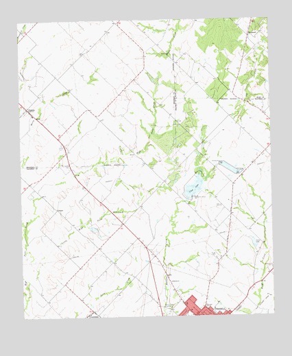
Terrell North, TX USGS Topographic Map
Click on map above to begin viewing in our Map Viewer.

This topographic map contains these locations and features:
Feature Name Type Latitude Longitude GNIS ID View Map
Airpark EastAirportN32.8140°W96.3522°1386479View Map
ChisholmPopulated PlaceN32.8382°W96.3716°1388183View Map
Club LakeReservoirN32.8041°W96.2890°1333795View Map
ColquittPopulated PlaceN32.7954°W96.3575°1378145View Map
Dry Creek CemeteryCemeteryN32.8404°W96.2605°1334686View Map
Emmanuel Baptist ChurchChurchN32.7546°W96.2672°2022669View Map
First Church of the NazareneChurchN32.7560°W96.2953°2022686View Map
KTER-AM (Terrell)TowerN32.7551°W96.2830°1387890View Map
Little High Point CreekStreamN32.7629°W96.3722°1340114View Map
McLendon - Chisholm City HallBuildingN32.8373°W96.3710°2753841View Map
McLendon - Chisholm Volunteer Fire Department Station 1BuildingN32.8372°W96.3712°2551791View Map
McLendon - Chisholm Volunteer Fire Department Station 2BuildingN32.8613°W96.3118°2551690View Map
Oak Grove Country ClubLocaleN32.7537°W96.3011°1384442View Map
Porter LakeReservoirN32.7805°W96.2593°1344375View Map
Porter Lake DamDamN32.7785°W96.2586°1860905View Map
PSF HeliportAirportN32.8689°W96.2714°1384834View Map
Rives Air ParkAirportN32.8549°W96.3113°2675926View Map
Roberts LakeReservoirN32.7885°W96.3403°1860910View Map
Roberts Lake DamDamN32.7885°W96.3403°1860909View Map
Soil Conservation Service Site 11 DamDamN32.8668°W96.3603°1855801View Map
Soil Conservation Service Site 11 ReservoirReservoirN32.8668°W96.3603°1855802View Map
Soil Conservation Service Site 13 DamDamN32.8485°W96.3403°1855799View Map
Soil Conservation Service Site 13 ReservoirReservoirN32.8485°W96.3403°1855800View Map
Soil Conservation Service Site 16 DamDamN32.8135°W96.3386°1855797View Map
Soil Conservation Service Site 16 ReservoirReservoirN32.8135°W96.3386°1855798View Map
Soil Conservation Service Site 16a DamDamN32.8201°W96.3119°1855795View Map
Soil Conservation Service Site 16a ReservoirReservoirN32.8201°W96.3119°1855796View Map
Tawakoni Balancing ReservoirReservoirN32.8123°W96.2706°1860908View Map
Tawakoni Balancing Reservoir LeveeDamN32.8101°W96.2669°1860907View Map
Terrell Country Club Lake DamDamN32.8001°W96.2919°1860911View Map
Terrell Middle SchoolSchoolN32.7624°W96.2758°2007066View Map
Trinity Valley Baptist ChurchChurchN32.7854°W96.3294°2022679View Map
Walter C Porter FarmLocaleN32.7826°W96.2750°2032017View Map
WhiteheadPopulated PlaceN32.8682°W96.2603°1379269View Map
Wildwood ChurchChurchN32.7646°W96.3011°1350089View Map

Note: Coordinates in the location and feature list above are referenced to NAD83 datum.


Copyright (C) 2008-2024 Ryan Niemi / Sunset Dynamics ... All Rights Reserved