TopoQuest Logo
Do you find TopoQuest useful?
Help keep TopoQuest running and adding new maps/features by donating!
Bitcoin:  19c7KJd3qBynnjoSw5npx9KScwjBe4ifkT
Litecoin:  LXs6TkuXGGXo1vDsWCkWVdjQX94eUKd6ui
Home View Maps Find Maps Find Places Resources & Links


Quinlan, Texas Topographic Map

USGS Map Title: Quinlan, TX
USGS Map MRC: 32096H2
DRG (GeoTIFF) Download: o32096h2.tif


Neighboring USGS Topographic Map Quads:


  Josephine, TX  
33096A3
 

  Greenville SW, TX  
33096A2
 

  Greenville SE, TX  
33096A1
 

  Royse City, TX  
32096H3
 

  Quinlan, TX  
32096H2
 

  West Tawakoni, TX  
32096H1
 

  Terrell North, TX  
32096G3
 

  Poetry, TX  
32096G2
 

  Ables Springs, TX  
32096G1


Map MRC Location:

N33°
W97°
N33°
W96°
H8 H7 H6 H5 H4 H3 H2 H1
G8 G7 G6 G5 G4 G3 G2 G1
F8 F7 F6 F5 F4 F3 F2 F1
E8 E7 E6 E5 E4 E3 E2 E1
D8 D7 D6 D5 D4 D3 D2 D1
C8 C7 C6 C5 C4 C3 C2 C1
B8 B7 B6 B5 B4 B3 B2 B1
A8 A7 A6 A5 A4 A3 A2 A1
N32°
W97°
N32°
W96°

Quinlan, TX USGS 1:24K Topographic Map Preview:
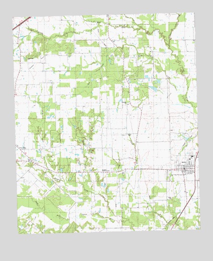
Quinlan, TX USGS Topographic Map
Click on map above to begin viewing in our Map Viewer.

This topographic map contains these locations and features:
Feature Name Type Latitude Longitude GNIS ID View Map
A E Butler Intermediate SchoolSchoolN32.9182°W96.1289°2006265View Map
Bearpen CreekStreamN32.8818°W96.1750°1372453View Map
Brushy CreekStreamN32.9962°W96.1891°1331438View Map
C B Thompson Middle SchoolSchoolN32.9179°W96.1266°2006271View Map
City of QuinlanCivilN32.9089°W96.1317°2411508View Map
City of Union ValleyCivilN32.9218°W96.2471°2435849View Map
Dry CreekStreamN32.9496°W96.1325°1334665View Map
Dry CreekStreamN32.8887°W96.2283°1334684View Map
Dry Creek CemeteryCemeteryN32.9760°W96.1647°1334113View Map
Dry Creek Ranch Lake Number 1ReservoirN32.9568°W96.1519°1855175View Map
Dry Creek Ranch Lake Number 1 DamDamN32.9568°W96.1519°1855174View Map
Dry Creek Ranch Lake Number 2ReservoirN32.9611°W96.1511°1855177View Map
Dry Creek Ranch Lake Number 2 DamDamN32.9601°W96.1503°1855176View Map
East Caddo CreekStreamN32.9821°W96.1433°1334886View Map
Elm CreekStreamN32.9926°W96.1622°1335374View Map
Flying 'T' Ranch Airport (historical)AirportN32.9526°W96.2283°1386325View Map
Ford High SchoolSchoolN32.9182°W96.1289°2006233View Map
Graham PointRidgeN32.9832°W96.2314°1336792View Map
Graham Point CemeteryCemeteryN32.9762°W96.2408°1336793View Map
Hail CemeteryCemeteryN32.9087°W96.1764°1337221View Map
Hodges CemeteryCemeteryN32.8935°W96.1441°1337866View Map
Hunt County Constable's Office Precinct 4BuildingN32.9107°W96.1338°2751324View Map
Hurst CreekStreamN32.9112°W96.2280°1338325View Map
Ivy LakeReservoirN32.9570°W96.1547°1864647View Map
Ivy Lake DamDamN32.9568°W96.1553°1864646View Map
Joe Martin Early Childhood CenterSchoolN32.9096°W96.1347°2006239View Map
Lytal StadiumParkN32.9162°W96.1294°2027786View Map
Paynetown CemeteryCemeteryN32.9493°W96.1733°1343695View Map
QuinlanPopulated PlaceN32.9104°W96.1355°1344664View Map
Quinlan City HallBuildingN32.9108°W96.1342°2753801View Map
Quinlan DivisionCivilN32.9091°W96.1430°1939115View Map
Quinlan Police DepartmentBuildingN32.9108°W96.1342°2751177View Map
Quinlan Post OfficePost OfficeN32.9144°W96.1282°2731505View Map
Quinlan Public SchoolSchoolN32.9173°W96.1297°1344666View Map
Quinlan Volunteer Fire DepartmentBuildingN32.9111°W96.1360°2655160View Map
Sandy CreekStreamN32.8973°W96.1944°1346591View Map
Stringtown Community CenterLocaleN32.9107°W96.1914°1348002View Map
Tawakoni Area Public LibraryBuildingN32.9979°W96.1361°2014728View Map
West Caddo CreekStreamN32.9821°W96.1433°1376684View Map
Williams ChapelChurchN32.9310°W96.1733°1350129View Map

Note: Coordinates in the location and feature list above are referenced to NAD83 datum.


Copyright (C) 2008-2024 Ryan Niemi / Sunset Dynamics ... All Rights Reserved