TopoQuest Logo
Do you find TopoQuest useful?
Help keep TopoQuest running and adding new maps/features by donating!
Bitcoin:  19c7KJd3qBynnjoSw5npx9KScwjBe4ifkT
Litecoin:  LXs6TkuXGGXo1vDsWCkWVdjQX94eUKd6ui
Home View Maps Find Maps Find Places Resources & Links


Tariff, West Virginia Topographic Map

USGS Map Title: Tariff, WV
USGS Map MRC: 38081F2
DRG (GeoTIFF) Download: o38081f2.tif


Neighboring USGS Topographic Map Quads:


  Spencer, WV  
38081G3
 

  Arnoldsburg, WV  
38081G2
 

  Millstone, WV  
38081G1
 

  Looneyville, WV  
38081F3
 

  Tariff, WV  
38081F2
 

  Chloe, WV  
38081F1
 

  Clio, WV  
38081E3
 

  Newton, WV  
38081E2
 

  Ivydale, WV  
38081E1


Map MRC Location:

N39°
W82°
N39°
W81°
H8 H7 H6 H5 H4 H3 H2 H1
G8 G7 G6 G5 G4 G3 G2 G1
F8 F7 F6 F5 F4 F3 F2 F1
E8 E7 E6 E5 E4 E3 E2 E1
D8 D7 D6 D5 D4 D3 D2 D1
C8 C7 C6 C5 C4 C3 C2 C1
B8 B7 B6 B5 B4 B3 B2 B1
A8 A7 A6 A5 A4 A3 A2 A1
N38°
W82°
N38°
W81°

Tariff, WV USGS 1:24K Topographic Map Preview:
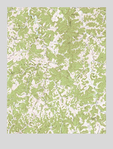
Tariff, WV USGS Topographic Map
Click on map above to begin viewing in our Map Viewer.

This topographic map contains these locations and features:
Feature Name Type Latitude Longitude GNIS ID View Map
Bailey CemeteryCemeteryN38.7395°W81.1554°1535126View Map
Blowntimber RunStreamN38.7120°W81.1496°1536118View Map
BrightPopulated PlaceN38.6259°W81.2346°1740858View Map
Brush RunStreamN38.6606°W81.1812°1536469View Map
Canoe RunStreamN38.7037°W81.2009°1537009View Map
Chewning CemeteryCemeteryN38.6895°W81.2012°1537306View Map
Cook RunStreamN38.7495°W81.1612°1537596View Map
Cottrill RunStreamN38.6482°W81.1315°1537706View Map
Desert KnobSummitN38.7426°W81.1662°1538146View Map
Duck RunStreamN38.7109°W81.2012°1538399View Map
Fink CemeteryCemeteryN38.7234°W81.1440°1538964View Map
Fink RunStreamN38.7218°W81.1451°1538966View Map
Flat RunStreamN38.7181°W81.2034°1539054View Map
Harold CemeteryCemeteryN38.6251°W81.1334°2586170View Map
Hayes Fork ChurchChurchN38.7104°W81.2009°1540081View Map
Hayes RunStreamN38.7193°W81.2107°1540082View Map
Helmic CemeteryCemeteryN38.6477°W81.1901°2574026View Map
Henry Fork ChurchChurchN38.6709°W81.2043°1540158View Map
Jarvis CemeteryCemeteryN38.6480°W81.2193°2574027View Map
Jarvis CemeteryCemeteryN38.6643°W81.1398°1696963View Map
Keffer ChurchChurchN38.7179°W81.2398°1541111View Map
King RocksSummitN38.6968°W81.2215°1554882View Map
LindenPopulated PlaceN38.7198°W81.2109°1541993View Map
Linden Post OfficePost OfficeN38.7198°W81.2107°1740936View Map
Linden School (historical)SchoolN38.7115°W81.2012°1541994View Map
Looney CemeteryCemeteryN38.6523°W81.2396°1542447View Map
Maple RunStreamN38.6743°W81.1884°1542734View Map
Marys ForkStreamN38.7206°W81.1398°1542842View Map
MiloPopulated PlaceN38.7223°W81.1437°1549825View Map
Mount Vernon ChurchChurchN38.7131°W81.1498°1543790View Map
OkaPopulated PlaceN38.6562°W81.1365°1549861View Map
Pocatalico River Structure Number 14 DamDamN38.6718°W81.2082°1559302View Map
Rush RunStreamN38.7423°W81.2212°1546181View Map
Sams RunStreamN38.7248°W81.1493°1546333View Map
Sand RunStreamN38.7323°W81.2076°1546371View Map
Sang RunStreamN38.6915°W81.1465°1546422View Map
Silcott LakeReservoirN38.6718°W81.2082°1559303View Map
Simmons ForkStreamN38.6904°W81.2137°1546801View Map
Sycamore ForkStreamN38.6787°W81.1979°1547837View Map
TariffLocaleN38.6793°W81.1973°1547906View Map
Tariff CemeteryCemeteryN38.6785°W81.2044°2574028View Map
Tariff Oil FieldOilfieldN38.6573°W81.2087°1557897View Map
Tariff Post OfficePost OfficeN38.6790°W81.1984°1741020View Map
Twolick RunStreamN38.6976°W81.1418°1548422View Map
Wayne CemeteryCemeteryN38.7445°W81.1532°1548851View Map
Wolf RunStreamN38.6962°W81.1971°1549285View Map
Young CemeteryCemeteryN38.7212°W81.2048°1549464View Map

Note: Coordinates in the location and feature list above are referenced to NAD83 datum.


Copyright (C) 2008-2024 Ryan Niemi / Sunset Dynamics ... All Rights Reserved