TopoQuest Logo
Do you find TopoQuest useful?
Help keep TopoQuest running and adding new maps/features by donating!
Bitcoin:  19c7KJd3qBynnjoSw5npx9KScwjBe4ifkT
Litecoin:  LXs6TkuXGGXo1vDsWCkWVdjQX94eUKd6ui
Home View Maps Find Maps Find Places Resources & Links


Arnoldsburg, West Virginia Topographic Map

USGS Map Title: Arnoldsburg, WV
USGS Map MRC: 38081G2
DRG (GeoTIFF) Download: o38081g2.tif


Neighboring USGS Topographic Map Quads:


  Burning Springs, WV  
38081H3
 

  Annamoriah, WV  
38081H2
 

  Grantsville, WV  
38081H1
 

  Spencer, WV  
38081G3
 

  Arnoldsburg, WV  
38081G2
 

  Millstone, WV  
38081G1
 

  Looneyville, WV  
38081F3
 

  Tariff, WV  
38081F2
 

  Chloe, WV  
38081F1


Map MRC Location:

N39°
W82°
N39°
W81°
H8 H7 H6 H5 H4 H3 H2 H1
G8 G7 G6 G5 G4 G3 G2 G1
F8 F7 F6 F5 F4 F3 F2 F1
E8 E7 E6 E5 E4 E3 E2 E1
D8 D7 D6 D5 D4 D3 D2 D1
C8 C7 C6 C5 C4 C3 C2 C1
B8 B7 B6 B5 B4 B3 B2 B1
A8 A7 A6 A5 A4 A3 A2 A1
N38°
W82°
N38°
W81°

Arnoldsburg, WV USGS 1:24K Topographic Map Preview:
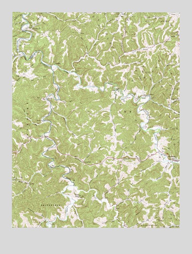
Arnoldsburg, WV USGS Topographic Map
Click on map above to begin viewing in our Map Viewer.

This topographic map contains these locations and features:
Feature Name Type Latitude Longitude GNIS ID View Map
AdamPopulated PlaceN38.8301°W81.1718°1549557View Map
AltizerPopulated PlaceN38.8273°W81.1479°1553720View Map
Anthony RunStreamN38.7887°W81.1346°1534971View Map
ArnoldsburgPopulated PlaceN38.7890°W81.1276°1553752View Map
Arnoldsburg Baptist ChurchChurchN38.7895°W81.1262°1696818View Map
Arnoldsburg CemeteryCemeteryN38.7898°W81.1312°1696819View Map
Arnoldsburg Post OfficePost OfficeN38.7894°W81.1287°1696820View Map
Arnoldsburg SchoolSchoolN38.7876°W81.1333°1696821View Map
Arnoldsburg Volunteer Fire Department Station 300BuildingN38.7897°W81.1301°2577672View Map
Barnes RunStreamN38.8401°W81.2068°1535257View Map
Bee CemeteryCemeteryN38.8651°W81.2409°1696825View Map
BeechPopulated PlaceN38.7626°W81.1723°1549585View Map
Beech ForkStreamN38.7745°W81.2043°1535530View Map
Big RunStreamN38.8401°W81.2198°1535944View Map
Bluehead Church (historical)ChurchN38.8381°W81.2437°1740852View Map
Board ForkStreamN38.8743°W81.2243°1536162View Map
Cabin RunStreamN38.7656°W81.1809°1536833View Map
Carpenter CemeteryCemeteryN38.8631°W81.2054°1696843View Map
Childrens Learning CenterSchoolN38.7881°W81.1320°2487397View Map
Clover RunStreamN38.7534°W81.2226°1537428View Map
Coon CemeteryCemeteryN38.8679°W81.1946°1696846View Map
Coon ForkStreamN38.8456°W81.1696°1537625View Map
Cove RunStreamN38.7704°W81.2129°1537728View Map
Daniels RunStreamN38.8248°W81.1473°1537993View Map
Daniels Run School (historical)SchoolN38.8237°W81.1293°1537996View Map
Deep Valley School (historical)SchoolN38.8451°W81.1723°1696850View Map
Dennis ForkStreamN38.8506°W81.1668°1538129View Map
District 4CivilN38.8318°W81.1787°1928238View Map
Dry Hill CemeteryCemeteryN38.8381°W81.2443°1538363View Map
Dry Hill School (historical)SchoolN38.8351°W81.2448°1740878View Map
Fairview CemeteryCemeteryN38.7540°W81.1396°1696855View Map
Fairview ChurchChurchN38.7545°W81.1393°1538811View Map
Falls RunStreamN38.8070°W81.1393°1538883View Map
Flesher RunStreamN38.7556°W81.1726°1539082View Map
Gibson CemeteryCemeteryN38.8162°W81.1479°1696860View Map
Hays CemeteryCemeteryN38.7940°W81.1390°1696867View Map
Henry ForkStreamN38.8434°W81.2207°1540157View Map
Henry Fork ChurchChurchN38.8256°W81.2210°1540159View Map
Hog ForkStreamN38.8512°W81.1937°1540346View Map
Hollywood RunStreamN38.7545°W81.2254°1540402View Map
Hughes RunStreamN38.8256°W81.1526°1540573View Map
HurPopulated PlaceN38.8734°W81.1696°1554758View Map
Hur CemeteryCemeteryN38.8742°W81.1684°1696870View Map
Husk CemeteryCemeteryN38.8159°W81.1515°1696872View Map
Island RunStreamN38.7851°W81.2212°1540745View Map
Island Run ChurchChurchN38.7756°W81.2373°1540747View Map
Island Run School (historical)SchoolN38.7798°W81.2346°1740913View Map
Jakes ForkStreamN38.7881°W81.1968°1540799View Map
Jesse RunStreamN38.8301°W81.1732°1540886View Map
Jesse Run School (historical)SchoolN38.8140°W81.1757°1696876View Map
Laurel RunStreamN38.8043°W81.2248°1541537View Map
Laurel School (historical)SchoolN38.7940°W81.2454°1740928View Map
Laurel Shoal RunStreamN38.8081°W81.1534°1541549View Map
LeatherbarkPopulated PlaceN38.7884°W81.1968°1554932View Map
Leatherbark CreekStreamN38.7970°W81.2193°1541585View Map
Lee RunStreamN38.8698°W81.2398°1541610View Map
Left Fork Barnes RunStreamN38.8504°W81.1940°1541625View Map
Liberty HillPopulated PlaceN38.7904°W81.1682°1554949View Map
Liberty Hill CemeteryCemeteryN38.7895°W81.1676°1696883View Map
Liberty Hill ChurchChurchN38.7890°W81.1679°1696884View Map
Lick RunStreamN38.8243°W81.2240°1541911View Map
Little Leatherbark CreekStreamN38.8204°W81.2212°1542163View Map
Little Leatherbark School (historical)SchoolN38.8123°W81.2096°1696886View Map
Louisa ChapelChurchN38.7895°W81.1293°1542481View Map
Lynch School (historical)SchoolN38.8206°W81.1537°1696889View Map
McCoy SpringSpringN38.8526°W81.1909°1677971View Map
McCume RunStreamN38.7890°W81.1371°1542978View Map
Meadows CemeteryCemeteryN38.8654°W81.2412°1696891View Map
Middle Fork Daniels RunStreamN38.8198°W81.1332°1543180View Map
Mount Olive ChurchChurchN38.8740°W81.1684°1543710View Map
Mount Zion CemeteryCemeteryN38.8606°W81.1254°1696895View Map
Mount Zion Methodist ChurchChurchN38.8604°W81.1251°1696896View Map
Mulberry RunStreamN38.8734°W81.2421°1543984View Map
Mushroom RunStreamN38.7940°W81.1407°1544020View Map
Orchard RunStreamN38.7643°W81.2040°1544439View Map
OttoPopulated PlaceN38.7523°W81.2210°1555284View Map
Otto Advent Christian ChurchChurchN38.7526°W81.2210°1740963View Map
Paintrock RunStreamN38.8281°W81.1684°1544533View Map
Panther RunStreamN38.7718°W81.1912°1544561View Map
Pine Grove School (historical)SchoolN38.8629°W81.2262°1696905View Map
PinkPopulated PlaceN38.7854°W81.2201°1555363View Map
Pleasant Valley ChurchChurchN38.8120°W81.2262°1545027View Map
Pleasant Valley School (historical)SchoolN38.8118°W81.2262°1740974View Map
Pup RunStreamN38.8123°W81.2265°1545320View Map
RichardsonPopulated PlaceN38.8654°W81.2365°1555474View Map
Right Fork Daniels RunStreamN38.8195°W81.1329°1545634View Map
Right Fork Triplett RunStreamN38.8487°W81.2473°1545717View Map
Road RunStreamN38.7620°W81.1732°1545825View Map
RocksdalePopulated PlaceN38.8448°W81.2182°1555509View Map
Rocksdale BridgeBridgeN38.8437°W81.2210°2647449View Map
Saul RunStreamN38.7665°W81.1640°1546446View Map
Sinking Spring RunStreamN38.8268°W81.1479°1546834View Map
Slider CemeteryCemeteryN38.8515°W81.1587°1696923View Map
Spring RunStreamN38.7884°W81.1307°1547208View Map
Starcher CemeteryCemeteryN38.8256°W81.2207°1696929View Map
Starcher CemeteryCemeteryN38.8642°W81.2198°1696930View Map
Starcher ForkStreamN38.7759°W81.2373°1547343View Map
Steel RunStreamN38.8679°W81.2382°1547361View Map
Stony Point ChurchChurchN38.8251°W81.1465°1547495View Map
Sugar RunStreamN38.8251°W81.2148°1547643View Map
Triplett RunStreamN38.8506°W81.2415°1548280View Map
TristanPopulated PlaceN38.8026°W81.2271°1555825View Map
Walnut Grove ChurchChurchN38.8404°W81.2029°1548763View Map
Wayne CemeteryCemeteryN38.7515°W81.1662°1696935View Map
West Fork School (historical)SchoolN38.8254°W81.1679°1696936View Map

Note: Coordinates in the location and feature list above are referenced to NAD83 datum.


Copyright (C) 2008-2024 Ryan Niemi / Sunset Dynamics ... All Rights Reserved