TopoQuest Logo
Do you find TopoQuest useful?
Help keep TopoQuest running and adding new maps/features by donating!
Bitcoin:  19c7KJd3qBynnjoSw5npx9KScwjBe4ifkT
Litecoin:  LXs6TkuXGGXo1vDsWCkWVdjQX94eUKd6ui
Home View Maps Find Maps Find Places Resources & Links


Superior, Arizona Topographic Map

USGS Map Title: Superior, AZ
USGS Map MRC: 33111C1
DRG (GeoTIFF) Download: o33111c1.tif


Neighboring USGS Topographic Map Quads:


  Iron Mountain, AZ  
33111D2
 

  Haunted Canyon, AZ  
33111D1
 

  Inspiration, AZ  
33110D8
 

  Picketpost Mountain, AZ  
33111C2
 

  Superior, AZ  
33111C1
 

  Pinal Ranch, AZ  
33110C8
 

  Mineral Mountain, AZ  
33111B2
 

  Teapot Mountain, AZ  
33111B1
 

  Hot Tamale Peak, AZ  
33110B8


Map MRC Location:

N34°
W112°
N34°
W111°
H8 H7 H6 H5 H4 H3 H2 H1
G8 G7 G6 G5 G4 G3 G2 G1
F8 F7 F6 F5 F4 F3 F2 F1
E8 E7 E6 E5 E4 E3 E2 E1
D8 D7 D6 D5 D4 D3 D2 D1
C8 C7 C6 C5 C4 C3 C2 C1
B8 B7 B6 B5 B4 B3 B2 B1
A8 A7 A6 A5 A4 A3 A2 A1
N33°
W112°
N33°
W111°

Superior, AZ USGS 1:24K Topographic Map Preview:
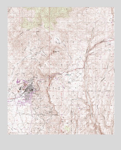
Superior, AZ USGS Topographic Map
Click on map above to begin viewing in our Map Viewer.

This topographic map contains these locations and features:
Feature Name Type Latitude Longitude GNIS ID View Map
Apache LeapCliffN33.2812°W111.0743°25705View Map
Apache MineMineN33.3281°W111.0826°25711View Map
Apex MineMineN33.3095°W111.1065°25727View Map
Arizona Highway Department Devils Canyon Maintenance CampLocaleN33.3273°W111.0329°43509View Map
Belmont CanyonValleyN33.2689°W111.0893°26207View Map
Belmont MineMineN33.2723°W111.0760°1228View Map
Bitter SpringSpringN33.3431°W111.0887°40314View Map
Bored SpringSpringN33.2709°W111.0915°40320View Map
Cedar TankReservoirN33.3514°W111.1248°40324View Map
Comstock WashStreamN33.3267°W111.1026°27840View Map
Conley Spring WashStreamN33.3264°W111.0954°27849View Map
Cross CanyonValleyN33.2845°W111.0990°28183View Map
Devils Canyon CampgroundLocaleN33.3237°W111.0335°41285View Map
Donkey CanyonValleyN33.2745°W111.0937°28534View Map
East Fork TankReservoirN33.3601°W111.0035°40337View Map
Elm CanyonValleyN33.2937°W111.0890°28891View Map
Fig SpringSpringN33.3401°W111.0940°40338View Map
First Assembly of GodChurchN33.2946°W111.0972°2670928View Map
First Baptist ChurchChurchN33.2864°W111.1031°2670945View Map
Fortuna MineMineN33.3509°W111.0923°29123View Map
Fortuna PeakSummitN33.3570°W111.0873°29124View Map
Fortuna WashStreamN33.3417°W111.0879°29125View Map
Gospel Light Baptist ChurchChurchN33.2873°W111.1020°2671080View Map
Grand Pacific MineMineN33.2695°W111.0710°29466View Map
Hackberry CreekStreamN33.2737°W111.0279°29662View Map
Harding SchoolSchoolN33.2878°W111.1104°40351View Map
Headquarters TankReservoirN33.3362°W111.0104°40353View Map
Hidden SpringSpringN33.2584°W111.0954°40354View Map
Horse Pasture TankReservoirN33.3189°W111.0790°23718View Map
Iron CanyonValleyN33.3159°W111.0365°30411View Map
J I RanchLocaleN33.3392°W111.0079°30445View Map
John F Kennedy Elementary SchoolSchoolN33.2777°W111.1101°40359View Map
Kings Crown PeakSummitN33.3320°W111.0712°30777View Map
Little Cement TankReservoirN33.3640°W111.0034°41290View Map
Little Rock TankReservoirN33.3639°W111.0032°40369View Map
Mac SpringSpringN33.3662°W111.0771°40372View Map
Magma Copper MinesMineN33.3031°W111.1001°31445View Map
Magma HospitalHospitalN33.2998°W111.0971°40373View Map
Magma Number Nine MineMineN33.3059°W111.0648°41288View Map
Magma Railroad StationBuildingN33.2895°W111.1101°40374View Map
Magma Tailings Dam Number FiveDamN33.3001°W111.1007°40375View Map
Magma Tailings Dam Number SixDamN33.2917°W111.1007°40376View Map
Magma Tailings Dam Numbers One and TwoDamN33.2917°W111.1007°40377View Map
Magma Tailings Dam Numbers Three and FourDamN33.2917°W111.1007°40378View Map
McGinnel SpringSpringN33.3387°W111.1210°40381View Map
North Fork TankReservoirN33.3598°W111.0229°40389View Map
Oak CreekStreamN33.2701°W111.0273°32427View Map
Oak FlatFlatN33.3081°W111.0471°32440View Map
Oak Flat CampgroundLocaleN33.3076°W111.0435°40391View Map
Pacific CanyonValleyN33.2637°W111.0821°32613View Map
Peachville MountainSummitN33.3473°W111.1101°32755View Map
Peachville TankReservoirN33.3501°W111.1168°40400View Map
Peachville WashStreamN33.3276°W111.1015°32756View Map
Presbyterian ChurchChurchN33.2950°W111.0962°2671721View Map
Pump Station SpringSpringN33.3395°W111.0637°33225View Map
Queen Creek CanyonValleyN33.2895°W111.1073°33285View Map
Queen Creek MineMineN33.2892°W111.0885°33286View Map
Queen Creek TunnelTunnelN33.3051°W111.0812°40412View Map
Rancho Rio CreekStreamN33.2809°W111.0298°33365View Map
Roosevelt Elementary SchoolSchoolN33.2948°W111.0998°40422View Map
Saint Francis of Assisi ChurchChurchN33.2926°W111.1025°2671284View Map
Silver King MineMineN33.3303°W111.0893°34442View Map
Silver King SubstationLocaleN33.3401°W111.0335°41287View Map
Silver King WindmillWellN33.3206°W111.1123°40429View Map
Silverado RidgeRidgeN33.3370°W111.0821°34451View Map
Silverado WashStreamN33.3337°W111.0960°34452View Map
Silverrona SpringSpringN33.3506°W111.1015°40430View Map
SuperiorPopulated PlaceN33.2939°W111.0962°34981View Map
Superior Fire DepartmentBuildingN33.2789°W111.1145°2672336View Map
Superior Junior / Senior High SchoolSchoolN33.2787°W111.1115°40434View Map
Superior Junior High SchoolSchoolN33.2786°W111.1115°2544998View Map
Superior Police DepartmentBuildingN33.2867°W111.1069°2672308View Map
Superior Post OfficePost OfficeN33.2942°W111.0956°2670058View Map
Superior Public LibraryBuildingN33.2945°W111.0976°2669482View Map
Superior Sanitary District Wastewater Treatment PlantLocaleN33.2804°W111.1240°2669624View Map
Superior Senior CenterBuildingN33.2936°W111.0989°2669897View Map
Superior StadiumParkN33.2864°W111.1162°40436View Map
Superior Town HallBuildingN33.2940°W111.0946°2669596View Map
Superior Water TankReservoirN33.3017°W111.0857°34983View Map
Town of SuperiorCivilN33.2852°W111.1105°2413353View Map
Trail TankReservoirN33.3414°W111.0403°40445View Map
Tunnel SpringSpringN33.3426°W111.0862°40446View Map
Yellowjack WashStreamN33.3320°W111.0862°36471View Map

Note: Coordinates in the location and feature list above are referenced to NAD83 datum.


Copyright (C) 2008-2024 Ryan Niemi / Sunset Dynamics ... All Rights Reserved