TopoQuest Logo
Do you find TopoQuest useful?
Help keep TopoQuest running and adding new maps/features by donating!
Bitcoin:  19c7KJd3qBynnjoSw5npx9KScwjBe4ifkT
Litecoin:  LXs6TkuXGGXo1vDsWCkWVdjQX94eUKd6ui
Home View Maps Find Maps Find Places Resources & Links


Summerville, Oregon Topographic Map

USGS Map Title: Summerville, OR
USGS Map MRC: 45118D1
DRG (GeoTIFF) Download: o45118d1.tif


Neighboring USGS Topographic Map Quads:


  Thimbleberry Mountain, OR  
45118E2
 

  Sanderson Spring, OR  
45118E1
 

  Elgin, OR  
45117E8
 

  Drumhill Ridge, OR  
45118D2
 

  Summerville, OR  
45118D1
 

  Imbler, OR  
45117D8
 

  Hilgard, OR  
45118C2
 

  La Grande, OR  
45118C1
 

  Conley, OR  
45117C8


Map MRC Location:

N46°
W119°
N46°
W118°
H8 H7 H6 H5 H4 H3 H2 H1
G8 G7 G6 G5 G4 G3 G2 G1
F8 F7 F6 F5 F4 F3 F2 F1
E8 E7 E6 E5 E4 E3 E2 E1
D8 D7 D6 D5 D4 D3 D2 D1
C8 C7 C6 C5 C4 C3 C2 C1
B8 B7 B6 B5 B4 B3 B2 B1
A8 A7 A6 A5 A4 A3 A2 A1
N45°
W119°
N45°
W118°

Summerville, OR USGS 1:24K Topographic Map Preview:
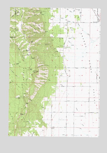
Summerville, OR USGS Topographic Map
Click on map above to begin viewing in our Map Viewer.

This topographic map contains these locations and features:
Feature Name Type Latitude Longitude GNIS ID View Map
Big Rock SpringSpringN45.4442°W118.1151°1138061View Map
Bull CanyonValleyN45.4707°W118.0599°1138893View Map
Canyon CreekStreamN45.3768°W118.0144°1139323View Map
Conklin SpringSpringN45.4950°W118.1121°1140037View Map
Conley CreekStreamN45.3846°W118.0452°1140039View Map
Coon CanyonValleyN45.4751°W118.0819°1140065View Map
Coon CreekStreamN45.4826°W118.0316°1140071View Map
Coon RidgeRidgeN45.4801°W118.0933°1140079View Map
Crystal SpringSpringN45.4401°W118.0977°1140515View Map
Dry CreekStreamN45.4876°W118.0324°1141311View Map
End CreekStreamN45.4624°W118.0338°1141876View Map
Evans TrailTrailN45.4262°W118.1174°1141929View Map
Fir CreekStreamN45.4957°W118.0372°1142111View Map
Frizzell CreekStreamN45.4712°W118.0633°1142491View Map
Grandview CampgroundLocaleN45.4540°W118.0974°1142908View Map
Grandview SpringSpringN45.4507°W118.0945°1142909View Map
Grange HallBuildingN45.4837°W118.0463°1639279View Map
Hacker CreekStreamN45.4999°W118.0358°1152855View Map
Hale SpringSpringN45.4949°W118.0810°1143203View Map
Hale Spring TrailTrailN45.4957°W118.0961°1143204View Map
Halfway SpringSpringN45.3962°W118.1054°1143217View Map
Hunter CanyonValleyN45.3901°W118.0774°1152844View Map
Imbler Rural Fire Protection District Summerville StationBuildingN45.4894°W118.0038°2577137View Map
Indian RockPillarN45.4665°W118.0969°1144071View Map
Indian Rock Recreation Site (historical)LocaleN45.4654°W118.0955°1156569View Map
Indian Trail CanyonValleyN45.4429°W118.0666°1144082View Map
Kaleib SpringSpringN45.4069°W118.1021°1144480View Map
Lewis BranchStreamN45.4999°W118.0502°1144962View Map
Lyons CanyonValleyN45.4935°W118.0830°1145697View Map
Mayville SpringSpringN45.3888°W118.0988°1152843View Map
Mint SpringSpringN45.4946°W118.0705°1153021View Map
Mount EmilySummitN45.4379°W118.0913°1146535View Map
Mount Emily Lookout TowerTowerN45.4379°W118.0916°1167195View Map
Mount Emily Sno-ParkLocaleN45.4374°W118.0877°1156571View Map
Mud SpringSpringN45.4116°W118.1124°1146606View Map
Ordell DitchCanalN45.3846°W118.0341°1147257View Map
Pioneer MonumentParkN45.3835°W118.0663°1147759View Map
Pole Creek Ridge TrailheadLocaleN45.4685°W118.1027°1156570View Map
Rail CanyonValleyN45.4949°W118.0744°1148144View Map
Slide CreekStreamN45.4418°W118.0247°1127077View Map
Smith CreekStreamN45.4962°W118.0366°1149751View Map
South Fork Willow Creek (historical)StreamN45.4676°W118.0077°1158956View Map
Starr ReservoirReservoirN45.4882°W118.0524°1153020View Map
SummervillePopulated PlaceN45.4885°W118.0030°1150602View Map
Summerville City HallBuildingN45.4906°W118.0043°2700354View Map
Summerville Post OfficePost OfficeN45.4907°W118.0037°1166003View Map
Telephone SpringSpringN45.4589°W118.1012°1150954View Map
Tin Flag RidgeRidgeN45.4857°W118.0924°1151262View Map
Town of SummervilleCivilN45.4897°W118.0041°2413348View Map
Waite CreekStreamN45.3846°W118.0455°1152845View Map
West RanchLocaleN45.4624°W118.0513°1152140View Map
Wrights ReservoirsReservoirN45.3916°W118.0554°1152846View Map
York ReservoirReservoirN45.4785°W118.0370°1152847View Map

Note: Coordinates in the location and feature list above are referenced to NAD83 datum.


Copyright (C) 2008-2024 Ryan Niemi / Sunset Dynamics ... All Rights Reserved