TopoQuest Logo
Do you find TopoQuest useful?
Help keep TopoQuest running and adding new maps/features by donating!
Bitcoin:  19c7KJd3qBynnjoSw5npx9KScwjBe4ifkT
Litecoin:  LXs6TkuXGGXo1vDsWCkWVdjQX94eUKd6ui
Home View Maps Find Maps Find Places Resources & Links


Drumhill Ridge, Oregon Topographic Map

USGS Map Title: Drumhill Ridge, OR
USGS Map MRC: 45118D2
DRG (GeoTIFF) Download: o45118d2.tif


Neighboring USGS Topographic Map Quads:


  Duncan, OR  
45118E3
 

  Thimbleberry Mountain, OR  
45118E2
 

  Sanderson Spring, OR  
45118E1
 

  Huron, OR  
45118D3
 

  Drumhill Ridge, OR  
45118D2
 

  Summerville, OR  
45118D1
 

  Kamela SE, OR  
45118C3
 

  Hilgard, OR  
45118C2
 

  La Grande, OR  
45118C1


Map MRC Location:

N46°
W119°
N46°
W118°
H8 H7 H6 H5 H4 H3 H2 H1
G8 G7 G6 G5 G4 G3 G2 G1
F8 F7 F6 F5 F4 F3 F2 F1
E8 E7 E6 E5 E4 E3 E2 E1
D8 D7 D6 D5 D4 D3 D2 D1
C8 C7 C6 C5 C4 C3 C2 C1
B8 B7 B6 B5 B4 B3 B2 B1
A8 A7 A6 A5 A4 A3 A2 A1
N45°
W119°
N45°
W118°

Drumhill Ridge, OR USGS 1:24K Topographic Map Preview:
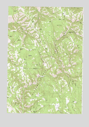
Drumhill Ridge, OR USGS Topographic Map
Click on map above to begin viewing in our Map Viewer.

This topographic map contains these locations and features:
Feature Name Type Latitude Longitude GNIS ID View Map
Allen SpringSpringN45.4730°W118.1941°1137153View Map
Burnt CanyonValleyN45.4835°W118.1316°1138985View Map
Camp OneLocaleN45.4182°W118.1913°1139262View Map
Camp ThreeLocaleN45.4460°W118.2288°1139272View Map
Cantrell SpringSpringN45.3929°W118.2465°1139317View Map
Carters Hog RidgeRidgeN45.4132°W118.1430°1139406View Map
Daniel SpringSpringN45.4482°W118.2145°1140618View Map
Deer Lick SpringSpringN45.4420°W118.1779°1140856View Map
Dixie FlatFlatN45.3835°W118.1683°1141079View Map
Dollar SpringSpringN45.4509°W118.1847°1141160View Map
Drumhill RidgeRidgeN45.4712°W118.2016°1141260View Map
End SpringSpringN45.3920°W118.2310°1141877View Map
Fiddlers HellValleyN45.4276°W118.1591°1142081View Map
Five Points TrailTrailN45.4685°W118.1524°1142197View Map
Fox HillSummitN45.3807°W118.1436°1851714View Map
Green MountainSummitN45.4774°W118.1647°1143049View Map
Herron RidgeRidgeN45.4749°W118.1269°1143517View Map
Horse RidgeRidgeN45.4551°W118.1399°1143785View Map
Hoskins SpringSpringN45.4821°W118.2104°1143828View Map
Hugh SpringSpringN45.4379°W118.2236°1143895View Map
Indian SpringSpringN45.4825°W118.1820°1144078View Map
Kellers CabinLocaleN45.3879°W118.1333°1144518View Map
Knob CreekStreamN45.4999°W118.1941°1144687View Map
Lewis SpringSpringN45.4470°W118.1840°1144973View Map
Little John Day CreekStreamN45.4182°W118.1924°1145189View Map
Long PondLakeN45.4047°W118.2475°1145428View Map
Long RidgeRidgeN45.4454°W118.1533°1145444View Map
Middle Fork Mount Emily CreekStreamN45.4735°W118.1469°1146152View Map
Mount Emily CreekStreamN45.4596°W118.1705°1146524View Map
Mouse SpringSpringN45.3768°W118.2031°1146552View Map
North Flat SpringSpringN45.4704°W118.2419°1146898View Map
Rock SpringSpringN45.4318°W118.2026°1148634View Map
Rocky FlatFlatN45.3893°W118.1369°1148661View Map
S S SpringSpringN45.4525°W118.1331°1148888View Map
Sacajawea SpringSpringN45.4646°W118.2473°1148893View Map
Simerson SpringSpringN45.4489°W118.2096°1149520View Map
Smith RidgeRidgeN45.4124°W118.1524°1149760View Map
Spring MountainSummitN45.4604°W118.2352°1150193View Map
Standfield MeadowFlatN45.4499°W118.2308°1150335View Map
Sugarloaf MountainSummitN45.4418°W118.2149°1150558View Map
Summit Guard StationBuildingN45.4757°W118.2071°1150619View Map
Summit Mount Emily TrailTrailN45.4610°W118.1458°1150628View Map
Summit SpringSpringN45.4715°W118.2049°1153692View Map
Telephone RidgeRidgeN45.4632°W118.1436°1150948View Map
Three Cabin RidgeRidgeN45.3954°W118.1980°1151149View Map
Tie Camp SpringSpringN45.4944°W118.2409°1116594View Map
Tie CreekStreamN45.4229°W118.1574°1151213View Map
Tie SpringSpringN45.4186°W118.1287°1151214View Map
Walker SpringSpringN45.4056°W118.2414°1151843View Map
Weed SpringSpringN45.4913°W118.1570°1151995View Map
Y RidgeRidgeN45.4221°W118.2233°1152678View Map
Yarn SpringSpringN45.4857°W118.1659°1152701View Map

Note: Coordinates in the location and feature list above are referenced to NAD83 datum.


Copyright (C) 2008-2024 Ryan Niemi / Sunset Dynamics ... All Rights Reserved