TopoQuest Logo
Do you find TopoQuest useful?
Help keep TopoQuest running and adding new maps/features by donating!
Bitcoin:  19c7KJd3qBynnjoSw5npx9KScwjBe4ifkT
Litecoin:  LXs6TkuXGGXo1vDsWCkWVdjQX94eUKd6ui
Home View Maps Find Maps Find Places Resources & Links


Suamico, Wisconsin Topographic Map

USGS Map Title: Suamico, WI
USGS Map MRC: 44088F1
DRG (GeoTIFF) Download: o44088f1.tif


Neighboring USGS Topographic Map Quads:


  Oconto Falls South, WI  
44088G2
 

  Abrams, WI  
44088G1
 

  Pensaukee, WI  
44087G8
 

  Pulaski, WI  
44088F2
 

  Suamico, WI  
44088F1
 

  Little Tail Point, WI  
44087F8
 

  Oneida North, WI  
44088E2
 

  Green Bay West, WI  
44088E1
 

  Green Bay East, WI  
44087E8


Map MRC Location:

N45°
W89°
N45°
W88°
H8 H7 H6 H5 H4 H3 H2 H1
G8 G7 G6 G5 G4 G3 G2 G1
F8 F7 F6 F5 F4 F3 F2 F1
E8 E7 E6 E5 E4 E3 E2 E1
D8 D7 D6 D5 D4 D3 D2 D1
C8 C7 C6 C5 C4 C3 C2 C1
B8 B7 B6 B5 B4 B3 B2 B1
A8 A7 A6 A5 A4 A3 A2 A1
N44°
W89°
N44°
W88°

Suamico, WI USGS 1:24K Topographic Map Preview:
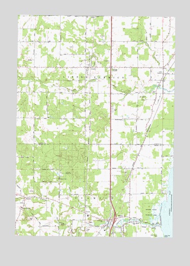
Suamico, WI USGS Topographic Map
Click on map above to begin viewing in our Map Viewer.

This topographic map contains these locations and features:
Feature Name Type Latitude Longitude GNIS ID View Map
Cottonwood Grove School (historical)SchoolN44.7361°W88.0090°1843953View Map
Dewey School (historical)SchoolN44.7353°W88.1082°1843955View Map
EJ Smith County ParkParkN44.6608°W88.0895°1564230View Map
FlintvillePopulated PlaceN44.6467°W88.1179°1565073View Map
Grosse CemeteryCemeteryN44.7075°W88.0179°1565918View Map
Haller CreekStreamN44.6330°W88.0515°1565991View Map
Little SuamicoPopulated PlaceN44.7175°W88.0093°1568434View Map
Little Suamico Fire DepartmentBuildingN44.7215°W88.0654°2696774View Map
Locust Grove School (historical)SchoolN44.6992°W88.0501°1843980View Map
Riverside CemeteryCemeteryN44.7044°W88.0276°1572363View Map
Saint Benedict Catholic CemeteryCemeteryN44.6341°W88.0553°1572856View Map
Saint Pats ParkParkN44.6317°W88.0890°1573421View Map
Saints Edward and Isidore ChurchChurchN44.6408°W88.1198°1577483View Map
Sensiba State Wildlife AreaParkN44.6394°W88.0165°1573903View Map
SobieskiPopulated PlaceN44.7208°W88.0720°1574358View Map
Sobieski Census Designated PlaceCensusN44.7227°W88.0659°2586553View Map
Sobieski CornersPopulated PlaceN44.7211°W88.0523°1574359View Map
SuamicoPopulated PlaceN44.6319°W88.0393°1575003View Map
Suamico Elementary SchoolSchoolN44.6364°W88.0675°2716596View Map
Suamico Fire Department - Station 1BuildingN44.6315°W88.0521°2697716View Map
Suamico RiverStreamN44.6314°W88.0090°1577486View Map
Town of Little SuamicoCivilN44.7149°W88.0555°1583586View Map
Town of Suamico (historical)CivilN44.6330°W88.0320°1584242View Map
TremblePopulated PlaceN44.6380°W88.0695°1575589View Map
Village of SuamicoCivilN44.6300°W88.0316°2013449View Map
West Lakeside ParkParkN44.6330°W88.0320°1576527View Map
West Side School (historical)SchoolN44.6989°W88.1012°1844036View Map
Woodview School (historical)SchoolN44.6642°W88.0409°1838200View Map

Note: Coordinates in the location and feature list above are referenced to NAD83 datum.


Copyright (C) 2008-2024 Ryan Niemi / Sunset Dynamics ... All Rights Reserved