TopoQuest Logo
Do you find TopoQuest useful?
Help keep TopoQuest running and adding new maps/features by donating!
Bitcoin:  19c7KJd3qBynnjoSw5npx9KScwjBe4ifkT
Litecoin:  LXs6TkuXGGXo1vDsWCkWVdjQX94eUKd6ui
Home View Maps Find Maps Find Places Resources & Links


Oconto Falls South, Wisconsin Topographic Map

USGS Map Title: Oconto Falls South, WI
USGS Map MRC: 44088G2
DRG (GeoTIFF) Download: o44088g2.tif


Neighboring USGS Topographic Map Quads:


  Gillett, WI  
44088H3
 

  Oconto Falls North, WI  
44088H2
 

  Lena, WI  
44088H1
 

  Krakow, WI  
44088G3
 

  Oconto Falls South, WI  
44088G2
 

  Abrams, WI  
44088G1
 

  Zachow, WI  
44088F3
 

  Pulaski, WI  
44088F2
 

  Suamico, WI  
44088F1


Map MRC Location:

N45°
W89°
N45°
W88°
H8 H7 H6 H5 H4 H3 H2 H1
G8 G7 G6 G5 G4 G3 G2 G1
F8 F7 F6 F5 F4 F3 F2 F1
E8 E7 E6 E5 E4 E3 E2 E1
D8 D7 D6 D5 D4 D3 D2 D1
C8 C7 C6 C5 C4 C3 C2 C1
B8 B7 B6 B5 B4 B3 B2 B1
A8 A7 A6 A5 A4 A3 A2 A1
N44°
W89°
N44°
W88°

Oconto Falls South, WI USGS 1:24K Topographic Map Preview:
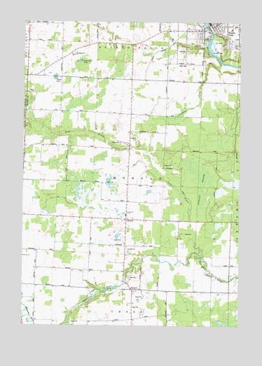
Oconto Falls South, WI USGS Topographic Map
Click on map above to begin viewing in our Map Viewer.

This topographic map contains these locations and features:
Feature Name Type Latitude Longitude GNIS ID View Map
731 ReservoirReservoirN44.8717°W88.1434°1792998View Map
Central Morgan School (historical)SchoolN44.8078°W88.1893°1843946View Map
City of Oconto FallsCivilN44.8738°W88.1444°1583852View Map
Community Memorial Hospital HeliportAirportN44.8650°W88.1284°1582122View Map
Coopman CreekStreamN44.8580°W88.1362°1563383View Map
Degantown SchoolSchoolN44.8619°W88.2229°1563866View Map
Delzer LakeLakeN44.8521°W88.2321°1563895View Map
Dombroski LakeLakeN44.8591°W88.2171°1564045View Map
Falls Alternative Learning SiteSchoolN44.8747°W88.1407°2713203View Map
First Methodist Church (historical)ChurchN44.8736°W88.1420°1843960View Map
Flats Recreation AreaParkN44.8636°W88.1387°1565066View Map
Flowing Spring School (historical)SchoolN44.7639°W88.1507°1843962View Map
Grace Lutheran ChurchChurchN44.8697°W88.1362°1843968View Map
HSHS Saint Clare Memorial HospitalHospitalN44.8652°W88.1277°1843952View Map
Jefferson SchoolSchoolN44.8717°W88.1495°1843973View Map
Lincoln School (historical)SchoolN44.7522°W88.1976°1843978View Map
Lower Oconto Falls 1857c195 DamDamN44.8717°W88.1434°1792997View Map
MorganPopulated PlaceN44.7939°W88.1901°1569725View Map
Morgan MarshSwampN44.8067°W88.1468°1569732View Map
New Path SchoolSchoolN44.8747°W88.1407°2713380View Map
North Branch Pensaukee RiverStreamN44.7783°W88.1462°1570387View Map
North Morgan School (historical)SchoolN44.8372°W88.1887°1843991View Map
Oconto FallsPopulated PlaceN44.8739°W88.1429°1570743View Map
Oconto Falls Area Ambulance ServiceBuildingN44.8653°W88.1262°2698335View Map
Oconto Falls Elementary SchoolSchoolN44.8698°W88.1285°2713414View Map
Oconto Falls High SchoolSchoolN44.8732°W88.1277°1843998View Map
Oconto Falls Hospital (historical)HospitalN44.8733°W88.1423°1843999View Map
Oconto Falls Wastewater Treatment PlantLocaleN44.8681°W88.1439°2710348View Map
Saint Johns CemeteryCemeteryN44.7969°W88.1895°1844010View Map
Saint Johns ChurchChurchN44.7964°W88.1893°1573104View Map
Saint Pauls Evangelical Lutheran ChurchChurchN44.8733°W88.1365°1844015View Map
SampsonPopulated PlaceN44.7650°W88.1862°1573644View Map
South Morgan School (historical)SchoolN44.7758°W88.1915°1844019View Map
Town of MorganCivilN44.8082°W88.1895°1583751View Map
Volk CemeteryCemeteryN44.8678°W88.1637°1576123View Map
Volk School (historical)SchoolN44.8650°W88.1673°1844032View Map
Washington Middle SchoolSchoolN44.8743°W88.1393°1844034View Map
Zion Lutheran Church (historical)ChurchN44.8730°W88.1401°1844039View Map

Note: Coordinates in the location and feature list above are referenced to NAD83 datum.


Copyright (C) 2008-2024 Ryan Niemi / Sunset Dynamics ... All Rights Reserved