TopoQuest Logo
Do you find TopoQuest useful?
Help keep TopoQuest running and adding new maps/features by donating!
Bitcoin:  19c7KJd3qBynnjoSw5npx9KScwjBe4ifkT
Litecoin:  LXs6TkuXGGXo1vDsWCkWVdjQX94eUKd6ui
Home View Maps Find Maps Find Places Resources & Links


Strum SE, Wisconsin Topographic Map

USGS Map Title: Strum SE, WI
USGS Map MRC: 44091E3
DRG (GeoTIFF) Download: o44091e3.tif


Neighboring USGS Topographic Map Quads:


  Cleghorn, WI  
44091F4
 

  Brackett, WI  
44091F3
 

  Augusta West, WI  
44091F2
 

  Strum, WI  
44091E4
 

  Strum SE, WI  
44091E3
 

  Osseo, WI  
44091E2
 

  Elk Creek, WI  
44091D4
 

  Pleasantville, WI  
44091D3
 

  Pigeon Falls, WI  
44091D2


Map MRC Location:

N45°
W92°
N45°
W91°
H8 H7 H6 H5 H4 H3 H2 H1
G8 G7 G6 G5 G4 G3 G2 G1
F8 F7 F6 F5 F4 F3 F2 F1
E8 E7 E6 E5 E4 E3 E2 E1
D8 D7 D6 D5 D4 D3 D2 D1
C8 C7 C6 C5 C4 C3 C2 C1
B8 B7 B6 B5 B4 B3 B2 B1
A8 A7 A6 A5 A4 A3 A2 A1
N44°
W92°
N44°
W91°

Strum SE, WI USGS 1:24K Topographic Map Preview:
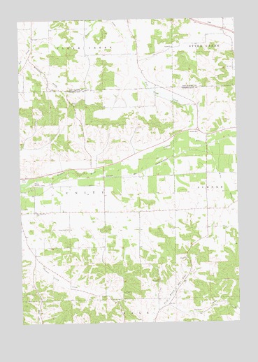
Strum SE, WI USGS Topographic Map
Click on map above to begin viewing in our Map Viewer.

This topographic map contains these locations and features:
Feature Name Type Latitude Longitude GNIS ID View Map
Brick School (historical)SchoolN44.5455°W91.3274°1851071View Map
Brion Memorial AirportAirportN44.5569°W91.3679°2444143View Map
Clemenson School (historical)SchoolN44.6102°W91.3343°1846646View Map
Fowler CreekStreamN44.5626°W91.3074°2760862View Map
Holman ValleyValleyN44.5079°W91.2914°1566558View Map
Howreys CreekStreamN44.5613°W91.3399°2760861View Map
Johnson Valley School (historical)SchoolN44.5316°W91.3707°1851120View Map
King CreekStreamN44.5730°W91.2679°1567497View Map
Kingdom HallChurchN44.5786°W91.2724°1567504View Map
Kings ValleyValleyN44.5730°W91.2677°1851121View Map
Norseville School (historical)SchoolN44.6089°W91.3721°1846717View Map
Pine CreekStreamN44.5772°W91.2790°1571428View Map
Pine Creek School (historical)SchoolN44.5905°W91.2865°1851152View Map
Plainview School (historical)SchoolN44.6225°W91.2563°1846734View Map
Prairie View CemeteryCemeteryN44.5386°W91.3477°1571894View Map
River View School (historical)SchoolN44.5658°W91.3215°1851161View Map
Rumstead ValleyValleyN44.6090°W91.3712°1572721View Map
Town of UnityCivilN44.5528°W91.3457°1584320View Map
Tracy Valley School (historical)SchoolN44.5466°W91.2682°1851188View Map
West Beef River CemeteryCemeteryN44.5455°W91.3671°1576452View Map
York Valley School (historical)SchoolN44.6147°W91.3068°1846789View Map

Note: Coordinates in the location and feature list above are referenced to NAD83 datum.


Copyright (C) 2008-2024 Ryan Niemi / Sunset Dynamics ... All Rights Reserved