TopoQuest Logo
Do you find TopoQuest useful?
Help keep TopoQuest running and adding new maps/features by donating!
Bitcoin:  19c7KJd3qBynnjoSw5npx9KScwjBe4ifkT
Litecoin:  LXs6TkuXGGXo1vDsWCkWVdjQX94eUKd6ui
Home View Maps Find Maps Find Places Resources & Links


Elk Creek, Wisconsin Topographic Map

USGS Map Title: Elk Creek, WI
USGS Map MRC: 44091D4
DRG (GeoTIFF) Download: o44091d4.tif


Neighboring USGS Topographic Map Quads:


  Rossman Creek, WI  
44091E5
 

  Strum, WI  
44091E4
 

  Strum SE, WI  
44091E3
 

  Lookout, WI  
44091D5
 

  Elk Creek, WI  
44091D4
 

  Pleasantville, WI  
44091D3
 

  Swinns Valley, WI  
44091C5
 

  Independence, WI  
44091C4
 

  Whitehall, WI  
44091C3


Map MRC Location:

N45°
W92°
N45°
W91°
H8 H7 H6 H5 H4 H3 H2 H1
G8 G7 G6 G5 G4 G3 G2 G1
F8 F7 F6 F5 F4 F3 F2 F1
E8 E7 E6 E5 E4 E3 E2 E1
D8 D7 D6 D5 D4 D3 D2 D1
C8 C7 C6 C5 C4 C3 C2 C1
B8 B7 B6 B5 B4 B3 B2 B1
A8 A7 A6 A5 A4 A3 A2 A1
N44°
W92°
N44°
W91°

Elk Creek, WI USGS 1:24K Topographic Map Preview:
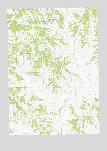
Elk Creek, WI USGS Topographic Map
Click on map above to begin viewing in our Map Viewer.

This topographic map contains these locations and features:
Feature Name Type Latitude Longitude GNIS ID View Map
Borst ValleyValleyN44.4028°W91.4324°1562082View Map
Borst Valley CreekStreamN44.3994°W91.4302°1577304View Map
Borst Valley School (historical)SchoolN44.4161°W91.4538°1851067View Map
Brick School (historical)SchoolN44.4800°W91.4215°1851069View Map
Chimney RockLocaleN44.4691°W91.4163°1563024View Map
Chimney Rock CreekStreamN44.4294°W91.3999°1563029View Map
Chimney Rock State Public Hunting GroundsParkN44.4897°W91.4546°1563030View Map
Cripps CemeteryCemeteryN44.3988°W91.4243°1563534View Map
Cripps School (historical)SchoolN44.3925°W91.4257°1851085View Map
Elk CreekPopulated PlaceN44.4269°W91.3996°1564514View Map
Elk Creek School (historical)SchoolN44.4250°W91.3988°1851094View Map
Farmers School (historical)SchoolN44.3805°W91.4971°1851097View Map
Hawkenson School (historical)SchoolN44.4908°W91.4465°1851620View Map
Hawkinson CreekStreamN44.4761°W91.4218°1566161View Map
Hawkinson ValleyValleyN44.4764°W91.4226°1566162View Map
Hunt ValleyValleyN44.3809°W91.4986°1566808View Map
Insteness School (historical)SchoolN44.4550°W91.4360°1851117View Map
Insteness ValleyValleyN44.4567°W91.4132°1566942View Map
Johnson ValleyValleyN44.4174°W91.4558°1567250View Map
Kwuosek ValleyValleyN44.4415°W91.4783°1567667View Map
Little Elk CreekStreamN44.3977°W91.4298°2760863View Map
Maule Coulee School (historical)SchoolN44.3855°W91.3793°1851132View Map
Olson ValleyValleyN44.4666°W91.4130°1570809View Map
Roskos School (historical)SchoolN44.4602°W91.3871°1851162View Map
Roskos ValleyValleyN44.4495°W91.3973°1572621View Map
RussellPopulated PlaceN44.4280°W91.4785°1851163View Map
Russell School (historical)SchoolN44.4289°W91.4788°1851164View Map
Skagstad School (historical)SchoolN44.4944°W91.4177°1851173View Map
Sport ValleyValleyN44.4263°W91.4783°1574573View Map
Sport Valley CreekStreamN44.4200°W91.4618°1574574View Map
Sunshine ValleyValleyN44.4524°W91.4877°1575124View Map
Town of BurnsideCivilN44.3808°W91.4695°1582892View Map
Town of Chimney RockCivilN44.4657°W91.4685°1582956View Map
Veum School (historical)SchoolN44.4544°W91.4888°1851194View Map
Walek KnobSummitN44.3969°W91.4799°1576155View Map

Note: Coordinates in the location and feature list above are referenced to NAD83 datum.


Copyright (C) 2008-2024 Ryan Niemi / Sunset Dynamics ... All Rights Reserved