TopoQuest Logo
Do you find TopoQuest useful?
Help keep TopoQuest running and adding new maps/features by donating!
Bitcoin:  19c7KJd3qBynnjoSw5npx9KScwjBe4ifkT
Litecoin:  LXs6TkuXGGXo1vDsWCkWVdjQX94eUKd6ui
Home View Maps Find Maps Find Places Resources & Links


Soza Canyon, Arizona Topographic Map

USGS Map Title: Soza Canyon, AZ
USGS Map MRC: 32110C4
DRG (GeoTIFF) Download: o32110c4.tif


Neighboring USGS Topographic Map Quads:


  Buehman Canyon, AZ  
32110D5
 

  Redington, AZ  
32110D4
 

  Cherry Spring Peak, AZ  
32110D3
 

  Piety Hill, AZ  
32110C5
 

  Soza Canyon, AZ  
32110C4
 

  Soza Mesa, AZ  
32110C3
 

  Mica Mountain, AZ  
32110B5
 

  Happy Valley, AZ  
32110B4
 

  Wildhorse Mountain, AZ  
32110B3


Map MRC Location:

N33°
W111°
N33°
W110°
H8 H7 H6 H5 H4 H3 H2 H1
G8 G7 G6 G5 G4 G3 G2 G1
F8 F7 F6 F5 F4 F3 F2 F1
E8 E7 E6 E5 E4 E3 E2 E1
D8 D7 D6 D5 D4 D3 D2 D1
C8 C7 C6 C5 C4 C3 C2 C1
B8 B7 B6 B5 B4 B3 B2 B1
A8 A7 A6 A5 A4 A3 A2 A1
N32°
W111°
N32°
W110°

Soza Canyon, AZ USGS 1:24K Topographic Map Preview:
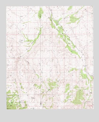
Soza Canyon, AZ USGS Topographic Map
Click on map above to begin viewing in our Map Viewer.

This topographic map contains these locations and features:
Feature Name Type Latitude Longitude GNIS ID View Map
Banco RidgeRidgeN32.2854°W110.4440°25941View Map
Banco RidgeRidgeN32.3001°W110.4359°39193View Map
Bar L Y RanchLocaleN32.3142°W110.4776°25964View Map
Bolt CanyonValleyN32.3148°W110.4767°26583View Map
Caņada Atravesada CanyonValleyN32.3148°W110.4765°27239View Map
CascabelPopulated PlaceN32.2915°W110.3795°27318View Map
Cascabel RanchLocaleN32.3156°W110.3892°27319View Map
Cascabel SchoolSchoolN32.3020°W110.3856°27320View Map
Chimney CanyonValleyN32.2692°W110.4884°27589View Map
Coffee Pot TankReservoirN32.2616°W110.4739°42635View Map
Espiritu CanyonValleyN32.3144°W110.4769°28921View Map
Espiritu WellWellN32.2598°W110.4815°37293View Map
Flagtail SpringSpringN32.2540°W110.4949°37300View Map
Gibson RanchLocaleN32.2712°W110.3804°29320View Map
Hidden TankReservoirN32.2591°W110.4924°5773View Map
High TankReservoirN32.2592°W110.4926°37339View Map
Hot Springs Canyon CreekStreamN32.2899°W110.3828°2572927View Map
Last Chance TrailheadLocaleN32.2675°W110.4714°2611801View Map
Middle Canyon TankReservoirN32.2508°W110.4602°37404View Map
Mineta RidgeRidgeN32.3223°W110.4940°31917View Map
Paige CanyonValleyN32.2854°W110.3802°25490View Map
Paige CreekStreamN32.2842°W110.3801°25491View Map
Pelon SpringSpringN32.2642°W110.4623°37466View Map
Roble CanyonValleyN32.2984°W110.3973°33689View Map
Roble SpringSpringN32.2696°W110.4487°33690View Map
Saucito CanyonValleyN32.2890°W110.4537°34089View Map
Soza CanyonValleyN32.3604°W110.4359°34695View Map
Soza RanchLocaleN32.3523°W110.4248°34696View Map
Soza WashStreamN32.3598°W110.4331°34697View Map
Spear RanchLocaleN32.3565°W110.4254°34702View Map
Tres Pipas CanyonValleyN32.2658°W110.4845°35463View Map
West Fork Aliso SpringSpringN32.2515°W110.4995°37586View Map
White RidgeRidgeN32.2848°W110.4784°36100View Map
Willow SpringSpringN32.2521°W110.4768°37595View Map
Youtcy CanyonValleyN32.3342°W110.4631°36492View Map

Note: Coordinates in the location and feature list above are referenced to NAD83 datum.


Copyright (C) 2008-2024 Ryan Niemi / Sunset Dynamics ... All Rights Reserved