TopoQuest Logo
Do you find TopoQuest useful?
Help keep TopoQuest running and adding new maps/features by donating!
Bitcoin:  19c7KJd3qBynnjoSw5npx9KScwjBe4ifkT
Litecoin:  LXs6TkuXGGXo1vDsWCkWVdjQX94eUKd6ui
Home View Maps Find Maps Find Places Resources & Links


Happy Valley, Arizona Topographic Map

USGS Map Title: Happy Valley, AZ
USGS Map MRC: 32110B4
DRG (GeoTIFF) Download: o32110b4.tif


Neighboring USGS Topographic Map Quads:


  Piety Hill, AZ  
32110C5
 

  Soza Canyon, AZ  
32110C4
 

  Soza Mesa, AZ  
32110C3
 

  Mica Mountain, AZ  
32110B5
 

  Happy Valley, AZ  
32110B4
 

  Wildhorse Mountain, AZ  
32110B3
 

  Rincon Peak, AZ  
32110A5
 

  Galleta Flat West, AZ  
32110A4
 

  Galleta Flat East, AZ  
32110A3


Map MRC Location:

N33°
W111°
N33°
W110°
H8 H7 H6 H5 H4 H3 H2 H1
G8 G7 G6 G5 G4 G3 G2 G1
F8 F7 F6 F5 F4 F3 F2 F1
E8 E7 E6 E5 E4 E3 E2 E1
D8 D7 D6 D5 D4 D3 D2 D1
C8 C7 C6 C5 C4 C3 C2 C1
B8 B7 B6 B5 B4 B3 B2 B1
A8 A7 A6 A5 A4 A3 A2 A1
N32°
W111°
N32°
W110°

Happy Valley, AZ USGS 1:24K Topographic Map Preview:
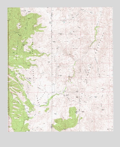
Happy Valley, AZ USGS Topographic Map
Click on map above to begin viewing in our Map Viewer.

This topographic map contains these locations and features:
Feature Name Type Latitude Longitude GNIS ID View Map
Bald MountainSummitN32.1449°W110.4171°25916View Map
Barney RanchLocaleN32.2087°W110.4401°25993View Map
Bear CreekStreamN32.1912°W110.4220°26078View Map
Bear SpringSpringN32.2295°W110.4777°22405View Map
Bear SpringSpringN32.2292°W110.4773°26106View Map
Boulder TankReservoirN32.1428°W110.4422°26654View Map
Buckhorn CanyonValleyN32.1635°W110.4339°26911View Map
Buckhorn SpringSpringN32.1609°W110.4312°26920View Map
Caņon la CarneValleyN32.2061°W110.4820°27263View Map
Caņon la Carne SpringSpringN32.2123°W110.4823°27262View Map
Cement DamDamN32.2187°W110.4506°41791View Map
Cement Dam TankReservoirN32.2187°W110.4506°22447View Map
Cement Dam TankReservoirN32.2187°W110.4506°37219View Map
Clopton RanchLocaleN32.1540°W110.4540°27728View Map
Cold SpringSpringN32.1651°W110.4165°27796View Map
Collins WashStreamN32.2434°W110.3895°27821View Map
Deer CreekStreamN32.1956°W110.4184°28372View Map
Dripping SpringSpringN32.2154°W110.4432°28597View Map
Driscoll MountainSummitN32.1814°W110.4387°28604View Map
Eagle PeakSummitN32.1597°W110.4166°28723View Map
Forest HillSummitN32.1275°W110.4320°29098View Map
Fox MountainSummitN32.2337°W110.4689°29158View Map
Fresno SpringSpringN32.1952°W110.4525°29205View Map
Gardner CanyonValleyN32.1974°W110.4126°29258View Map
Gardner MountainSummitN32.1839°W110.4144°29260View Map
Grapevine CanyonValleyN32.1646°W110.3874°29505View Map
Grapevine SpringSpringN32.1467°W110.3890°29516View Map
Grapevine SpringSpringN32.1468°W110.3889°41788View Map
Happy ValleyBasinN32.1534°W110.4662°29740View Map
Hells GateGapN32.1798°W110.4270°29865View Map
Iron FlatFlatN32.2154°W110.4304°30415View Map
Juanuņa SpringSpringN32.1450°W110.4098°30636View Map
Last Chance RanchLocaleN32.2370°W110.4329°30900View Map
Lechuguilla PeakSummitN32.2231°W110.4354°30923View Map
Little Rincon MountainsRangeN32.1537°W110.3921°31117View Map
Lower SpringSpringN32.2050°W110.4738°31379View Map
Lower Turkey Creek SpringSpringN32.1732°W110.4821°35548View Map
McCormick CanyonValleyN32.2014°W110.4090°31637View Map
Mesquite CanyonValleyN32.1582°W110.4510°31760View Map
Mesquite Canyon SpringSpringN32.1790°W110.4724°31761View Map
Miller CanyonValleyN32.1502°W110.4796°31864View Map
Miller Creek TrailheadLocaleN32.1503°W110.4806°2611760View Map
Miller FlatFlatN32.1454°W110.4773°31868View Map
Miller RanchLocaleN32.1481°W110.4801°41789View Map
Paige WellWellN32.1392°W110.4759°32630View Map
RedrockPillarN32.1681°W110.3859°33538View Map
Redrock TankReservoirN32.1603°W110.3966°33542View Map
Secret PastureFlatN32.1256°W110.4765°34194View Map
Steel Trough SpringSpringN32.2389°W110.4758°34815View Map
Sycamore CanyonValleyN32.2050°W110.4854°35014View Map
Sycamore SpringSpringN32.2458°W110.4757°35045View Map
Sycamore SpringSpringN32.2220°W110.4865°35046View Map
Turkey CreekStreamN32.1529°W110.4534°35543View Map
Turkey Creek TrailheadLocaleN32.1692°W110.4767°2611761View Map
Twin TanksReservoirN32.2342°W110.4483°35631View Map
Upper Mesquite Canyon SpringSpringN32.1836°W110.4843°35699View Map
Upper SpringSpringN32.2050°W110.4918°35711View Map
Upper West Fork SpringSpringN32.2469°W110.4779°35730View Map
Wino TankReservoirN32.2476°W110.4132°36323View Map

Note: Coordinates in the location and feature list above are referenced to NAD83 datum.


Copyright (C) 2008-2024 Ryan Niemi / Sunset Dynamics ... All Rights Reserved