TopoQuest Logo
Do you find TopoQuest useful?
Help keep TopoQuest running and adding new maps/features by donating!
Bitcoin:  19c7KJd3qBynnjoSw5npx9KScwjBe4ifkT
Litecoin:  LXs6TkuXGGXo1vDsWCkWVdjQX94eUKd6ui
Home View Maps Find Maps Find Places Resources & Links


Sneads Ferry, North Carolina Topographic Map

USGS Map Title: Sneads Ferry, NC
USGS Map MRC: 34077E4
DRG (GeoTIFF) Download: o34077e4.tif


Neighboring USGS Topographic Map Quads:


  Haws Run, NC  
34077F5
 

  Jacksonville South, NC  
34077F4
 

  Camp Lejeune, NC  
34077F3
 

  Folkstone, NC  
34077E5
 

  Sneads Ferry, NC  
34077E4
 

  New River Inlet, NC  
34077E3
 

  Holly Ridge, NC  
34077D5
 

  Spicer Bay, NC  
34077D4


Map MRC Location:

N35°
W78°
N35°
W77°
H8 H7 H6 H5 H4 H3 H2 H1
G8 G7 G6 G5 G4 G3 G2 G1
F8 F7 F6 F5 F4 F3 F2 F1
E8 E7 E6 E5 E4 E3 E2 E1
D8 D7 D6 D5 D4 D3 D2 D1
C8 C7 C6 C5 C4 C3 C2 C1
B8 B7 B6 B5 B4 B3 B2 B1
A8 A7 A6 A5 A4 A3 A2 A1
N34°
W78°
N34°
W77°

Sneads Ferry, NC USGS 1:24K Topographic Map Preview:
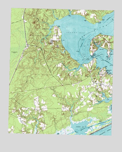
Sneads Ferry, NC USGS Topographic Map
Click on map above to begin viewing in our Map Viewer.

This topographic map contains these locations and features:
Feature Name Type Latitude Longitude GNIS ID View Map
Alligator BayBayN34.5082°W77.4111°980125View Map
Biglins CreekStreamN34.5338°W77.3897°981476View Map
Camp Lejeune Fire DepartmentBuildingN34.5914°W77.4503°2639331View Map
Camp Lejeune Fire DepartmentBuildingN34.6126°W77.4880°2639339View Map
Carrel ChapelChurchN34.5513°W77.3894°982677View Map
Catfish PointCapeN34.6149°W77.4083°982758View Map
Charles CreekStreamN34.5371°W77.3816°983039View Map
Davis Mobile Home ParkPopulated PlaceN34.5497°W77.4228°2505453View Map
DixonPopulated PlaceN34.5860°W77.4800°1019982View Map
Dixon Elementary SchoolSchoolN34.5578°W77.4451°1003108View Map
Dixon Senior High SchoolSchoolN34.5849°W77.4794°1003107View Map
Ellis CoveBayN34.5854°W77.3889°984736View Map
Everett CreekStreamN34.5710°W77.4125°984870View Map
Fannie CreekStreamN34.5691°W77.3933°985000View Map
Ferry PointCapeN34.5771°W77.3961°985059View Map
First United Methodist Church of Sneads FerryChurchN34.5708°W77.4007°2504748View Map
Foys LandingLocaleN34.6196°W77.4302°1020348View Map
Fulcher LandingPopulated PlaceN34.5654°W77.3827°1020377View Map
Hickory PointCapeN34.6154°W77.3891°986715View Map
Hines PointCapeN34.6129°W77.3930°986845View Map
Jarretts PointCapeN34.5782°W77.3805°987528View Map
Little Zion ChurchChurchN34.5571°W77.3980°988805View Map
Marine Corps Base Camp LejeuneMilitaryN34.5877°W77.3926°2512280View Map
Mill CreekStreamN34.5091°W77.4208°989909View Map
Mill CreekStreamN34.6204°W77.4286°989942View Map
Millstone CreekStreamN34.6082°W77.4514°990032View Map
Muddy CreekStreamN34.6143°W77.4439°990756View Map
Onslow County Emergency Medical Services Station 6BuildingN34.5597°W77.4489°2720466View Map
Onslow County Public Library - Sneads Ferry BranchBuildingN34.5519°W77.3955°2505958View Map
Pollocks PointCapeN34.5799°W77.3991°992647View Map
Poverty PointCapeN34.5685°W77.3844°992763View Map
Sandford LandingLocaleN34.5132°W77.3891°1022482View Map
Sneads CreekStreamN34.5879°W77.3914°995049View Map
Sneads FerryPopulated PlaceN34.5527°W77.3972°995050View Map
Sneads Ferry BridgeBridgeN34.5785°W77.3991°995051View Map
Sneads Ferry Census Designated PlaceCensusN34.5564°W77.3824°2402862View Map
Sneads Ferry Post OfficePost OfficeN34.5504°W77.4314°2773821View Map
Sneads Ferry Rescue SquadBuildingN34.5530°W77.3932°2720334View Map
Sneads Ferry Volunteer Fire DepartmentBuildingN34.5454°W77.4025°2638926View Map
Stones BayBayN34.6007°W77.4208°995540View Map
Stones CreekStreamN34.6118°W77.4430°995542View Map
Stones LandingLocaleN34.6077°W77.4433°1022800View Map
Township of Stump SoundCivilN34.5388°W77.4839°1027008View Map
Turkey Creek Mobile Home ParkPopulated PlaceN34.5057°W77.4561°2505677View Map
Turkey Creek Volunteer Fire DepartmentBuildingN34.5246°W77.4762°2638842View Map
Unorganized Territory of Camp LejeuneCivilN34.6207°W77.3839°2402948View Map
Wheeler CreekStreamN34.5677°W77.3886°997108View Map
Whitewood Forest AirportBuildingN34.5660°W77.4412°2506030View Map
Winding Creek Airport (historical)AirportN34.5658°W77.4408°2679265View Map
Yopps ChurchChurchN34.5588°W77.4041°997722View Map

Note: Coordinates in the location and feature list above are referenced to NAD83 datum.


Copyright (C) 2008-2024 Ryan Niemi / Sunset Dynamics ... All Rights Reserved