TopoQuest Logo
Do you find TopoQuest useful?
Help keep TopoQuest running and adding new maps/features by donating!
Bitcoin:  19c7KJd3qBynnjoSw5npx9KScwjBe4ifkT
Litecoin:  LXs6TkuXGGXo1vDsWCkWVdjQX94eUKd6ui
Home View Maps Find Maps Find Places Resources & Links


Slaughters, Kentucky Topographic Map

USGS Map Title: Slaughters, KY
USGS Map MRC: 37087D5
DRG (GeoTIFF) Download: o37087d5.tif


Neighboring USGS Topographic Map Quads:


  Dixon, KY  
37087E6
 

  Sebree, KY  
37087E5
 

  Beech Grove, KY  
37087E4
 

  Nebo, KY  
37087D6
 

  Slaughters, KY  
37087D5
 

  Hanson, KY  
37087D4
 

  Coiltown, KY  
37087C6
 

  Madisonville West, KY  
37087C5
 

  Madisonville East, KY  
37087C4


Map MRC Location:

N38°
W88°
N38°
W87°
H8 H7 H6 H5 H4 H3 H2 H1
G8 G7 G6 G5 G4 G3 G2 G1
F8 F7 F6 F5 F4 F3 F2 F1
E8 E7 E6 E5 E4 E3 E2 E1
D8 D7 D6 D5 D4 D3 D2 D1
C8 C7 C6 C5 C4 C3 C2 C1
B8 B7 B6 B5 B4 B3 B2 B1
A8 A7 A6 A5 A4 A3 A2 A1
N37°
W88°
N37°
W87°

Slaughters, KY USGS 1:24K Topographic Map Preview:
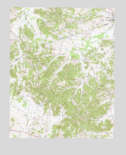
Slaughters, KY USGS Topographic Map
Click on map above to begin viewing in our Map Viewer.

This topographic map contains these locations and features:
Feature Name Type Latitude Longitude GNIS ID View Map
Antioch Primitive Baptist ChurchChurchN37.4255°W87.5146°485984View Map
Bailey CemeteryCemeteryN37.4561°W87.5105°486216View Map
Brooks CemeteryCemeteryN37.4978°W87.5383°487958View Map
Browder CemeteryCemeteryN37.4550°W87.5608°487980View Map
Brown CemeteryCemeteryN37.4603°W87.5139°487993View Map
Brown CemeteryCemeteryN37.4821°W87.5989°487995View Map
City of SlaughtersCivilN37.4903°W87.5021°2405469View Map
Concord ChurchChurchN37.4170°W87.5869°489931View Map
Coxs CemeteryCemeteryN37.4473°W87.5917°490234View Map
Durm CemeteryCemeteryN37.4428°W87.6131°491351View Map
Faucett CemeteryCemeteryN37.4503°W87.5817°492002View Map
Gardwell CemeteryCemeteryN37.4400°W87.5056°492702View Map
Groves CemeteryCemeteryN37.4711°W87.5622°493439View Map
Hester CemeteryCemeteryN37.4425°W87.6082°494099View Map
Hobgood CemeteryCemeteryN37.4806°W87.5747°494324View Map
Jackson Stage Stop Historical MarkerParkN37.4444°W87.5301°2744441View Map
Key CemeteryCemeteryN37.4467°W87.5983°495708View Map
Mangum CemeteryCemeteryN37.4386°W87.5728°497489View Map
Manitou Census Designated PlaceCensusN37.3755°W87.5781°2629646View Map
Manitou Volunteer Fire DepartmentBuildingN37.3782°W87.5808°2636368View Map
Mount Carmel CemeteryCemeteryN37.4714°W87.5300°498696View Map
Mount Gilead ChurchChurchN37.4931°W87.5653°498732View Map
Oakley Home (historical)Populated PlaceN37.4506°W87.5915°2743538View Map
Oakley Home ChurchChurchN37.4503°W87.5914°499751View Map
Oakliff Store (historical)Populated PlaceN37.4482°W87.5320°2743539View Map
Olive Branch Baptist ChurchChurchN37.4219°W87.5203°499920View Map
Owen CemeteryCemeteryN37.4175°W87.5858°500054View Map
Ruby CemeteryCemeteryN37.4898°W87.6169°502450View Map
Shake Rag HillsRangeN37.3962°W87.5458°503228View Map
SlaughtersPopulated PlaceN37.4889°W87.5022°503668View Map
Slaughters Fire DepartmentBuildingN37.4874°W87.5029°2636710View Map
Tapp CemeteryCemeteryN37.4724°W87.5460°504950View Map
Trice CemeteryCemeteryN37.4734°W87.5736°505493View Map
Utterback CemeteryCemeteryN37.3756°W87.5203°505930View Map
Vaughn CemeteryCemeteryN37.4742°W87.5528°505993View Map
VeazeyPopulated PlaceN37.4481°W87.5903°509278View Map
Veazey CemeteryCemeteryN37.4456°W87.5872°506013View Map
West HansonPopulated PlaceN37.4177°W87.5005°2743549View Map
WHRZ-FM (Providence)TowerN37.4145°W87.5731°518016View Map
Winstead CemeteryCemeteryN37.4873°W87.6242°506956View Map
WLCN-TV (Madisonville)TowerN37.4128°W87.5256°518061View Map
YarbroPopulated PlaceN37.4171°W87.6154°2743551View Map
Yarbro HillSummitN37.4178°W87.6156°507192View Map

Note: Coordinates in the location and feature list above are referenced to NAD83 datum.


Copyright (C) 2008-2024 Ryan Niemi / Sunset Dynamics ... All Rights Reserved