TopoQuest Logo
Do you find TopoQuest useful?
Help keep TopoQuest running and adding new maps/features by donating!
Bitcoin:  19c7KJd3qBynnjoSw5npx9KScwjBe4ifkT
Litecoin:  LXs6TkuXGGXo1vDsWCkWVdjQX94eUKd6ui
Home View Maps Find Maps Find Places Resources & Links


Sisseton, South Dakota Topographic Map

USGS Map Title: Sisseton, SD
USGS Map MRC: 45097F1
DRG (GeoTIFF) Download: o45097f1.tif


Neighboring USGS Topographic Map Quads:


  Claire City SW, SD  
45097G2
 

  Claire City, SD  
45097G1
 

  New Effington, SD  
45096G8
 

  Whitestone Lake, SD  
45097F2
 

  Sisseton, SD  
45097F1
 

  Peever NW, SD  
45096F8
 

  Drywood Lakes, SD  
45097E2
 

  Goodwill, SD  
45097E1
 

  Peever, SD  
45096E8


Map MRC Location:

N46°
W98°
N46°
W97°
H8 H7 H6 H5 H4 H3 H2 H1
G8 G7 G6 G5 G4 G3 G2 G1
F8 F7 F6 F5 F4 F3 F2 F1
E8 E7 E6 E5 E4 E3 E2 E1
D8 D7 D6 D5 D4 D3 D2 D1
C8 C7 C6 C5 C4 C3 C2 C1
B8 B7 B6 B5 B4 B3 B2 B1
A8 A7 A6 A5 A4 A3 A2 A1
N45°
W98°
N45°
W97°

Sisseton, SD USGS 1:24K Topographic Map Preview:
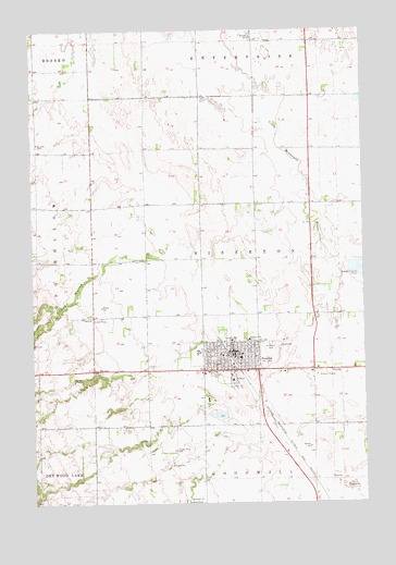
Sisseton, SD USGS Topographic Map
Click on map above to begin viewing in our Map Viewer.

This topographic map contains these locations and features:
Feature Name Type Latitude Longitude GNIS ID View Map
City of SissetonCivilN45.6625°W97.0453°1267567View Map
Coteau des Prairies HospitalHospitalN45.6575°W97.0502°2610934View Map
Episcopal Indian ChurchChurchN45.6361°W97.0651°1263955View Map
Grant - Roberts Ambulance Service SissetonBuildingN45.6560°W97.0513°2659010View Map
Lake Traverse ReservationCivilN45.6455°W97.0986°1934336View Map
Long HollowValleyN45.6891°W97.0970°1256226View Map
Roberts County CourthouseBuildingN45.6642°W97.0477°2722898View Map
Roberts County JailBuildingN45.6557°W97.0589°2755648View Map
Roberts County Sheriff's OfficeBuildingN45.6556°W97.0590°2755621View Map
Saint Peter's CemeteryCemeteryN45.6666°W97.0353°1265356View Map
Saint Peters SchoolSchoolN45.6683°W97.0440°1257739View Map
Saron ChurchChurchN45.7205°W97.1231°1257813View Map
School Number 2 (historical)SchoolN45.6883°W97.0398°1263927View Map
SissetonPopulated PlaceN45.6647°W97.0498°1258093View Map
Sisseton - Wahpeton - Oyate Wildland FirefightersBuildingN45.6677°W97.0477°2580793View Map
Sisseton City CemeteryCemeteryN45.6665°W97.0370°2779321View Map
Sisseton City HallBuildingN45.6651°W97.0494°2725278View Map
Sisseton Fire DepartmentBuildingN45.6644°W97.0506°2580658View Map
Sisseton High SchoolSchoolN45.6648°W97.0624°2729636View Map
Sisseton Memorial LibraryBuildingN45.6640°W97.0467°2723677View Map
Sisseton Middle SchoolSchoolN45.6648°W97.0624°2729638View Map
Sisseton Police DepartmentBuildingN45.6651°W97.0494°2755508View Map
Sisseton Post OfficePost OfficeN45.6649°W97.0482°2711889View Map
Sisseton Public Health Service HospitalHospitalN45.6675°W97.0509°2610947View Map
Tekakwitha DamDamN45.6483°W97.0537°1260508View Map
Torvik SubdivisionPopulated PlaceN45.6625°W97.0770°1263907View Map
Township of SissetonCivilN45.6901°W97.0403°1268559View Map
Union District School (historical)SchoolN45.7338°W97.0731°1263917View Map
Valley View EstatesPopulated PlaceN45.6541°W97.1245°1263908View Map
Westside Elementary SchoolSchoolN45.6616°W97.0558°2729639View Map

Note: Coordinates in the location and feature list above are referenced to NAD83 datum.


Copyright (C) 2008-2024 Ryan Niemi / Sunset Dynamics ... All Rights Reserved