TopoQuest Logo
Do you find TopoQuest useful?
Help keep TopoQuest running and adding new maps/features by donating!
Bitcoin:  19c7KJd3qBynnjoSw5npx9KScwjBe4ifkT
Litecoin:  LXs6TkuXGGXo1vDsWCkWVdjQX94eUKd6ui
Home View Maps Find Maps Find Places Resources & Links


Peever, South Dakota Topographic Map

USGS Map Title: Peever, SD
USGS Map MRC: 45096E8
DRG (GeoTIFF) Download: o45096e8.tif


Neighboring USGS Topographic Map Quads:


  Sisseton, SD  
45097F1
 

  Peever NW, SD  
45096F8
 

  Peever NE, SD  
45096F7
 

  Goodwill, SD  
45097E1
 

  Peever, SD  
45096E8
 

  Browns Valley, MN  
45096E7
 

  Summit NE, SD  
45097D1
 

  Wilmot NW, SD  
45096D8
 

  Wilmot, SD  
45096D7


Map MRC Location:

N46°
W97°
N46°
W96°
H8 H7 H6 H5 H4 H3 H2 H1
G8 G7 G6 G5 G4 G3 G2 G1
F8 F7 F6 F5 F4 F3 F2 F1
E8 E7 E6 E5 E4 E3 E2 E1
D8 D7 D6 D5 D4 D3 D2 D1
C8 C7 C6 C5 C4 C3 C2 C1
B8 B7 B6 B5 B4 B3 B2 B1
A8 A7 A6 A5 A4 A3 A2 A1
N45°
W97°
N45°
W96°

Peever, SD USGS 1:24K Topographic Map Preview:
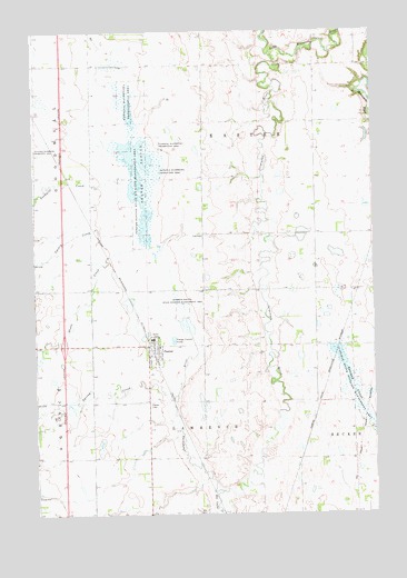
Peever, SD USGS Topographic Map
Click on map above to begin viewing in our Map Viewer.

This topographic map contains these locations and features:
Feature Name Type Latitude Longitude GNIS ID View Map
Agency CreekStreamN45.5719°W96.9609°1253595View Map
Big Coulee CreekStreamN45.5058°W96.9315°1253914View Map
Big Spring CreekStreamN45.5311°W96.9479°1253926View Map
Eastman SloughGutN45.5286°W96.8801°1254870View Map
Eastman State Wildlife Management AreaParkN45.5308°W96.8837°1254871View Map
Goodwill CreekStreamN45.5858°W96.9642°1255289View Map
Hines CreekStreamN45.5675°W96.9587°1255588View Map
Interchange 224CrossingN45.5439°W96.9894°2725735View Map
Jorgenson RiverStreamN45.6186°W96.9123°1255887View Map
Lake Traverse DistrictCivilN45.6009°W96.9022°2418994View Map
Peaver Post OfficePost OfficeN45.5415°W96.9573°2711091View Map
PeeverPopulated PlaceN45.5430°W96.9548°1256998View Map
Peever CemeteryCemeteryN45.5283°W96.9579°1256999View Map
Peever FlatsPopulated PlaceN45.5238°W96.9359°1263894View Map
Peever SloughGutN45.5869°W96.9579°1257000View Map
Peever Slough State Wildlife Management AreaParkN45.5858°W96.9606°1257001View Map
Peever Volunteer Fire DepartmentBuildingN45.5423°W96.9579°2580760View Map
Roberts County State Wildlife Management AreaParkN45.5530°W96.9454°1257429View Map
Saint John's Episcopal CemeteryCemeteryN45.6236°W96.8761°2779329View Map
School Number 1 (historical)SchoolN45.5736°W96.9051°1263966View Map
School Number 2 (historical)SchoolN45.5211°W96.8817°1263965View Map
School Number 2 (historical)SchoolN45.6241°W96.9565°1263967View Map
Town of PeeverCivilN45.5422°W96.9561°1267529View Map
Township of EasterCivilN45.6034°W96.9202°1268564View Map
Township of LawrenceCivilN45.5184°W96.9399°1268567View Map

Note: Coordinates in the location and feature list above are referenced to NAD83 datum.


Copyright (C) 2008-2024 Ryan Niemi / Sunset Dynamics ... All Rights Reserved