TopoQuest Logo
Do you find TopoQuest useful?
Help keep TopoQuest running and adding new maps/features by donating!
Bitcoin:  19c7KJd3qBynnjoSw5npx9KScwjBe4ifkT
Litecoin:  LXs6TkuXGGXo1vDsWCkWVdjQX94eUKd6ui
Home View Maps Find Maps Find Places Resources & Links


Silt, Colorado Topographic Map

USGS Map Title: Silt, CO
USGS Map MRC: 39107E6
DRG (GeoTIFF) Download: o39107e6.tif


Neighboring USGS Topographic Map Quads:


  Horse Mountain, CO  
39107F7
 

  Rifle Falls, CO  
39107F6
 

  Deep Creek Point, CO  
39107F5
 

  Rifle, CO  
39107E7
 

  Silt, CO  
39107E6
 

  New Castle, CO  
39107E5
 

  North Mamm Peak, CO  
39107D7
 

  Hunter Mesa, CO  
39107D6
 

  Gibson Gulch, CO  
39107D5


Map MRC Location:

N40°
W108°
N40°
W107°
H8 H7 H6 H5 H4 H3 H2 H1
G8 G7 G6 G5 G4 G3 G2 G1
F8 F7 F6 F5 F4 F3 F2 F1
E8 E7 E6 E5 E4 E3 E2 E1
D8 D7 D6 D5 D4 D3 D2 D1
C8 C7 C6 C5 C4 C3 C2 C1
B8 B7 B6 B5 B4 B3 B2 B1
A8 A7 A6 A5 A4 A3 A2 A1
N39°
W108°
N39°
W107°

Silt, CO USGS 1:24K Topographic Map Preview:
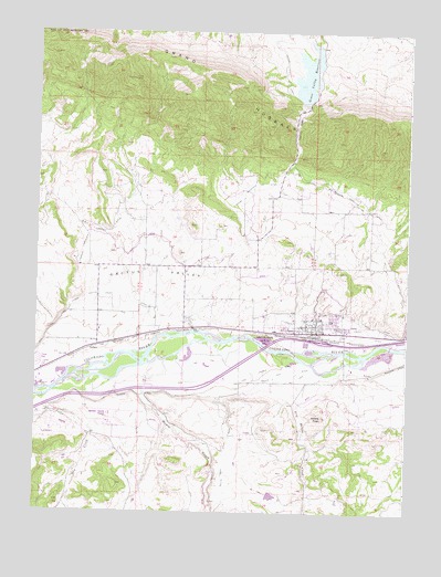
Silt, CO USGS Topographic Map
Click on map above to begin viewing in our Map Viewer.

This topographic map contains these locations and features:
Feature Name Type Latitude Longitude GNIS ID View Map
AntlersPopulated PlaceN39.5433°W107.7278°174052View Map
Black Raven MineMineN39.6186°W107.7328°1684096View Map
Burning Mountains Fire Protection District Station 1 SiltBuildingN39.5468°W107.6564°2695557View Map
Cactus ValleyBasinN39.5625°W107.7065°202204View Map
Davie DitchCanalN39.5930°W107.7492°202205View Map
Dry CreekStreamN39.5297°W107.7484°174756View Map
Dry Hollow CreekStreamN39.5372°W107.6587°174769View Map
East Lateral Farmers Irrigation Company DitchCanalN39.5836°W107.6476°174054View Map
Eastside MineMineN39.5503°W107.6539°1684095View Map
Farmers Irrigation Company DitchCanalN39.5736°W107.7003°174053View Map
Graham MesaSummitN39.5780°W107.7451°202200View Map
Grass Valley DamDamN39.6066°W107.6603°199430View Map
Grass Valley ReservoirReservoirN39.6139°W107.6594°174050View Map
Harvey GapGapN39.5997°W107.6637°174051View Map
Ingle Haas and Ingle MineMineN39.6194°W107.7331°1684097View Map
KRMW-AM (Silt)TowerN39.5105°W107.6476°204062View Map
Last Chance DitchCanalN39.5308°W107.7142°202198View Map
Le Donne MineMineN39.6053°W107.6584°1684098View Map
Lower Cactus Valley DitchCanalN39.5486°W107.6498°202206View Map
Mamm CreekStreamN39.5375°W107.7159°174770View Map
Nu Gap Number Three MineMineN39.5986°W107.6631°1684089View Map
Rifle Creek Canyon DitchCanalN39.5514°W107.7470°202199View Map
Rifle Fire Protection District Station 2BuildingN39.5220°W107.7229°2667214View Map
Rifle Garfield County AirportAirportN39.5236°W107.7222°174055View Map
Rifle PitMineN39.5394°W107.7351°1684094View Map
Rifle Valley DamDamN39.5400°W107.6873°199438View Map
Rifle Valley ReservoirReservoirN39.5400°W107.6873°199439View Map
Rising Sun DitchCanalN39.5369°W107.6664°174056View Map
SiltPopulated PlaceN39.5486°W107.6562°204657View Map
Silt Police DepartmentBuildingN39.5484°W107.6561°2757244View Map
Silt Post OfficePost OfficeN39.5461°W107.6412°2750900View Map
Tipple MineMineN39.6205°W107.7334°1684100View Map
Town of SiltCivilN39.5478°W107.6539°2413284View Map
Weible PeakSummitN39.5250°W107.6534°174057View Map

Note: Coordinates in the location and feature list above are referenced to NAD83 datum.


Copyright (C) 2008-2024 Ryan Niemi / Sunset Dynamics ... All Rights Reserved