TopoQuest Logo
Do you find TopoQuest useful?
Help keep TopoQuest running and adding new maps/features by donating!
Bitcoin:  19c7KJd3qBynnjoSw5npx9KScwjBe4ifkT
Litecoin:  LXs6TkuXGGXo1vDsWCkWVdjQX94eUKd6ui
Home View Maps Find Maps Find Places Resources & Links


Sidell, Illinois Topographic Map

USGS Map Title: Sidell, IL
USGS Map MRC: 39087H7
DRG (GeoTIFF) Download: o39087h7.tif


Neighboring USGS Topographic Map Quads:


  Homer, IL  
40087A8
 

  Oakwood, IL  
40087A7
 

  Danville SW, IL  
40087A6
 

  Allerton, IL  
39087H8
 

  Sidell, IL  
39087H7
 

  Georgetown, IL  
39087H6
 

  Newman, IL  
39087G8
 

  Hume, IL  
39087G7
 

  Chrisman, IL  
39087G6


Map MRC Location:

N40°
W88°
N40°
W87°
H8 H7 H6 H5 H4 H3 H2 H1
G8 G7 G6 G5 G4 G3 G2 G1
F8 F7 F6 F5 F4 F3 F2 F1
E8 E7 E6 E5 E4 E3 E2 E1
D8 D7 D6 D5 D4 D3 D2 D1
C8 C7 C6 C5 C4 C3 C2 C1
B8 B7 B6 B5 B4 B3 B2 B1
A8 A7 A6 A5 A4 A3 A2 A1
N39°
W88°
N39°
W87°

Sidell, IL USGS 1:24K Topographic Map Preview:
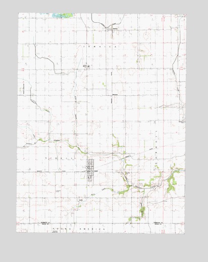
Sidell, IL USGS Topographic Map
Click on map above to begin viewing in our Map Viewer.

This topographic map contains these locations and features:
Feature Name Type Latitude Longitude GNIS ID View Map
ArchiePopulated PlaceN39.8942°W87.8284°422413View Map
Archie CreekStreamN39.9020°W87.7909°403593View Map
Baum BranchStreamN39.9248°W87.8311°403974View Map
Dillon BranchStreamN39.9003°W87.7803°407221View Map
Fairview CemeteryCemeteryN39.8986°W87.8459°408189View Map
Freedwell BranchStreamN39.9278°W87.8506°408722View Map
Goodall BranchStreamN39.9278°W87.8598°409145View Map
JamaicaPopulated PlaceN39.9911°W87.8067°411025View Map
Jamaica High SchoolSchoolN39.9703°W87.8228°411026View Map
Maddox Airport (historical)AirportN39.9570°W87.8711°427010View Map
MaizetownPopulated PlaceN39.9542°W87.8045°422931View Map
Miller SchoolLocaleN39.9936°W87.7570°413604View Map
SidellPopulated PlaceN39.9098°W87.8211°418491View Map
Sidell Fire and RescueBuildingN39.9109°W87.8201°2682081View Map
Sidell Post OfficePost OfficeN39.9109°W87.8212°2788331View Map
Stunkard CemeteryCemeteryN39.9099°W87.7941°419242View Map
Township of JamaicaCivilN39.9848°W87.8072°429180View Map
Village of SidellCivilN39.9097°W87.8236°2399819View Map

Note: Coordinates in the location and feature list above are referenced to NAD83 datum.


Copyright (C) 2008-2024 Ryan Niemi / Sunset Dynamics ... All Rights Reserved