TopoQuest Logo
Do you find TopoQuest useful?
Help keep TopoQuest running and adding new maps/features by donating!
Bitcoin:  19c7KJd3qBynnjoSw5npx9KScwjBe4ifkT
Litecoin:  LXs6TkuXGGXo1vDsWCkWVdjQX94eUKd6ui
Home View Maps Find Maps Find Places Resources & Links


Newman, Illinois Topographic Map

USGS Map Title: Newman, IL
USGS Map MRC: 39087G8
DRG (GeoTIFF) Download: o39087g8.tif


Neighboring USGS Topographic Map Quads:


  Longview, IL  
39088H1
 

  Allerton, IL  
39087H8
 

  Sidell, IL  
39087H7
 

  Murdock, IL  
39088G1
 

  Newman, IL  
39087G8
 

  Hume, IL  
39087G7
 

  Oakland, IL  
39088F1
 

  Brocton, IL  
39087F8
 

  Redmon, IL  
39087F7


Map MRC Location:

N40°
W88°
N40°
W87°
H8 H7 H6 H5 H4 H3 H2 H1
G8 G7 G6 G5 G4 G3 G2 G1
F8 F7 F6 F5 F4 F3 F2 F1
E8 E7 E6 E5 E4 E3 E2 E1
D8 D7 D6 D5 D4 D3 D2 D1
C8 C7 C6 C5 C4 C3 C2 C1
B8 B7 B6 B5 B4 B3 B2 B1
A8 A7 A6 A5 A4 A3 A2 A1
N39°
W88°
N39°
W87°

Newman, IL USGS 1:24K Topographic Map Preview:
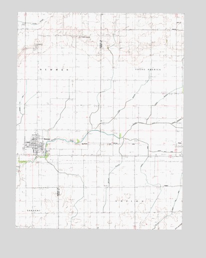
Newman, IL USGS Topographic Map
Click on map above to begin viewing in our Map Viewer.

This topographic map contains these locations and features:
Feature Name Type Latitude Longitude GNIS ID View Map
City of NewmanCivilN39.7971°W87.9876°2395226View Map
Clark BranchStreamN39.8111°W87.8842°1736485View Map
Fairfield ChurchChurchN39.8556°W87.9853°408164View Map
Gilkey BranchStreamN39.8111°W87.9028°1736494View Map
HughesPopulated PlaceN39.7745°W87.8911°422829View Map
Hughes DrainStreamN39.8031°W87.9203°1736499View Map
McCownPopulated PlaceN39.7992°W87.9281°422963View Map
McCown BranchStreamN39.8025°W87.9200°1736519View Map
Memorial ParkParkN39.7942°W87.9781°1747787View Map
NewmanPopulated PlaceN39.7986°W87.9859°414490View Map
Newman Community Fire Protection DistrictBuildingN39.7977°W87.9859°2681815View Map
Newman Grade SchoolSchoolN39.7964°W87.9878°1807766View Map
Newman High SchoolSchoolN39.8039°W87.9850°1747789View Map
Newman Post OfficePost OfficeN39.7977°W87.9827°2788390View Map
Newman United Methodist ChurchChurchN39.8045°W87.9839°1984347View Map
PalermoPopulated PlaceN39.8656°W87.8809°423051View Map
Palermo ChurchChurchN39.8695°W87.8811°1808117View Map
Palermo Post Office (historical)Post OfficeN39.8656°W87.8806°1808118View Map
Phoenix Post Office (historical)Post OfficeN39.8542°W87.9850°1807771View Map
Pleasant Ridge CemeteryCemeteryN39.8609°W87.9528°1807772View Map
Pleasant Ridge ChurchChurchN39.8609°W87.9528°415886View Map
Pope BranchStreamN39.8073°W87.9414°1747792View Map
Shiloh Number 2 DrainStreamN39.7956°W87.9009°1736548View Map
Township of NewmanCivilN39.8285°W87.9943°429438View Map

Note: Coordinates in the location and feature list above are referenced to NAD83 datum.


Copyright (C) 2008-2024 Ryan Niemi / Sunset Dynamics ... All Rights Reserved