TopoQuest Logo
Do you find TopoQuest useful?
Help keep TopoQuest running and adding new maps/features by donating!
Bitcoin:  19c7KJd3qBynnjoSw5npx9KScwjBe4ifkT
Litecoin:  LXs6TkuXGGXo1vDsWCkWVdjQX94eUKd6ui
Home View Maps Find Maps Find Places Resources & Links


Shoshone, Colorado Topographic Map

USGS Map Title: Shoshone, CO
USGS Map MRC: 39107E2
DRG (GeoTIFF) Download: o39107e2.tif


Neighboring USGS Topographic Map Quads:


  Carbonate, CO  
39107F3
 

  Broken Rib Creek, CO  
39107F2
 

  Dotsero, CO  
39107F1
 

  Glenwood Springs, CO  
39107E3
 

  Shoshone, CO  
39107E2
 

  Cottonwood Pass, CO  
39107E1
 

  Cattle Creek, CO  
39107D3
 

  Carbondale, CO  
39107D2
 

  Leon, CO  
39107D1


Map MRC Location:

N40°
W108°
N40°
W107°
H8 H7 H6 H5 H4 H3 H2 H1
G8 G7 G6 G5 G4 G3 G2 G1
F8 F7 F6 F5 F4 F3 F2 F1
E8 E7 E6 E5 E4 E3 E2 E1
D8 D7 D6 D5 D4 D3 D2 D1
C8 C7 C6 C5 C4 C3 C2 C1
B8 B7 B6 B5 B4 B3 B2 B1
A8 A7 A6 A5 A4 A3 A2 A1
N39°
W108°
N39°
W107°

Shoshone, CO USGS 1:24K Topographic Map Preview:
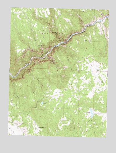
Shoshone, CO USGS Topographic Map
Click on map above to begin viewing in our Map Viewer.

This topographic map contains these locations and features:
Feature Name Type Latitude Longitude GNIS ID View Map
AllenLocaleN39.6108°W107.1434°174093View Map
Bear CreekStreamN39.5569°W107.2459°174106View Map
Blue GulchValleyN39.5766°W107.2219°174102View Map
Bouller TankReservoirN39.5631°W107.1525°174116View Map
Bridal Veil FallsFallsN39.6016°W107.1920°174098View Map
Cinnamon CreekStreamN39.5905°W107.1873°174100View Map
Consolidated DamDamN39.5236°W107.1448°199402View Map
Consolidated ReservoirReservoirN39.5237°W107.1444°174118View Map
Dead Horse CreekStreamN39.5925°W107.1839°196550View Map
Deadmans CreekStreamN39.5680°W107.2292°174104View Map
Deadmans GulchValleyN39.5678°W107.2291°174105View Map
Devils Hole CanyonValleyN39.5783°W107.2044°174111View Map
Devils Hole CreekStreamN39.5786°W107.2051°174112View Map
Dock FlatsFlatN39.5603°W107.1345°202212View Map
Dry GulchValleyN39.5875°W107.2112°174101View Map
East Fork Dead Horse CreekStreamN39.6000°W107.1909°173985View Map
French CreekStreamN39.6069°W107.1551°173980View Map
Green LakeLakeN39.5515°W107.1747°174114View Map
GrizzlyLocaleN39.5578°W107.2478°202210View Map
Grizzly Creek Picnic GroundLocaleN39.5616°W107.2487°197205View Map
Hanging LakeLakeN39.6014°W107.1917°174097View Map
Hanging Lake ParkParkN39.6050°W107.1870°174099View Map
Hanging Lake Tunnels Fire DepartmentBuildingN39.5891°W107.1854°2666971View Map
HigbyLocaleN39.5697°W107.2262°174110View Map
Hopkins DamDamN39.5325°W107.2087°199408View Map
Hopkins HomesteadLocaleN39.5080°W107.2109°174119View Map
Hopkins ReservoirReservoirN39.5322°W107.2073°174120View Map
Ike CreekStreamN39.6136°W107.1362°174094View Map
Landis CreekStreamN39.5047°W107.2489°174103View Map
Last TankReservoirN39.5542°W107.1333°174115View Map
Northwest TankReservoirN39.5651°W107.1390°174117View Map
Ralston Number 1 DamDamN39.5150°W107.1423°201104View Map
Ralston Reservoir Number 1ReservoirN39.5142°W107.1407°201105View Map
ShoshoneLocaleN39.5905°W107.1864°174096View Map
Shoshone DamDamN39.5875°W107.1942°174095View Map
Shoshone PowerplantLocaleN39.5700°W107.2267°174107View Map
Spruce CreekStreamN39.6183°W107.1270°174092View Map
Tie GulchValleyN39.6169°W107.1309°173981View Map
Wagon GulchValleyN39.5804°W107.2036°174121View Map
West Fork Dead Horse CreekStreamN39.6000°W107.1909°173984View Map

Note: Coordinates in the location and feature list above are referenced to NAD83 datum.


Copyright (C) 2008-2024 Ryan Niemi / Sunset Dynamics ... All Rights Reserved