TopoQuest Logo
Do you find TopoQuest useful?
Help keep TopoQuest running and adding new maps/features by donating!
Bitcoin:  19c7KJd3qBynnjoSw5npx9KScwjBe4ifkT
Litecoin:  LXs6TkuXGGXo1vDsWCkWVdjQX94eUKd6ui
Home View Maps Find Maps Find Places Resources & Links


Leon, Colorado Topographic Map

USGS Map Title: Leon, CO
USGS Map MRC: 39107D1
DRG (GeoTIFF) Download: o39107d1.tif


Neighboring USGS Topographic Map Quads:


  Shoshone, CO  
39107E2
 

  Cottonwood Pass, CO  
39107E1
 

  Suicide Mountain, CO  
39106E8
 

  Carbondale, CO  
39107D2
 

  Leon, CO  
39107D1
 

  Toner Reservoir, CO  
39106D8
 

  Mount Sopris, CO  
39107C2
 

  Basalt, CO  
39107C1
 

  Woody Creek, CO  
39106C8


Map MRC Location:

N40°
W108°
N40°
W107°
H8 H7 H6 H5 H4 H3 H2 H1
G8 G7 G6 G5 G4 G3 G2 G1
F8 F7 F6 F5 F4 F3 F2 F1
E8 E7 E6 E5 E4 E3 E2 E1
D8 D7 D6 D5 D4 D3 D2 D1
C8 C7 C6 C5 C4 C3 C2 C1
B8 B7 B6 B5 B4 B3 B2 B1
A8 A7 A6 A5 A4 A3 A2 A1
N39°
W108°
N39°
W107°

Leon, CO USGS 1:24K Topographic Map Preview:
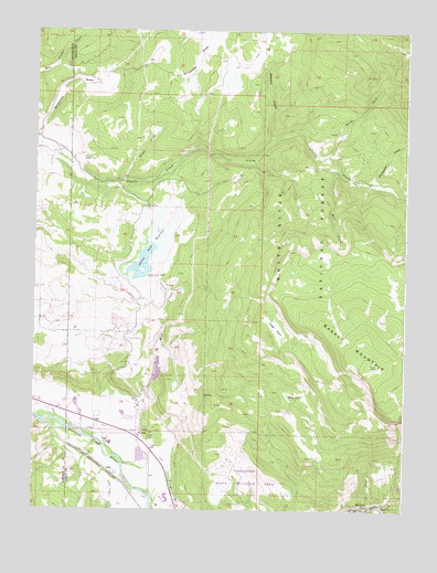
Leon, CO USGS Topographic Map
Click on map above to begin viewing in our Map Viewer.

This topographic map contains these locations and features:
Feature Name Type Latitude Longitude GNIS ID View Map
Basalt and Rural Fire Protection District El Jebel Station 42BuildingN39.3997°W107.0935°2667091View Map
Basalt MountainSummitN39.4128°W107.0120°202279View Map
Blue CreekStreamN39.4039°W107.1092°174868View Map
Blue Creek TrailTrailN39.4233°W107.0592°202281View Map
Bowers GulchValleyN39.4717°W107.0454°174866View Map
Catherine Census Designated PlaceCensusN39.4012°W107.1241°2583220View Map
Cattle Creek Guard StationLocaleN39.4644°W107.0242°174867View Map
Center CreekStreamN39.3755°W107.0120°174856View Map
Eagle County Sheriff's Office El Jebel SubstationBuildingN39.3951°W107.0883°2735580View Map
El JebelPopulated PlaceN39.3950°W107.0903°174858View Map
El Jebel Census Designated PlaceCensusN39.4051°W107.0921°2408058View Map
High ParkFlatN39.4228°W107.0439°174861View Map
Kelly LakeLakeN39.4045°W107.0395°174857View Map
Kelly Pond DamDamN39.4033°W107.0389°201100View Map
Kelly Pond ReservoirReservoirN39.4033°W107.0389°201101View Map
LeonPopulated PlaceN39.3847°W107.0992°174859View Map
McNulty DamDamN39.4916°W107.0873°201102View Map
McNulty ReservoirReservoirN39.4922°W107.0872°201103View Map
Mill CreekStreamN39.4639°W107.0231°174862View Map
Mount Sopris Tree NurseryLocaleN39.3917°W107.0970°197039View Map
North Fork Cattle CreekStreamN39.4672°W107.0262°174863View Map
Sleepy CreekStreamN39.4605°W107.0945°174865View Map
Spring Park DamDamN39.4444°W107.0867°199416View Map
Spring Park ReservoirReservoirN39.4393°W107.0888°174860View Map
Thompson CreekStreamN39.4605°W107.0120°174864View Map
Whitnach FallsFallsN39.3761°W107.0120°174855View Map

Note: Coordinates in the location and feature list above are referenced to NAD83 datum.


Copyright (C) 2008-2024 Ryan Niemi / Sunset Dynamics ... All Rights Reserved