TopoQuest Logo
Do you find TopoQuest useful?
Help keep TopoQuest running and adding new maps/features by donating!
Bitcoin:  19c7KJd3qBynnjoSw5npx9KScwjBe4ifkT
Litecoin:  LXs6TkuXGGXo1vDsWCkWVdjQX94eUKd6ui
Home View Maps Find Maps Find Places Resources & Links


Black Hawk, Wisconsin Topographic Map

USGS Map Title: Black Hawk, WI
USGS Map MRC: 43089C8
DRG (GeoTIFF) Download: o43089c8.tif


Neighboring USGS Topographic Map Quads:


  Loganville, WI  
43090D1
 

  Rock Springs, WI  
43089D8
 

  North Freedom, WI  
43089D7
 

  Plain, WI  
43090C1
 

  Black Hawk, WI  
43089C8
 

  Sauk Prairie, WI  
43089C7
 

  Spring Green, WI  
43090B1
 

  Arena, WI  
43089B8
 

  Mazomanie, WI  
43089B7


Map MRC Location:

N44°
W90°
N44°
W89°
H8 H7 H6 H5 H4 H3 H2 H1
G8 G7 G6 G5 G4 G3 G2 G1
F8 F7 F6 F5 F4 F3 F2 F1
E8 E7 E6 E5 E4 E3 E2 E1
D8 D7 D6 D5 D4 D3 D2 D1
C8 C7 C6 C5 C4 C3 C2 C1
B8 B7 B6 B5 B4 B3 B2 B1
A8 A7 A6 A5 A4 A3 A2 A1
N43°
W90°
N43°
W89°

Black Hawk, WI USGS 1:24K Topographic Map Preview:
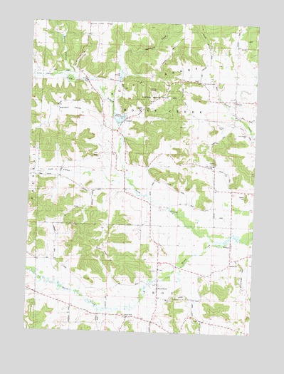
Black Hawk, WI USGS Topographic Map
Click on map above to begin viewing in our Map Viewer.

This topographic map contains these locations and features:
Feature Name Type Latitude Longitude GNIS ID View Map
Bethlehem ChurchChurchN43.2755°W89.9271°1561654View Map
Black HawkPopulated PlaceN43.2692°W89.9273°1561864View Map
Black Hawk Elementary SchoolSchoolN43.2633°W89.9221°1561866View Map
Borns HollowValleyN43.3548°W89.9781°1562079View Map
Cedar HillSummitN43.3050°W89.8796°1562845View Map
Dalkey RidgeRidgeN43.2825°W89.9579°1563675View Map
DenzerPopulated PlaceN43.3442°W89.8868°1563909View Map
Durst Rockshelter State Natural AreaParkN43.3569°W89.9564°2081921View Map
Federman ValleyValleyN43.2562°W89.9568°1564896View Map
Free Thinkers CemeteryCemeteryN43.3311°W89.8801°1565288View Map
Free Thinkers Hall (historical)ChurchN43.3311°W89.8798°1846842View Map
Hemlock DrawValleyN43.3636°W89.9485°1566287View Map
Honey Creek State Natural AreaParkN43.3692°W89.9853°2081925View Map
Irish ValleyValleyN43.3150°W89.9607°1566958View Map
LelandPopulated PlaceN43.3355°W89.9476°1567961View Map
Leland DamDamN43.3344°W89.9512°1792024View Map
Leland MillpondReservoirN43.3341°W89.9510°1567962View Map
Leland Millpond 25ReservoirN43.3350°W89.9668°1792025View Map
Leland Natural BridgeArchN43.3483°W89.9312°1679049View Map
Lins ValleyValleyN43.3483°W89.9607°1568153View Map
Little PrairieFlatN43.3005°W89.9371°2760498View Map
Natural Bridge and Rockshelter State Natural AreaParkN43.3497°W89.9308°2082067View Map
Natural Bridge State ParkParkN43.3442°W89.9287°1570116View Map
North Branch Honey CreekStreamN43.2880°W89.8840°1570374View Map
Our Lady of Loretta ChurchChurchN43.3508°W89.9051°1570932View Map
Pillar RockPillarN43.3205°W89.9629°1571408View Map
Pine HollowValleyN43.3614°W89.8957°1571467View Map
Pine Hollow State Natural AreaParkN43.3708°W89.9106°2082070View Map
Sandpit ValleyValleyN43.3355°W89.9620°1573711View Map
Sugar BowlBasinN43.3408°W89.9410°1575011View Map
Tower RockPillarN43.3189°W89.8973°1575525View Map
Tower Rock Elementary SchoolSchoolN43.3176°W89.8987°1575526View Map
Town of Honey CreekCivilN43.3368°W89.9158°1583408View Map
Union Grove CemeteryCemeteryN43.2564°W89.9454°1575904View Map
WitwenPopulated PlaceN43.2853°W89.8873°1576926View Map

Note: Coordinates in the location and feature list above are referenced to NAD83 datum.


Copyright (C) 2008-2024 Ryan Niemi / Sunset Dynamics ... All Rights Reserved