TopoQuest Logo
Do you find TopoQuest useful?
Help keep TopoQuest running and adding new maps/features by donating!
Bitcoin:  19c7KJd3qBynnjoSw5npx9KScwjBe4ifkT
Litecoin:  LXs6TkuXGGXo1vDsWCkWVdjQX94eUKd6ui
Home View Maps Find Maps Find Places Resources & Links


Shingle Mill Mountain, Arizona Topographic Map

USGS Map Title: Shingle Mill Mountain, AZ
USGS Map MRC: 32109G8
DRG (GeoTIFF) Download: o32109g8.tif


Neighboring USGS Topographic Map Quads:


  Telegraph Wash, AZ  
32110H1
 

  Eden, AZ  
32109H8
 

  Pima, AZ  
32109H7
 

  Tripp Canyon, AZ  
32110G1
 

  Shingle Mill Mountain, AZ  
32109G8
 

  Thatcher, AZ  
32109G7
 

  Blue Jay Peak, AZ  
32110F1
 

  Webb Peak, AZ  
32109F8
 

  Mount Graham, AZ  
32109F7


Map MRC Location:

N33°
W110°
N33°
W109°
H8 H7 H6 H5 H4 H3 H2 H1
G8 G7 G6 G5 G4 G3 G2 G1
F8 F7 F6 F5 F4 F3 F2 F1
E8 E7 E6 E5 E4 E3 E2 E1
D8 D7 D6 D5 D4 D3 D2 D1
C8 C7 C6 C5 C4 C3 C2 C1
B8 B7 B6 B5 B4 B3 B2 B1
A8 A7 A6 A5 A4 A3 A2 A1
N32°
W110°
N32°
W109°

Shingle Mill Mountain, AZ USGS 1:24K Topographic Map Preview:
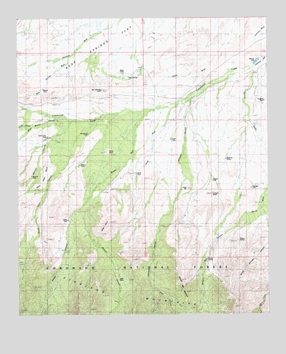
Shingle Mill Mountain, AZ USGS Topographic Map
Click on map above to begin viewing in our Map Viewer.

This topographic map contains these locations and features:
Feature Name Type Latitude Longitude GNIS ID View Map
Bear BasinBasinN32.7670°W109.9484°1103View Map
Bear SpringsSpringN32.8501°W109.9493°1145View Map
Bear Springs KnollSummitN32.8445°W109.9584°1148View Map
Bear Springs WashStreamN32.8590°W109.9742°1149View Map
Bigler PondsLakeN32.8519°W109.9484°1404View Map
Blair CanyonValleyN32.7612°W109.9340°1661View Map
Browns TankReservoirN32.8573°W109.8804°2017View Map
Bryce KnollSummitN32.8187°W109.9556°2054View Map
Carter CanyonValleyN32.7859°W109.9762°2491View Map
Carter Canyon Number Thirty four TrailTrailN32.7653°W109.9812°22443View Map
Carter TankReservoirN32.7901°W109.9759°22444View Map
Chatfield PondLakeN32.8400°W109.8772°2774View Map
Cottonwood CreekStreamN32.8581°W109.8759°3336View Map
Coyote KnollSummitN32.8012°W109.9034°3480View Map
Coyote TankReservoirN32.8064°W109.9035°3508View Map
Dead Steer MesaSummitN32.8103°W109.9865°3759View Map
Dickey SpringSpringN32.7817°W109.8872°22469View Map
Flying J Ranch AirportAirportN32.8468°W109.8772°45474View Map
Goat HillSummitN32.8034°W109.9159°5079View Map
Green SpringSpringN32.7739°W109.9059°22514View Map
Hells Hole CanyonValleyN32.7503°W109.9561°5715View Map
Hells Hole CreekStreamN32.7503°W109.9561°22521View Map
Hulda Gap CorralLocaleN32.7501°W109.9159°6104View Map
Lamb HotelBuildingN32.8334°W109.8859°6854View Map
Lamb TankReservoirN32.8238°W109.9238°6856View Map
Lefthand CanyonValleyN32.8387°W109.9145°6967View Map
Merrill WashStreamN32.8473°W109.8834°7888View Map
Mexican CanyonValleyN32.8201°W109.9867°7953View Map
Mexican TankReservoirN32.8087°W109.9938°7964View Map
Middle WashStreamN32.8370°W109.9312°8016View Map
North Taylor CanyonValleyN32.8126°W109.9790°8790View Map
Nuttall CanyonValleyN32.7945°W109.9715°8824View Map
Pima WellWellN32.8437°W109.9076°9445View Map
Ringcone TankReservoirN32.8156°W109.8967°10306View Map
Sand TankReservoirN32.8096°W109.9411°10893View Map
Sand WashStreamN32.8387°W109.9204°10904View Map
Seven Cross TankReservoirN32.8249°W109.9861°11097View Map
Shingle Mill CanyonValleyN32.7926°W109.8873°11219View Map
Shingle Mill Mesa Thirty Five TrailTrailN32.7742°W109.9084°22656View Map
Shingle Mill MountainSummitN32.7595°W109.9165°11220View Map
Squaw TankReservoirN32.8452°W109.9877°11754View Map
Stockpond TankReservoirN32.8262°W109.9656°11856View Map
Stowe KnollSummitN32.7851°W109.9581°11890View Map
Tramline TankReservoirN32.8034°W109.8838°12679View Map
Tunnel CanyonValleyN32.8294°W109.9933°12848View Map
Webb One TankReservoirN32.8131°W109.9692°13422View Map
Wide Mouth CanyonValleyN32.8328°W109.9804°13736View Map

Note: Coordinates in the location and feature list above are referenced to NAD83 datum.


Copyright (C) 2008-2024 Ryan Niemi / Sunset Dynamics ... All Rights Reserved