TopoQuest Logo
Do you find TopoQuest useful?
Help keep TopoQuest running and adding new maps/features by donating!
Bitcoin:  19c7KJd3qBynnjoSw5npx9KScwjBe4ifkT
Litecoin:  LXs6TkuXGGXo1vDsWCkWVdjQX94eUKd6ui
Home View Maps Find Maps Find Places Resources & Links


Eden, Arizona Topographic Map

USGS Map Title: Eden, AZ
USGS Map MRC: 32109H8
DRG (GeoTIFF) Download: o32109h8.tif


Neighboring USGS Topographic Map Quads:


  Geronimo, AZ  
33110A1
 

  Fort Thomas, AZ  
33109A8
 

  Markham Creek, AZ  
33109A7
 

  Telegraph Wash, AZ  
32110H1
 

  Eden, AZ  
32109H8
 

  Pima, AZ  
32109H7
 

  Tripp Canyon, AZ  
32110G1
 

  Shingle Mill Mountain, AZ  
32109G8
 

  Thatcher, AZ  
32109G7


Map MRC Location:

N33°
W110°
N33°
W109°
H8 H7 H6 H5 H4 H3 H2 H1
G8 G7 G6 G5 G4 G3 G2 G1
F8 F7 F6 F5 F4 F3 F2 F1
E8 E7 E6 E5 E4 E3 E2 E1
D8 D7 D6 D5 D4 D3 D2 D1
C8 C7 C6 C5 C4 C3 C2 C1
B8 B7 B6 B5 B4 B3 B2 B1
A8 A7 A6 A5 A4 A3 A2 A1
N32°
W110°
N32°
W109°

Eden, AZ USGS 1:24K Topographic Map Preview:
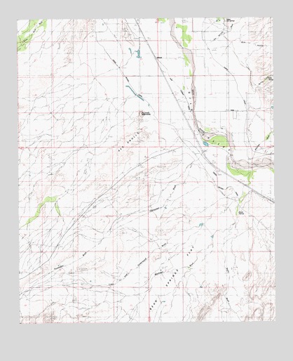
Eden, AZ USGS Topographic Map
Click on map above to begin viewing in our Map Viewer.

This topographic map contains these locations and features:
Feature Name Type Latitude Longitude GNIS ID View Map
AshurstPopulated PlaceN32.9842°W109.9323°25297View Map
Ashurst CemeteryCemeteryN32.9927°W109.9465°857View Map
Battle Creek CanalCanalN32.9612°W109.9020°22403View Map
Bear Springs FlatFlatN32.8912°W109.9340°1147View Map
Beauty SpringsSpringN32.9998°W109.8995°23917View Map
Bigler WashStreamN32.9151°W109.8967°1405View Map
Biglers ReservoirReservoirN32.8931°W109.9029°22413View Map
CorkPopulated PlaceN32.9570°W109.9187°24381View Map
Curtis CanalCanalN32.9553°W109.8909°3657View Map
Dodge Nevada CanalCanalN32.9567°W109.9309°3990View Map
EdenPopulated PlaceN32.9612°W109.8954°4351View Map
Eden Post OfficePost OfficeN32.9623°W109.8942°44933View Map
Eden SpringSpringN32.9755°W109.8779°4352View Map
Eldon Palmer ReservoirReservoirN32.9640°W109.9765°22484View Map
Gila WellWellN32.9687°W109.9204°5031View Map
Graham CountyCivilN32.9327°W109.8874°25444View Map
Hot Springs WashStreamN32.9890°W109.9090°6038View Map
Hunsacker WashStreamN32.9526°W109.9120°6132View Map
Indian Hot SpringsPopulated PlaceN32.9984°W109.9006°6214View Map
Indian Hot SpringsSpringN32.9992°W109.8994°23913View Map
Iron SpringsSpringN32.9998°W109.8992°23916View Map
Magnesium SpringsSpringN32.9995°W109.8992°23914View Map
Markham WashStreamN32.9381°W109.8887°7716View Map
Matthews WashStreamN32.9376°W109.8873°7777View Map
Mud SpringsSpringN32.9991°W109.8991°23915View Map
Oso Largo Dike DamDamN32.9101°W109.9056°22595View Map
Pima DivisionCivilN32.9988°W109.9656°1934969View Map
Quarry ReservoirReservoirN32.9737°W109.9784°22615View Map
Red KnollsSummitN32.9451°W109.9412°10074View Map
Red Knolls AmphitheaterBasinN32.9598°W109.9448°10076View Map
Simon SpringsSpringN32.9181°W109.8945°11351View Map
Spring CreekStreamN32.9726°W109.8906°11703View Map
Tripp and Underwood WashStreamN32.9251°W109.8929°12728View Map
White HouseLocaleN32.8917°W109.9665°13630View Map
Wide HollowValleyN32.9834°W109.9026°13734View Map

Note: Coordinates in the location and feature list above are referenced to NAD83 datum.


Copyright (C) 2008-2024 Ryan Niemi / Sunset Dynamics ... All Rights Reserved