TopoQuest Logo
Do you find TopoQuest useful?
Help keep TopoQuest running and adding new maps/features by donating!
Bitcoin:  19c7KJd3qBynnjoSw5npx9KScwjBe4ifkT
Litecoin:  LXs6TkuXGGXo1vDsWCkWVdjQX94eUKd6ui
Home View Maps Find Maps Find Places Resources & Links


Shell Knob, Missouri Topographic Map

USGS Map Title: Shell Knob, MO
USGS Map MRC: 36093F6
DRG (GeoTIFF) Download: o36093f6.tif


Neighboring USGS Topographic Map Quads:


  McDowell, MO  
36093G7
 

  Jenkins, MO  
36093G6
 

  Elsey, MO  
36093G5
 

  Cassville, MO  
36093F7
 

  Shell Knob, MO  
36093F6
 

  Cape Fair, MO  
36093F5
 

  Eagle Rock, MO  
36093E7
 

  Golden, MO  
36093E6
 

  Viola, MO  
36093E5


Map MRC Location:

N37°
W94°
N37°
W93°
H8 H7 H6 H5 H4 H3 H2 H1
G8 G7 G6 G5 G4 G3 G2 G1
F8 F7 F6 F5 F4 F3 F2 F1
E8 E7 E6 E5 E4 E3 E2 E1
D8 D7 D6 D5 D4 D3 D2 D1
C8 C7 C6 C5 C4 C3 C2 C1
B8 B7 B6 B5 B4 B3 B2 B1
A8 A7 A6 A5 A4 A3 A2 A1
N36°
W94°
N36°
W93°

Shell Knob, MO USGS 1:24K Topographic Map Preview:
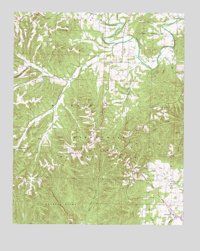
Shell Knob, MO USGS Topographic Map
Click on map above to begin viewing in our Map Viewer.

This topographic map contains these locations and features:
Feature Name Type Latitude Longitude GNIS ID View Map
Bailey BranchStreamN36.7442°W93.6721°748638View Map
Blacksmith BranchStreamN36.7465°W93.6816°748898View Map
CatoPopulated PlaceN36.7209°W93.6802°749254View Map
Cedar Mound School (historical)SchoolN36.7381°W93.6874°753401View Map
Coones CemeteryCemeteryN36.7448°W93.6530°749464View Map
Doughty CemeteryCemeteryN36.7373°W93.6405°749689View Map
Eorerly Memorial CemeteryCemeteryN36.6306°W93.6321°749849View Map
Fairview School (historical)SchoolN36.6581°W93.6513°749889View Map
Fortune BranchStreamN36.7095°W93.7085°749960View Map
Gaddis School (historical)SchoolN36.6820°W93.7205°753403View Map
Galena HollowValleyN36.7131°W93.7283°750015View Map
HaileyPopulated PlaceN36.7109°W93.7074°750190View Map
Hailey School (historical)SchoolN36.7098°W93.7113°732895View Map
Hill CityPopulated PlaceN36.6662°W93.6719°750327View Map
Lahmer Fire Lookout TowerTowerN36.6667°W93.7088°754961View Map
LohmerPopulated PlaceN36.6665°W93.7088°750826View Map
Mount View ChurchChurchN36.6709°W93.7088°751202View Map
Mountain Home School (historical)SchoolN36.7159°W93.6669°753402View Map
Pierce CemeteryCemeteryN36.6745°W93.7130°751577View Map
Rockhouse CreekStreamN36.7315°W93.6755°748549View Map
Rockhouse HollowValleyN36.7315°W93.6755°748550View Map
Rockhouse SpringSpringN36.6692°W93.7488°751931View Map
Shell KnobPopulated PlaceN36.6323°W93.6344°752104View Map
Shell Knob Elementary SchoolSchoolN36.6306°W93.6283°2710065View Map
Shell Knob School (historical)SchoolN36.6315°W93.6324°732883View Map
Snyder CemeteryCemeteryN36.7214°W93.6496°752241View Map
Sugarcamp HollowValleyN36.7181°W93.7394°752420View Map
Township of MineralCivilN36.6820°W93.7398°766261View Map
Township of Shell KnobCivilN36.6399°W93.6327°766269View Map
Williams BranchStreamN36.7198°W93.6546°752910View Map
Woods TrailTrailN36.6776°W93.6402°754018View Map

Note: Coordinates in the location and feature list above are referenced to NAD83 datum.


Copyright (C) 2008-2024 Ryan Niemi / Sunset Dynamics ... All Rights Reserved