TopoQuest Logo
Do you find TopoQuest useful?
Help keep TopoQuest running and adding new maps/features by donating!
Bitcoin:  19c7KJd3qBynnjoSw5npx9KScwjBe4ifkT
Litecoin:  LXs6TkuXGGXo1vDsWCkWVdjQX94eUKd6ui
Home View Maps Find Maps Find Places Resources & Links


Shelburne, New Hampshire Topographic Map

USGS Map Title: Shelburne, NH
USGS Map MRC: 44071D1
DRG (GeoTIFF) Download: o44071d1.tif


Neighboring USGS Topographic Map Quads:


  Milan, NH  
44071E2
 

  Success Pond, NH  
44071E1
 

  Old Speck Mountain, ME  
44070E8
 

  Berlin, NH  
44071D2
 

  Shelburne, NH  
44071D1
 

  Gilead, ME  
44070D8
 

  Carter Dome, NH  
44071C2
 

  Wild River, NH  
44071C1
 

  Speckled Mountain, ME  
44070C8


Map MRC Location:

N45°
W72°
N45°
W71°
H8 H7 H6 H5 H4 H3 H2 H1
G8 G7 G6 G5 G4 G3 G2 G1
F8 F7 F6 F5 F4 F3 F2 F1
E8 E7 E6 E5 E4 E3 E2 E1
D8 D7 D6 D5 D4 D3 D2 D1
C8 C7 C6 C5 C4 C3 C2 C1
B8 B7 B6 B5 B4 B3 B2 B1
A8 A7 A6 A5 A4 A3 A2 A1
N44°
W72°
N44°
W71°

Shelburne, NH USGS 1:24K Topographic Map Preview:
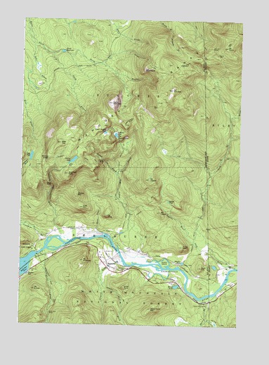
Shelburne, NH USGS Topographic Map
Click on map above to begin viewing in our Map Viewer.

This topographic map contains these locations and features:
Feature Name Type Latitude Longitude GNIS ID View Map
Androscoggin River ReservoirReservoirN44.4051°W71.1145°1774848View Map
Artist RockSummitN44.3903°W71.0645°871405View Map
Austin Brook TrailTrailN44.4384°W71.0687°871414View Map
Austin Mill BrookStreamN44.4095°W71.0717°871415View Map
Bald CapSummitN44.4492°W71.1026°871426View Map
Bald Cap PeakSummitN44.4370°W71.0979°871427View Map
Carlo ColGapN44.4864°W71.0131°580969View Map
Carlo Col ShelterLocaleN44.4889°W71.0165°580970View Map
Carlo Col TrailTrailN44.4926°W71.0223°871617View Map
Carlo Col TrailTrailN44.4995°W71.0290°580971View Map
Clement BrookStreamN44.4012°W71.0659°871696View Map
Connor BrookStreamN44.3862°W71.0206°871719View Map
Coos County ConstableBuildingN44.3994°W71.0746°2753030View Map
Crows NestSummitN44.4073°W71.0323°871749View Map
Dream LakeLakeN44.4424°W71.0951°871800View Map
Dryad BrookStreamN44.4370°W71.0698°871805View Map
Dryad FallsFallsN44.4423°W71.0776°871806View Map
Dryad Falls TrailTrailN44.4430°W71.0809°871807View Map
East BrookStreamN44.3934°W71.0776°871829View Map
Evans IslandIslandN44.4009°W71.0420°871870View Map
First MountainSummitN44.4234°W71.0892°871879View Map
Gates BrookStreamN44.4123°W71.0759°871928View Map
Gentian PondLakeN44.4528°W71.0710°871930View Map
Gentian ShelterLocaleN44.4517°W71.0692°871931View Map
Giant FallsFallsN44.4323°W71.1076°871933View Map
Hark HillSummitN44.3987°W71.0209°872012View Map
Hastings TrailTrailN44.3778°W71.0162°872019View Map
Hazelton CemeteryCemeteryN44.3977°W71.0641°872027View Map
Ingalls BrookStreamN44.4073°W71.0240°872077View Map
Judson PondLakeN44.4258°W71.0404°872117View Map
Keene ReservoirReservoirN44.4869°W71.1020°872129View Map
Larry FlumeStreamN44.4692°W71.0804°1916297View Map
Lary BrookStreamN44.3987°W71.0034°581089View Map
Lary Burbank CemeteryCemeteryN44.3963°W71.0117°2724706View Map
Leadmine BrookStreamN44.4162°W71.1245°872159View Map
Mahoosuc TrailTrailN44.4920°W71.0051°872249View Map
Mahoosuc TrailTrailN44.4920°W71.0051°581112View Map
Middle MountainSummitN44.4281°W71.0923°872292View Map
Mollywocket Brook DamDamN44.4867°W71.1162°1774893View Map
Moose PondLakeN44.3911°W71.0351°872317View Map
Mount CarloSummitN44.4891°W71.0081°580972View Map
Mount CragSummitN44.4198°W71.0748°871733View Map
Mount EvansSummitN44.3895°W71.1162°871871View Map
Mount IngallsSummitN44.4348°W71.0515°872078View Map
Mount SuccessSummitN44.4714°W71.0390°872754View Map
Mount WinthropSummitN44.4014°W71.0884°872959View Map
Nansen HutLocaleN44.4953°W71.1217°1916317View Map
North Bald CapSummitN44.4662°W71.0731°872387View Map
North Branch Horne BrookStreamN44.4864°W71.1081°872390View Map
Page PondLakeN44.4439°W71.1191°872450View Map
Peabody BrookStreamN44.4106°W71.1020°872468View Map
Peabody Brook TrailTrailN44.4370°W71.1081°872469View Map
Rattle RiverStreamN44.4051°W71.1115°872538View Map
Rattle River ShelterLocaleN44.3795°W71.1073°872539View Map
Red BrookStreamN44.4984°W71.1220°872549View Map
Reflection PondLakeN44.3953°W71.1244°872562View Map
Scudder TrailTrailN44.4231°W71.0484°872639View Map
Shadow PoolLakeN44.3956°W71.1206°872643View Map
ShelburnePopulated PlaceN44.4012°W71.0748°872646View Map
Shelburne DamDamN44.4036°W71.1151°1774847View Map
Shelburne Emergency Medical ServicesBuildingN44.3994°W71.0745°2658851View Map
Shelburne Fire DepartmentBuildingN44.3997°W71.0755°2605080View Map
South Branch Horne BrookStreamN44.4862°W71.1079°872695View Map
Stock Farm MountainSummitN44.3817°W71.0492°872745View Map
Success TrailTrailN44.4831°W71.0540°872753View Map
The OutlookSummitN44.4803°W71.0529°872792View Map
Town of ShelburneCivilN44.3896°W71.0875°873720View Map
Township of RileyCivilN44.4584°W71.0079°1907753View Map
Upper Gentian PondLakeN44.4538°W71.0772°872848View Map
Wheeler PondLakeN44.4008°W71.0318°872902View Map
Wocket LedgeSummitN44.4431°W71.1092°872961View Map

Note: Coordinates in the location and feature list above are referenced to NAD83 datum.


Copyright (C) 2008-2024 Ryan Niemi / Sunset Dynamics ... All Rights Reserved