TopoQuest Logo
Do you find TopoQuest useful?
Help keep TopoQuest running and adding new maps/features by donating!
Bitcoin:  19c7KJd3qBynnjoSw5npx9KScwjBe4ifkT
Litecoin:  LXs6TkuXGGXo1vDsWCkWVdjQX94eUKd6ui
Home View Maps Find Maps Find Places Resources & Links


Sharon, Mississippi Topographic Map

USGS Map Title: Sharon, MS
USGS Map MRC: 32089F8
DRG (GeoTIFF) Download: o32089f8.tif


Neighboring USGS Topographic Map Quads:


  Vaughan, MS  
32090G1
 

  Cameron, MS  
32089G8
 

  Camden, MS  
32089G7
 

  Way, MS  
32090F1
 

  Sharon, MS  
32089F8
 

  Farmhaven, MS  
32089F7
 

  Canton, MS  
32090E1
 

  Shoccoe, MS  
32089E8
 

  Sharon SE, MS  
32089E7


Map MRC Location:

N33°
W90°
N33°
W89°
H8 H7 H6 H5 H4 H3 H2 H1
G8 G7 G6 G5 G4 G3 G2 G1
F8 F7 F6 F5 F4 F3 F2 F1
E8 E7 E6 E5 E4 E3 E2 E1
D8 D7 D6 D5 D4 D3 D2 D1
C8 C7 C6 C5 C4 C3 C2 C1
B8 B7 B6 B5 B4 B3 B2 B1
A8 A7 A6 A5 A4 A3 A2 A1
N32°
W90°
N32°
W89°

Sharon, MS USGS 1:24K Topographic Map Preview:
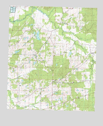
Sharon, MS USGS Topographic Map
Click on map above to begin viewing in our Map Viewer.

This topographic map contains these locations and features:
Feature Name Type Latitude Longitude GNIS ID View Map
Dry CreekStreamN32.7204°W89.9220°669437View Map
Grafton Family CemeteryCemeteryN32.7432°W89.9908°2042966View Map
Hagin CreekStreamN32.7490°W89.9665°670821View Map
Hassley-Herron LakeReservoirN32.7278°W89.9679°671002View Map
Hassley-Herron Lake DamDamN32.7285°W89.9668°681608View Map
Hobuck CreekStreamN32.7385°W89.9454°671253View Map
Holliday Family CemeteryCemeteryN32.6366°W89.9773°2042979View Map
Huckleberry Hills Lake DamDamN32.6935°W89.9851°681584View Map
Huckleberry Lake DamDamN32.6935°W89.9901°681585View Map
L S Farms Lake DamDamN32.6951°W89.9117°681587View Map
Lake LepaceReservoirN32.6453°W89.9306°672263View Map
Lottville CreekStreamN32.6865°W89.8804°672895View Map
Mississippi State Extension Lake DamDamN32.6285°W89.9734°681543View Map
Mount Zion ChurchChurchN32.6418°W89.9698°674363View Map
Mount Zion ChurchChurchN32.7068°W89.9856°674364View Map
New Garden ChurchChurchN32.6907°W89.9612°674629View Map
Pleasant Green ChurchChurchN32.6951°W89.8820°691058View Map
Pleasant Green Missionary Baptist Church CemeteryCemeteryN32.6952°W89.8822°2043020View Map
Pleasant Green School (historical)SchoolN32.6951°W89.8806°691162View Map
Poplar CreekStreamN32.7243°W89.9259°676221View Map
S S Divine Lake DamDamN32.6735°W89.9017°681573View Map
Saint John ChurchChurchN32.7301°W89.9204°677058View Map
Saint John Missionary Baptist Church CemeteryCemeteryN32.7306°W89.9202°2043043View Map
Saint Mark ChurchChurchN32.6751°W89.9073°691167View Map
Saint Mark Church of God In Christ CemeteryCemeteryN32.6750°W89.9071°2043045View Map
Saint Paul ChurchChurchN32.7060°W89.9479°677193View Map
Saint Paul Missionary Baptist Church CemeteryCemeteryN32.7063°W89.9478°2043047View Map
SharonPopulated PlaceN32.6585°W89.9362°677616View Map
Sharon ChurchChurchN32.6593°W89.9070°691059View Map
Sharon Methodist ChurchChurchN32.6579°W89.9334°707552View Map
Sharon Methodist Church CemeteryCemeteryN32.6586°W89.9341°2043033View Map
Sharon Post OfficePost OfficeN32.6584°W89.9366°2768816View Map
Sims ChapelChurchN32.6537°W89.9829°677835View Map
Sims ChapelCemeteryN32.6537°W89.9831°2043037View Map
Sims Chapel CemeteryCemeteryN32.6582°W89.9798°2043036View Map
Smithville ChurchChurchN32.6949°W89.9173°677946View Map
Stump Bridge (historical)BridgeN32.7254°W89.9287°686131View Map
Stump Bridge Post Office (historical)Post OfficeN32.7190°W89.9395°712195View Map
Supervisor District 5CivilN32.7175°W89.8927°711976View Map
Supplejack AirportAirportN32.6478°W89.9743°2676435View Map
Tip Ray Lake DamDamN32.7168°W89.9634°681598View Map
Tithelo LakeReservoirN32.7145°W89.9583°678786View Map
Tithelo Lake DamDamN32.7068°W89.9567°681591View Map
TurnettaPopulated PlaceN32.6254°W89.9931°692358View Map
Twin LakesReservoirN32.6394°W89.9232°679006View Map
Twin Lakes DamDamN32.6368°W89.9234°681547View Map
Wells CemeteryCemeteryN32.6544°W89.9306°2043061View Map

Note: Coordinates in the location and feature list above are referenced to NAD83 datum.


Copyright (C) 2008-2024 Ryan Niemi / Sunset Dynamics ... All Rights Reserved