TopoQuest Logo
Do you find TopoQuest useful?
Help keep TopoQuest running and adding new maps/features by donating!
Bitcoin:  19c7KJd3qBynnjoSw5npx9KScwjBe4ifkT
Litecoin:  LXs6TkuXGGXo1vDsWCkWVdjQX94eUKd6ui
Home View Maps Find Maps Find Places Resources & Links


Seeley, Wisconsin Topographic Map

USGS Map Title: Seeley, WI
USGS Map MRC: 46091A3
DRG (GeoTIFF) Download: o46091a3.tif


Neighboring USGS Topographic Map Quads:


  Totagatic Lake, WI  
46091B4
 

  Cable, WI  
46091B3
 

  Lake Tahkodah, WI  
46091B2
 

  Hayward, WI  
46091A4
 

  Seeley, WI  
46091A3
 

  Spider Lake, WI  
46091A2
 

  Reserve, WI  
45091H4
 

  Chief Lake, WI  
45091H3
 

  New Post, WI  
45091H2


Map MRC Location:

N47°
W92°
N47°
W91°
H8 H7 H6 H5 H4 H3 H2 H1
G8 G7 G6 G5 G4 G3 G2 G1
F8 F7 F6 F5 F4 F3 F2 F1
E8 E7 E6 E5 E4 E3 E2 E1
D8 D7 D6 D5 D4 D3 D2 D1
C8 C7 C6 C5 C4 C3 C2 C1
B8 B7 B6 B5 B4 B3 B2 B1
A8 A7 A6 A5 A4 A3 A2 A1
N46°
W92°
N46°
W91°

Seeley, WI USGS 1:24K Topographic Map Preview:
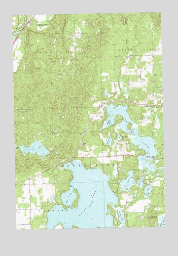
Seeley, WI USGS Topographic Map
Click on map above to begin viewing in our Map Viewer.

This topographic map contains these locations and features:
Feature Name Type Latitude Longitude GNIS ID View Map
Burns LakeLakeN46.0261°W91.2701°1562445View Map
Callahan-Mud Lake State Wildlife Management AreaParkN46.0047°W91.2546°1562519View Map
Clear LakeLakeN46.0208°W91.2644°1563158View Map
Clear Lake School (historical)SchoolN46.1002°W91.2582°1833746View Map
Farnsworth LakeLakeN46.0524°W91.2875°1564873View Map
Hinton BayBayN46.0183°W91.3310°1566484View Map
Jackson School (historical)SchoolN46.0408°W91.3227°1833768View Map
Lake PlacidReservoirN46.0266°W91.2902°1792828View Map
Lake PlacidLakeN46.0262°W91.2814°1571573View Map
Lake Placid 2 WP 298 DamDamN46.0266°W91.2902°1792827View Map
Lovejoy LakeLakeN46.0061°W91.2869°1568705View Map
McClaine LakeLakeN46.0566°W91.2770°1569178View Map
McClaine School (historical)SchoolN46.0094°W91.2830°1833774View Map
Mirror LakeLakeN46.0506°W91.2959°1569590View Map
Riverside CemeteryCemeteryN46.1197°W91.3635°1572368View Map
Round LakeLakeN46.0142°W91.3174°1572675View Map
Round Lake School (historical)SchoolN46.0050°W91.3627°1833792View Map
Round Lake Seaplane BaseAirportN46.0069°W91.3105°1582008View Map
SeeleyPopulated PlaceN46.1211°W91.3613°1573889View Map
Spider Lake ChurchChurchN46.0702°W91.2577°1574548View Map
Tiger Cat FlowageReservoirN46.0341°W91.2530°1580616View Map
Twin Lakes School (historical)SchoolN46.0772°W91.2896°1833808View Map
Uhrenholdt Memorial State ForestForestN46.1180°W91.3574°1575845View Map

Note: Coordinates in the location and feature list above are referenced to NAD83 datum.


Copyright (C) 2008-2024 Ryan Niemi / Sunset Dynamics ... All Rights Reserved