TopoQuest Logo
Do you find TopoQuest useful?
Help keep TopoQuest running and adding new maps/features by donating!
Bitcoin:  19c7KJd3qBynnjoSw5npx9KScwjBe4ifkT
Litecoin:  LXs6TkuXGGXo1vDsWCkWVdjQX94eUKd6ui
Home View Maps Find Maps Find Places Resources & Links


Schaghticoke, New York Topographic Map

USGS Map Title: Schaghticoke, NY
USGS Map MRC: 42073H5
DRG (GeoTIFF) Download: o42073h5.tif


Neighboring USGS Topographic Map Quads:


  Quaker Springs, NY  
43073A6
 

  Schuylerville, NY  
43073A5
 

  Cambridge, NY  
43073A4
 

  Mechanicville, NY  
42073H6
 

  Schaghticoke, NY  
42073H5
 

  Eagle Bridge, NY  
42073H4
 

  Troy North, NY  
42073G6
 

  Tomhannock, NY  
42073G5
 

  Grafton, NY  
42073G4


Map MRC Location:

N43°
W74°
N43°
W73°
H8 H7 H6 H5 H4 H3 H2 H1
G8 G7 G6 G5 G4 G3 G2 G1
F8 F7 F6 F5 F4 F3 F2 F1
E8 E7 E6 E5 E4 E3 E2 E1
D8 D7 D6 D5 D4 D3 D2 D1
C8 C7 C6 C5 C4 C3 C2 C1
B8 B7 B6 B5 B4 B3 B2 B1
A8 A7 A6 A5 A4 A3 A2 A1
N42°
W74°
N42°
W73°

Schaghticoke, NY USGS 1:24K Topographic Map Preview:
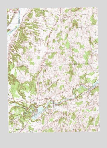
Schaghticoke, NY USGS Topographic Map
Click on map above to begin viewing in our Map Viewer.

This topographic map contains these locations and features:
Feature Name Type Latitude Longitude GNIS ID View Map
Arvilla E Diver Memorial LibraryBuildingN42.8984°W73.5858°2617211View Map
Barkers GrovePopulated PlaceN42.9879°W73.5518°943016View Map
Beadle HillSummitN42.9829°W73.5323°943233View Map
Borden's OrchardLocaleN42.9661°W73.5539°2559404View Map
Brownell CemeteryCemeteryN42.9942°W73.5043°944936View Map
Christ ChurchChurchN42.9142°W73.5128°2513559View Map
Crandall CornersPopulated PlaceN42.9551°W73.5715°947688View Map
East SchaghticokeLocaleN42.8845°W73.5871°949237View Map
EastonPopulated PlaceN42.9934°W73.5523°949304View Map
Easton Volunteer Fire CompanyBuildingN42.9929°W73.5516°2718427View Map
Elihu FarmLocaleN42.9525°W73.5397°2559406View Map
Elmwood CemeteryCemeteryN42.9079°W73.5938°949593View Map
Friends ChurchChurchN42.9909°W73.5404°950734View Map
Hoosic River BridgeBridgeN42.9180°W73.5142°2614921View Map
Hoosic Valley Central SchoolSchoolN42.9067°W73.5821°953174View Map
Hoosic Valley Community ChurchChurchN42.9210°W73.5830°2616495View Map
Hoosic Valley Elementary SchoolSchoolN42.9057°W73.5799°2668863View Map
JohnsonvillePopulated PlaceN42.9145°W73.5137°954145View Map
Johnsonville Fire DepartmentBuildingN42.9167°W73.5133°2718440View Map
Johnsonville Volunteer Ambulance ServiceBuildingN42.9160°W73.5135°2720174View Map
Kidney CreekStreamN42.9798°W73.6104°954596View Map
Kroma KillStreamN42.9981°W73.6082°970269View Map
Little Red Schoolhouse (historical)SchoolN42.8806°W73.5015°955653View Map
Mill CreekStreamN42.9765°W73.6229°957233View Map
MillertownPopulated PlaceN42.9059°W73.5107°957338View Map
Presbyterian United ChurchChurchN42.8964°W73.5872°2513542View Map
Saint John The Baptist Roman Catholic ChurchChurchN42.8940°W73.5912°963657View Map
Saint Johns CemeteryCemeteryN42.9080°W73.5857°963609View Map
SchaghticokePopulated PlaceN42.9001°W73.5854°964566View Map
Schaghticoke BridgeBridgeN42.8950°W73.5886°2614982View Map
Schaghticoke HillPopulated PlaceN42.8787°W73.6057°964567View Map
Schaghticoke Post OfficePost OfficeN42.8960°W73.5865°2618108View Map
School Number 1 (historical)SchoolN42.9568°W73.6131°2463095View Map
School Number 12 (historical)SchoolN42.9036°W73.5135°2463094View Map
School Number 14 (historical)SchoolN42.9282°W73.5973°2463007View Map
School Number 3 (historical)SchoolN42.9218°W73.5309°2463011View Map
School Number 4 (historical)SchoolN42.9991°W73.5112°2463098View Map
School Number 5 (historical)SchoolN42.9371°W73.5607°2463009View Map
School Number 6 (historical)SchoolN42.9911°W73.6018°2463096View Map
School Number 6 (historical)SchoolN42.9448°W73.5097°2463097View Map
Sherwood Farm AirportAirportN42.8937°W73.5079°978094View Map
South EastonPopulated PlaceN42.9795°W73.5223°965740View Map
Town of SchaghticokeCivilN42.8850°W73.6115°979467View Map
Valley FallsPopulated PlaceN42.9034°W73.5626°968358View Map
Valley Falls Free LibraryBuildingN42.8985°W73.5630°2617448View Map
Valley Falls Post OfficePost OfficeN42.8989°W73.5630°2618163View Map
Valley Falls Village Wastewater Treatment FacilityLocaleN42.9038°W73.5669°2617768View Map
Valley Falls Volunteer Fire DepartmentBuildingN42.8994°W73.5622°2718353View Map
Village of SchaghticokeCivilN42.8988°W73.5878°2391121View Map
Village of Valley FallsCivilN42.9006°W73.5627°2391180View Map
Wampecack CreekStreamN42.9212°W73.5240°969308View Map
Whiteside CreekStreamN42.9387°W73.5026°971162View Map

Note: Coordinates in the location and feature list above are referenced to NAD83 datum.


Copyright (C) 2008-2024 Ryan Niemi / Sunset Dynamics ... All Rights Reserved