TopoQuest Logo
Do you find TopoQuest useful?
Help keep TopoQuest running and adding new maps/features by donating!
Bitcoin:  19c7KJd3qBynnjoSw5npx9KScwjBe4ifkT
Litecoin:  LXs6TkuXGGXo1vDsWCkWVdjQX94eUKd6ui
Home View Maps Find Maps Find Places Resources & Links


Eagle Bridge, New York Topographic Map

USGS Map Title: Eagle Bridge, NY
USGS Map MRC: 42073H4
DRG (GeoTIFF) Download: o42073h4.tif


Neighboring USGS Topographic Map Quads:


  Schuylerville, NY  
43073A5
 

  Cambridge, NY  
43073A4
 

  Shushan, NY  
43073A3
 

  Schaghticoke, NY  
42073H5
 

  Eagle Bridge, NY  
42073H4
 

  Hoosick Falls, NY  
42073H3
 

  Tomhannock, NY  
42073G5
 

  Grafton, NY  
42073G4
 

  North Pownal, VT  
42073G3


Map MRC Location:

N43°
W74°
N43°
W73°
H8 H7 H6 H5 H4 H3 H2 H1
G8 G7 G6 G5 G4 G3 G2 G1
F8 F7 F6 F5 F4 F3 F2 F1
E8 E7 E6 E5 E4 E3 E2 E1
D8 D7 D6 D5 D4 D3 D2 D1
C8 C7 C6 C5 C4 C3 C2 C1
B8 B7 B6 B5 B4 B3 B2 B1
A8 A7 A6 A5 A4 A3 A2 A1
N42°
W74°
N42°
W73°

Eagle Bridge, NY USGS 1:24K Topographic Map Preview:
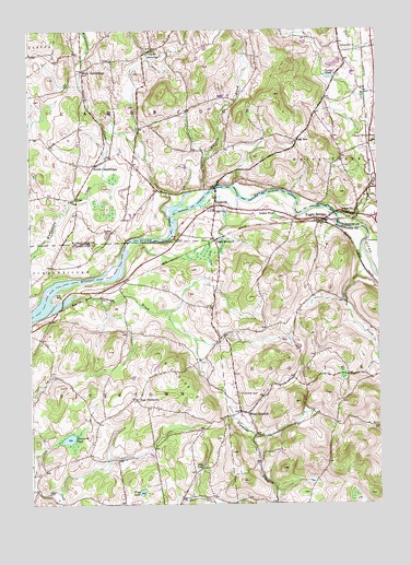
Eagle Bridge, NY USGS Topographic Map
Click on map above to begin viewing in our Map Viewer.

This topographic map contains these locations and features:
Feature Name Type Latitude Longitude GNIS ID View Map
BuskirkPopulated PlaceN42.9537°W73.4343°945334View Map
Buskirk Reformed ChurchChurchN42.9525°W73.4336°2513549View Map
Buskirk Volunteer Fire DepartmentBuildingN42.9560°W73.4334°2718615View Map
Buskirks Covered BridgeBridgeN42.9583°W73.4331°2097333View Map
Case BrookStreamN42.9445°W73.3798°945958View Map
Center CambridgePopulated PlaceN42.9948°W73.4559°946191View Map
Center White CreekPopulated PlaceN42.9704°W73.3776°969983View Map
Center White CreekStreamN42.9684°W73.3829°946205View Map
Diamondwood EstatesPopulated PlaceN42.8986°W73.4989°2513213View Map
Eagle BridgePopulated PlaceN42.9501°W73.3962°948909View Map
East BuskirkPopulated PlaceN42.9445°W73.4340°972412View Map
East PittstownPopulated PlaceN42.9026°W73.4623°972427View Map
Echo LakeReservoirN42.8857°W73.4380°949348View Map
Golden PondLakeN42.9513°W73.4116°951291View Map
LeePopulated PlaceN42.9562°W73.4834°972712View Map
Moseleys Airport (historical)AirportN42.9056°W73.4282°977936View Map
Newcomb PondLakeN42.8924°W73.4864°958503View Map
Nipmoose BrookStreamN42.9262°W73.4926°958615View Map
Nipmoose HillSummitN42.9151°W73.4554°958616View Map
Oak HillPopulated PlaceN42.9709°W73.4040°972883View Map
Owl KillStreamN42.9512°W73.3898°959677View Map
Passing Fancy FarmLocaleN42.8761°W73.4789°2542382View Map
Pencil BrookStreamN42.9992°W73.4240°969295View Map
School Number 3 (historical)SchoolN42.9523°W73.3826°975274View Map
School Number 4 (historical)SchoolN42.9954°W73.3879°975364View Map
South CambridgePopulated PlaceN42.9642°W73.4768°965718View Map
Stannard FarmLocaleN42.9744°W73.4794°2559423View Map
Thurber PondLakeN42.9877°W73.3918°967486View Map
West CambridgePopulated PlaceN42.9895°W73.4807°973223View Map
West HoosickPopulated PlaceN42.8995°W73.4251°969271View Map
West Hoosick Baptist ChurchChurchN42.8939°W73.4128°2513919View Map
West Hoosick Rural CemeteryCemeteryN42.9041°W73.4256°971718View Map
Whipple BrookStreamN42.9570°W73.4373°969310View Map
Whiteside ChurchChurchN42.9861°W73.4860°2598362View Map
Wing PondLakeN42.8782°W73.4605°971485View Map
WNGN-FM (Hoosick Falls)TowerN42.9012°W73.3843°978522View Map

Note: Coordinates in the location and feature list above are referenced to NAD83 datum.


Copyright (C) 2008-2024 Ryan Niemi / Sunset Dynamics ... All Rights Reserved