TopoQuest Logo
Do you find TopoQuest useful?
Help keep TopoQuest running and adding new maps/features by donating!
Bitcoin:  19c7KJd3qBynnjoSw5npx9KScwjBe4ifkT
Litecoin:  LXs6TkuXGGXo1vDsWCkWVdjQX94eUKd6ui
Home View Maps Find Maps Find Places Resources & Links


San Cayetano Mountains, Arizona Topographic Map

USGS Map Title: San Cayetano Mountains, AZ
USGS Map MRC: 31110E8
DRG (GeoTIFF) Download: o31110e8.tif


Neighboring USGS Topographic Map Quads:


  Amado, AZ  
31111F1
 

  Mount Hopkins, AZ  
31110F8
 

  Mount Wrightson, AZ  
31110F7
 

  Tubac, AZ  
31111E1
 

  San Cayetano Mountains, AZ  
31110E8
 

  Patagonia, AZ  
31110E7
 

  Pena Blanca Lake, AZ  
31111D1
 

  Rio Rico, AZ  
31110D8
 

  Cumero Canyon, AZ  
31110D7


Map MRC Location:

N32°
W111°
N32°
W110°
H8 H7 H6 H5 H4 H3 H2 H1
G8 G7 G6 G5 G4 G3 G2 G1
F8 F7 F6 F5 F4 F3 F2 F1
E8 E7 E6 E5 E4 E3 E2 E1
D8 D7 D6 D5 D4 D3 D2 D1
C8 C7 C6 C5 C4 C3 C2 C1
B8 B7 B6 B5 B4 B3 B2 B1
A8 A7 A6 A5 A4 A3 A2 A1
N31°
W111°
N31°
W110°

San Cayetano Mountains, AZ USGS 1:24K Topographic Map Preview:
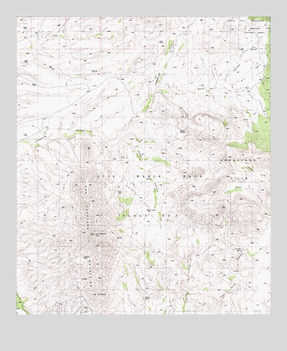
San Cayetano Mountains, AZ USGS Topographic Map
Click on map above to begin viewing in our Map Viewer.

This topographic map contains these locations and features:
Feature Name Type Latitude Longitude GNIS ID View Map
Alamo CanyonValleyN31.5718°W110.9568°25557View Map
AltoPopulated PlaceN31.6045°W110.8781°25608View Map
Alto GulchValleyN31.5945°W110.9015°25610View Map
Bergier RanchLocaleN31.6243°W110.8865°41812View Map
Bond CanyonValleyN31.5945°W110.9015°26589View Map
Chivas TankReservoirN31.5072°W110.9378°27608View Map
Coal Mine CanyonValleyN31.5095°W110.9156°27753View Map
Coal Mine SpringSpringN31.5270°W110.8894°27754View Map
Finleys (historical)LocaleN31.5029°W110.9173°40522View Map
Grosvenor HillsSummitN31.5765°W110.9034°29616View Map
Hacienda del Santa Rita (historical)LocaleN31.5915°W110.9154°36654View Map
Josephine Canyon Trail Number 133TrailN31.5965°W110.9281°14151View Map
Luis Maria Baca GrantCivilN31.5306°W110.9418°31400View Map
Mount ShibellSummitN31.5084°W110.9606°34376View Map
Rio Rico Northeast Census Designated Place (historical)CensusN31.5380°W110.9819°2409177View Map
Salero RanchLocaleN31.5951°W110.8881°33968View Map
San Cayetano MountainsSummitN31.5312°W110.9581°34007View Map
San Cayetano PeakSummitN31.5334°W110.9620°34008View Map
Sheuy WellWellN31.5434°W110.9351°34375View Map
Tejano SpringSpringN31.5769°W110.9203°35174View Map
Tubutana MineMineN31.5243°W110.9684°35492View Map

Note: Coordinates in the location and feature list above are referenced to NAD83 datum.


Copyright (C) 2008-2024 Ryan Niemi / Sunset Dynamics ... All Rights Reserved