TopoQuest Logo
Do you find TopoQuest useful?
Help keep TopoQuest running and adding new maps/features by donating!
Bitcoin:  19c7KJd3qBynnjoSw5npx9KScwjBe4ifkT
Litecoin:  LXs6TkuXGGXo1vDsWCkWVdjQX94eUKd6ui
Home View Maps Find Maps Find Places Resources & Links


Patagonia, Arizona Topographic Map

USGS Map Title: Patagonia, AZ
USGS Map MRC: 31110E7
DRG (GeoTIFF) Download: o31110e7.tif


Neighboring USGS Topographic Map Quads:


  Mount Hopkins, AZ  
31110F8
 

  Mount Wrightson, AZ  
31110F7
 

  Sonoita, AZ  
31110F6
 

  San Cayetano Mountains, AZ  
31110E8
 

  Patagonia, AZ  
31110E7
 

  Mount Hughes, AZ  
31110E6
 

  Rio Rico, AZ  
31110D8
 

  Cumero Canyon, AZ  
31110D7
 

  Harshaw, AZ  
31110D6


Map MRC Location:

N32°
W111°
N32°
W110°
H8 H7 H6 H5 H4 H3 H2 H1
G8 G7 G6 G5 G4 G3 G2 G1
F8 F7 F6 F5 F4 F3 F2 F1
E8 E7 E6 E5 E4 E3 E2 E1
D8 D7 D6 D5 D4 D3 D2 D1
C8 C7 C6 C5 C4 C3 C2 C1
B8 B7 B6 B5 B4 B3 B2 B1
A8 A7 A6 A5 A4 A3 A2 A1
N31°
W111°
N31°
W110°

Patagonia, AZ USGS 1:24K Topographic Map Preview:
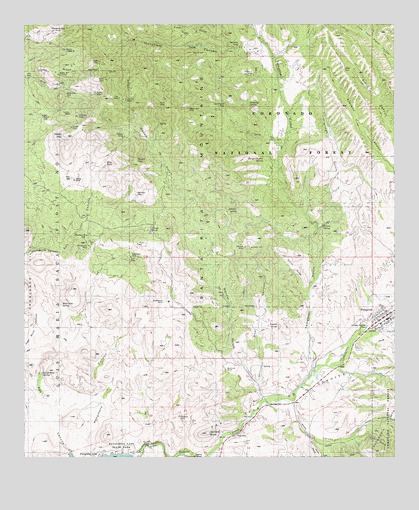
Patagonia, AZ USGS Topographic Map
Click on map above to begin viewing in our Map Viewer.

This topographic map contains these locations and features:
Feature Name Type Latitude Longitude GNIS ID View Map
Akes (historical)LocaleN31.5668°W110.7840°40523View Map
Alto GroupMineN31.6115°W110.8637°25609View Map
Alum CanyonValleyN31.5156°W110.7845°25481View Map
Alum GulchValleyN31.5051°W110.7654°25482View Map
Aztec GulchValleyN31.5062°W110.7640°25852View Map
Aztec Mill (historical)MineN31.5129°W110.7965°36534View Map
Bell Mare Mining Camp (historical)LocaleN31.5751°W110.8395°36543View Map
Bland MineMineN31.6054°W110.8534°26478View Map
Bradford MineMineN31.5120°W110.8231°26701View Map
Burro MineMineN31.6090°W110.8554°27049View Map
Castle ButteSummitN31.5379°W110.7893°27340View Map
CCC CanyonValleyN31.5362°W110.7506°36566View Map
Cieneguita CanyonValleyN31.5587°W110.8629°27664View Map
Cinigita TankReservoirN31.5609°W110.8680°27665View Map
Dragon Z MineMineN31.6106°W110.7987°28591View Map
Dripping SpringSpringN31.6023°W110.8001°28595View Map
El PlomoSummitN31.6134°W110.8618°42695View Map
Eureka MineMineN31.5954°W110.8595°28930View Map
Farallon (historical)LocaleN31.5154°W110.7979°36628View Map
Flux (historical)LocaleN31.5215°W110.7781°36631View Map
Flux CanyonValleyN31.5043°W110.7781°29077View Map
Fresno SpringSpringN31.5673°W110.7748°36634View Map
Gatlin Jones CemeteryCemeteryN31.5378°W110.7503°29280View Map
Gatlin RanchLocaleN31.5301°W110.7779°36638View Map
George Wise SpringSpringN31.5244°W110.8698°29304View Map
Goat CanyonValleyN31.5173°W110.7951°29356View Map
Gringo GulchValleyN31.5665°W110.7756°29610View Map
Happy Jack MineMineN31.6031°W110.8148°29737View Map
Hard Luck RanchLocaleN31.5251°W110.8079°36655View Map
Henry TankReservoirN31.5653°W110.8326°29895View Map
Ivanhoe MineMineN31.5618°W110.8015°30441View Map
Jefferson MineMineN31.5987°W110.8576°30518View Map
Johnson SpringSpringN31.5722°W110.8037°30589View Map
Joplin MineMineN31.6151°W110.8512°30618View Map
Last Chance MineMineN31.6012°W110.8059°30897View Map
Lee ShaftMineN31.6045°W110.8437°30929View Map
Lowells (historical)LocaleN31.5306°W110.7709°36700View Map
Malony (historical)LocaleN31.5126°W110.7837°36714View Map
Mammoth MineMineN31.5576°W110.8395°31475View Map
Mansfield CanyonValleyN31.6162°W110.7943°31486View Map
Mansfield GroupMineN31.6190°W110.8012°31487View Map
Marshal's Police DepartmentBuildingN31.5406°W110.7521°2751650View Map
Marshalls (historical)LocaleN31.5168°W110.8673°40521View Map
Mata Siete SpringSpringN31.5444°W110.8631°43096View Map
Mine TankReservoirN31.5854°W110.8483°31900View Map
Mohawk MineMineN31.5759°W110.8379°31946View Map
Montezuma MineMineN31.5612°W110.8537°36733View Map
Montezuma WellWellN31.5643°W110.8543°31970View Map
PatagoniaPopulated PlaceN31.5395°W110.7562°32726View Map
Patagonia CemeteryCemeteryN31.5317°W110.7632°2622956View Map
Patagonia Community ChurchChurchN31.5387°W110.7554°2623503View Map
Patagonia Post OfficePost OfficeN31.5416°W110.7513°2783306View Map
Patagonia Public LibraryBuildingN31.5389°W110.7540°2623594View Map
Patagonia School of MontessoriSchoolN31.5452°W110.7575°2544765View Map
Piper GulchValleyN31.6187°W110.8068°33032View Map
Ranger Station SpringSpringN31.5853°W110.7944°36797View Map
Rosario MineMineN31.5929°W110.8418°33797View Map
Royal Blue MineMineN31.6054°W110.8615°33853View Map
Saint Theresa of Lisieux Roman Catholic ChurchChurchN31.5423°W110.7536°2623275View Map
Salero MineMineN31.5806°W110.8590°33966View Map
Salero MountainSummitN31.5931°W110.8606°33967View Map
San Ramon MineMineN31.6181°W110.8579°34030View Map
Sanford ButteSummitN31.5068°W110.8140°34059View Map
Santa Cruz CountyCivilN31.5260°W110.8466°40472View Map
School CanyonValleyN31.5384°W110.7504°36839View Map
Siphon WellWellN31.5987°W110.8698°34468View Map
Smith GulchValleyN31.5484°W110.7804°34554View Map
Squaw GulchValleyN31.5131°W110.8004°34772View Map
Squaw PeakSummitN31.5848°W110.8387°34777View Map
Temporal GulchValleyN31.5254°W110.7790°35193View Map
Titus (historical)LocaleN31.5501°W110.8173°40526View Map
Town of Patagonia LandfillLocaleN31.5644°W110.7646°2622367View Map
Trenton MineMineN31.5998°W110.8601°35458View Map
Viceroy MineMineN31.6037°W110.8409°35775View Map
Victor MineMineN31.6015°W110.8309°35776View Map
Wadsworths (historical)LocaleN31.5834°W110.7509°40524View Map
Wandering Jew GroupMineN31.6231°W110.8654°35889View Map
Wards (historical)LocaleN31.5334°W110.8340°40527View Map
Weatherhead RanchLocaleN31.5448°W110.8270°35929View Map

Note: Coordinates in the location and feature list above are referenced to NAD83 datum.


Copyright (C) 2008-2024 Ryan Niemi / Sunset Dynamics ... All Rights Reserved