TopoQuest Logo
Do you find TopoQuest useful?
Help keep TopoQuest running and adding new maps/features by donating!
Bitcoin:  19c7KJd3qBynnjoSw5npx9KScwjBe4ifkT
Litecoin:  LXs6TkuXGGXo1vDsWCkWVdjQX94eUKd6ui
Home View Maps Find Maps Find Places Resources & Links


Saint Thomas, Minnesota Topographic Map

USGS Map Title: Saint Thomas, MN
USGS Map MRC: 44093D7
DRG (GeoTIFF) Download: o44093d7.tif


Neighboring USGS Topographic Map Quads:


  Henderson, MN  
44093E8
 

  Belle Plaine South, MN  
44093E7
 

  Union Hill, MN  
44093E6
 

  Le Sueur, MN  
44093D8
 

  Saint Thomas, MN  
44093D7
 

  Le Center, MN  
44093D6
 

  Saint Peter, MN  
44093C8
 

  Cleveland, MN  
44093C7
 

  Cordova, MN  
44093C6


Map MRC Location:

N45°
W94°
N45°
W93°
H8 H7 H6 H5 H4 H3 H2 H1
G8 G7 G6 G5 G4 G3 G2 G1
F8 F7 F6 F5 F4 F3 F2 F1
E8 E7 E6 E5 E4 E3 E2 E1
D8 D7 D6 D5 D4 D3 D2 D1
C8 C7 C6 C5 C4 C3 C2 C1
B8 B7 B6 B5 B4 B3 B2 B1
A8 A7 A6 A5 A4 A3 A2 A1
N44°
W94°
N44°
W93°

Saint Thomas, MN USGS 1:24K Topographic Map Preview:
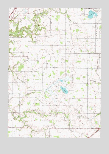
Saint Thomas, MN USGS Topographic Map
Click on map above to begin viewing in our Map Viewer.

This topographic map contains these locations and features:
Feature Name Type Latitude Longitude GNIS ID View Map
Calvary CemeteryCemeteryN44.4694°W93.7805°2063569View Map
Church of Saint HenryChurchN44.3864°W93.7878°2063507View Map
County Ditch Number Eight and FiftythreeCanalN44.4461°W93.7530°642334View Map
County Ditch Number FiftysevenCanalN44.3861°W93.8136°642197View Map
County Ditch Number FiftysixCanalN44.4425°W93.8436°642191View Map
County Ditch Number FiftythreeCanalN44.4275°W93.7516°642183View Map
County Ditch Number FortyoneCanalN44.3914°W93.7788°642074View Map
County Ditch Number ThirtyfourCanalN44.4661°W93.7891°641981View Map
Dresselville CemeteryCemeteryN44.4430°W93.8155°642926View Map
Ely LakeLakeN44.4206°W93.7997°643324View Map
German CemeteryCemeteryN44.4388°W93.8601°644092View Map
Hillside CemeteryCemeteryN44.3838°W93.8497°645006View Map
Rice LakeLakeN44.4300°W93.8005°649979View Map
Saint HenryPopulated PlaceN44.3841°W93.7886°654925View Map
Saint Henry CemeteryCemeteryN44.3861°W93.7880°2063567View Map
Saint Henry Post Office (historical)Post OfficeN44.3842°W93.7883°2063521View Map
Saint John's Evangelical CemeteryCemeteryN44.3986°W93.8583°2063568View Map
Saint ThomasPopulated PlaceN44.4977°W93.7575°651065View Map
Saint Thomas CemeteryCemeteryN44.4970°W93.7582°2063571View Map
Saint Thomas Post Office (historical)Post OfficeN44.4978°W93.7572°2063519View Map
Saint Thomas State Wildlife Management AreaParkN44.4939°W93.7608°651076View Map
Salem German Evangelical Church CemeteryCemeteryN44.4855°W93.7880°2063570View Map
Sharon CemeteryCemeteryN44.4172°W93.8494°651915View Map
Thomas LakeLakeN44.4944°W93.7635°653150View Map
Township of SharonCivilN44.4132°W93.8286°665584View Map

Note: Coordinates in the location and feature list above are referenced to NAD83 datum.


Copyright (C) 2008-2024 Ryan Niemi / Sunset Dynamics ... All Rights Reserved