TopoQuest Logo
Do you find TopoQuest useful?
Help keep TopoQuest running and adding new maps/features by donating!
Bitcoin:  19c7KJd3qBynnjoSw5npx9KScwjBe4ifkT
Litecoin:  LXs6TkuXGGXo1vDsWCkWVdjQX94eUKd6ui
Home View Maps Find Maps Find Places Resources & Links


Saddleblanket Mountain, Oregon Topographic Map

USGS Map Title: Saddleblanket Mountain, OR
USGS Map MRC: 43122H5
DRG (GeoTIFF) Download: o43122h5.tif


Neighboring USGS Topographic Map Quads:


  Leaburg, OR  
44122A6
 

  Goat Point, OR  
44122A5
 

  Nimrod, OR  
44122A4
 

  Fall Creek Lake, OR  
43122H6
 

  Saddleblanket Mountain, OR  
43122H5
 

  Sinker Mountain, OR  
43122H4
 

  Mount June, OR  
43122G6
 

  Westfir West, OR  
43122G5
 

  Westfir East, OR  
43122G4


Map MRC Location:

N44°
W123°
N44°
W122°
H8 H7 H6 H5 H4 H3 H2 H1
G8 G7 G6 G5 G4 G3 G2 G1
F8 F7 F6 F5 F4 F3 F2 F1
E8 E7 E6 E5 E4 E3 E2 E1
D8 D7 D6 D5 D4 D3 D2 D1
C8 C7 C6 C5 C4 C3 C2 C1
B8 B7 B6 B5 B4 B3 B2 B1
A8 A7 A6 A5 A4 A3 A2 A1
N43°
W123°
N43°
W122°

Saddleblanket Mountain, OR USGS 1:24K Topographic Map Preview:
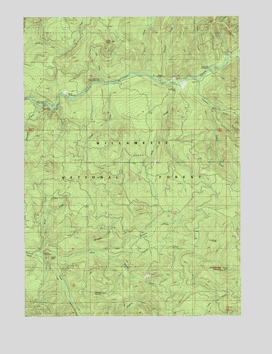
Saddleblanket Mountain, OR USGS Topographic Map
Click on map above to begin viewing in our Map Viewer.

This topographic map contains these locations and features:
Feature Name Type Latitude Longitude GNIS ID View Map
Andy CreekStreamN43.9718°W122.5373°1158105View Map
Bedrock CreekStreamN43.9721°W122.5437°1137868View Map
Bedrock Recreation SiteLocaleN43.9735°W122.5470°1134908View Map
Big Pool Recreation SiteLocaleN43.9665°W122.5984°1138051View Map
Blanket CreekStreamN43.9015°W122.5848°1138253View Map
Boundary CreekStreamN43.9626°W122.6164°1138502View Map
Broken Bowl Recreation SiteLocaleN43.9621°W122.6106°1134910View Map
Brush CreekStreamN43.9007°W122.6181°1138710View Map
Chichester FallsFallsN43.9702°W122.5378°1139627View Map
Clark ButteSummitN43.9894°W122.5755°1139749View Map
Clark CreekStreamN43.9723°W122.5806°1139750View Map
Clark Creek Group CampLocaleN43.9735°W122.5803°1134909View Map
Dolly Varden Recreation SiteLocaleN43.9637°W122.6167°1141163View Map
Fall Creek Guard StationLocaleN43.9690°W122.6001°1141990View Map
Fall Creek National Recreation TrailTrailN43.9748°W122.5345°1162581View Map
Fall Creek Work CenterLocaleN43.9679°W122.6026°1162580View Map
Indian CreekStreamN43.9679°W122.5928°1153376View Map
Johnny Creek Nature TrailTrailN43.9735°W122.5762°1167100View Map
Johnny Creek Recreation SiteLocaleN43.9726°W122.5709°1926270View Map
Jones CreekStreamN43.9773°W122.5189°1144381View Map
Little Blanket ShelterLocaleN43.9065°W122.5142°1145103View Map
Minnehaha CreekStreamN43.9018°W122.5895°1146335View Map
North Fork Winberry CreekStreamN43.9001°W122.6195°1147024View Map
Portland CreekStreamN43.9732°W122.5251°1147916View Map
Puma CreekStreamN43.9787°W122.5142°1148032View Map
Puma Creek Recreation SiteLocaleN43.9785°W122.5153°1148033View Map
Rubble CreekStreamN43.9626°W122.5170°1148823View Map
Saddleblanket MountainSummitN43.8938°W122.5104°1148918View Map
Slick CreekStreamN43.9762°W122.5562°1149680View Map
South Fork Winberry CreekStreamN43.9001°W122.6195°1150046View Map
Station ButteSummitN43.8992°W122.6120°1150366View Map
Timber ButteSummitN43.9260°W122.5728°1153377View Map
Timber CreekStreamN43.9721°W122.5773°1151240View Map
Traverse CreekStreamN43.8990°W122.5759°1151406View Map
Winberry MountainSummitN43.8845°W122.5814°1152472View Map
Winberry Recreation SiteLocaleN43.9012°W122.6137°1134911View Map

Note: Coordinates in the location and feature list above are referenced to NAD83 datum.


Copyright (C) 2008-2024 Ryan Niemi / Sunset Dynamics ... All Rights Reserved