TopoQuest Logo
Do you find TopoQuest useful?
Help keep TopoQuest running and adding new maps/features by donating!
Bitcoin:  19c7KJd3qBynnjoSw5npx9KScwjBe4ifkT
Litecoin:  LXs6TkuXGGXo1vDsWCkWVdjQX94eUKd6ui
Home View Maps Find Maps Find Places Resources & Links


Ruleville, Mississippi Topographic Map

USGS Map Title: Ruleville, MS
USGS Map MRC: 33090F5
DRG (GeoTIFF) Download: o33090f5.tif


Neighboring USGS Topographic Map Quads:


  Merigold, MS  
33090G6
 

  Drew, MS  
33090G5
 

  Brooks, MS  
33090G4
 

  Cleveland, MS  
33090F6
 

  Ruleville, MS  
33090F5
 

  Rattlesnake Bayou, MS  
33090F4
 

  Boyer, MS  
33090E6
 

  Sunflower, MS  
33090E5
 

  Bear Gut Bayou, MS  
33090E4


Map MRC Location:

N34°
W91°
N34°
W90°
H8 H7 H6 H5 H4 H3 H2 H1
G8 G7 G6 G5 G4 G3 G2 G1
F8 F7 F6 F5 F4 F3 F2 F1
E8 E7 E6 E5 E4 E3 E2 E1
D8 D7 D6 D5 D4 D3 D2 D1
C8 C7 C6 C5 C4 C3 C2 C1
B8 B7 B6 B5 B4 B3 B2 B1
A8 A7 A6 A5 A4 A3 A2 A1
N33°
W91°
N33°
W90°

Ruleville, MS USGS 1:24K Topographic Map Preview:
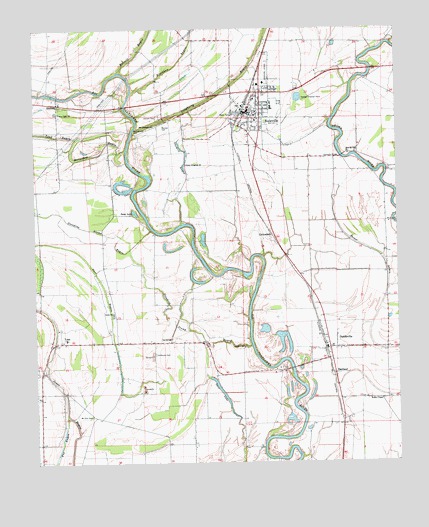
Ruleville, MS USGS Topographic Map
Click on map above to begin viewing in our Map Viewer.

This topographic map contains these locations and features:
Feature Name Type Latitude Longitude GNIS ID View Map
Big Eddy BendBendN33.6973°W90.5834°707726View Map
Blackhaw BayouStreamN33.7321°W90.5912°667242View Map
Burrell BayouStreamN33.7373°W90.5959°667837View Map
Central High SchoolSchoolN33.7287°W90.5431°686485View Map
Church of ChristChurchN33.7296°W90.6159°686487View Map
City of RulevilleCivilN33.7246°W90.5500°2404654View Map
CottondalePopulated PlaceN33.6901°W90.5429°668853View Map
Darr LakeLakeN33.6457°W90.5618°669119View Map
Dewberry Ferry (historical)CrossingN33.7276°W90.5937°707732View Map
DockeryPopulated PlaceN33.7287°W90.6168°691820View Map
Dockery Baptist ChurchChurchN33.7287°W90.6159°686494View Map
Dockery School (historical)SchoolN33.7251°W90.6143°686495View Map
DoddsvillePopulated PlaceN33.6576°W90.5248°669310View Map
Doddsville Industrial Institute (historical)SchoolN33.6807°W90.5154°686496View Map
Doddsville Post OfficePost OfficeN33.6574°W90.5250°2768761View Map
Dougherty BayouStreamN33.7212°W90.5904°669356View Map
EastlandPopulated PlaceN33.6507°W90.5220°669627View Map
Fairview Church (historical)ChurchN33.6793°W90.5031°686501View Map
Gillfield ChurchChurchN33.6584°W90.5537°670389View Map
Green Grove ChurchChurchN33.6676°W90.5987°670670View Map
Hannahs BridgeBridgeN33.7132°W90.5184°670887View Map
Hillhouse CemeteryCemeteryN33.6565°W90.5840°671224View Map
Horace Chapel (historical)ChurchN33.6887°W90.5826°686524View Map
Horseshoe BayouStreamN33.7159°W90.5931°671477View Map
Keys DeadeningLocaleN33.7168°W90.5529°707748View Map
Lead BayouStreamN33.7193°W90.6087°672337View Map
Lehrton (historical)Populated PlaceN33.7257°W90.5806°707750View Map
Lehrton CemeteryCemeteryN33.7251°W90.5818°672398View Map
Lindsey LakeLakeN33.7032°W90.5942°672509View Map
LinnPopulated PlaceN33.6598°W90.6165°672515View Map
Linn Baptist ChurchChurchN33.6637°W90.6173°686537View Map
Linn High School (historical)SchoolN33.6607°W90.6148°707752View Map
Linn Methodist ChurchChurchN33.6604°W90.6198°686566View Map
Lion BrakeSwampN33.7390°W90.5668°686538View Map
Mallalieu United Methodist ChurchChurchN33.7307°W90.6151°686542View Map
Marlow CemeteryCemeteryN33.7226°W90.5801°673144View Map
Marlow School (historical)SchoolN33.7126°W90.5715°686545View Map
Moorehouse CemeteryCemeteryN33.7201°W90.5901°673789View Map
Mount Galilee ChurchChurchN33.7179°W90.5393°686552View Map
Mount Galilee School (historical)SchoolN33.7182°W90.5406°686553View Map
Mount Leighton ChurchChurchN33.7223°W90.5834°674043View Map
Mount Zion CemeteryCemeteryN33.6387°W90.6062°674322View Map
Mount Zion Church (historical)ChurchN33.6382°W90.6056°686557View Map
New Jerusalem ChurchChurchN33.7287°W90.5440°686563View Map
New Mount Zion ChurchChurchN33.7140°W90.5165°674791View Map
North Sunflower County HospitalHospitalN33.7344°W90.5451°686570View Map
Old Jerusalem ChurchChurchN33.6615°W90.5212°686574View Map
Old Lehrton BridgeBridgeN33.7279°W90.5937°707758View Map
Onemile BayouStreamN33.6940°W90.5731°675289View Map
Petes LakeLakeN33.6973°W90.5909°675662View Map
Quiver (historical)Populated PlaceN33.6582°W90.5004°707764View Map
Ricoe School (historical)SchoolN33.6851°W90.5093°686582View Map
RulevillePopulated PlaceN33.7259°W90.5515°676950View Map
Ruleville Baptist ChurchChurchN33.7298°W90.5490°686587View Map
Ruleville City HallBuildingN33.7259°W90.5501°686588View Map
Ruleville Fire DepartmentBuildingN33.7255°W90.5500°2665757View Map
Ruleville Health Care CenterHospitalN33.7387°W90.5429°686589View Map
Ruleville Junior High SchoolSchoolN33.7237°W90.5487°686590View Map
Ruleville Lagoon DamDamN33.7334°W90.5218°682320View Map
Ruleville Memorial ParkParkN33.7268°W90.5520°686593View Map
Ruleville Police DepartmentBuildingN33.7256°W90.5502°2754284View Map
Ruleville Post OfficePost OfficeN33.7262°W90.5506°2768575View Map
Ruleville Public LibraryBuildingN33.7257°W90.5506°686594View Map
Ruleville United Methodist ChurchChurchN33.7251°W90.5504°686595View Map
Standing StumpAreaN33.6751°W90.5848°707775View Map
Standing Stump BayouStreamN33.6584°W90.5509°678219View Map
Sweet Kingdom ChurchChurchN33.7112°W90.5723°678482View Map
Town of DoddsvilleCivilN33.6599°W90.5214°2406383View Map
True Light ChurchChurchN33.7257°W90.6159°678900View Map
Union Temple (historical)ChurchN33.6932°W90.6245°686619View Map
Walker ChapelChurchN33.6432°W90.5059°679268View Map

Note: Coordinates in the location and feature list above are referenced to NAD83 datum.


Copyright (C) 2008-2024 Ryan Niemi / Sunset Dynamics ... All Rights Reserved