TopoQuest Logo
Do you find TopoQuest useful?
Help keep TopoQuest running and adding new maps/features by donating!
Bitcoin:  19c7KJd3qBynnjoSw5npx9KScwjBe4ifkT
Litecoin:  LXs6TkuXGGXo1vDsWCkWVdjQX94eUKd6ui
Home View Maps Find Maps Find Places Resources & Links


Ruby Mountain, Montana Topographic Map

USGS Map Title: Ruby Mountain, MT
USGS Map MRC: 45111E3
DRG (GeoTIFF) Download: o45111e3.tif


Neighboring USGS Topographic Map Quads:


  Madison Plateau, MT  
45111F4
 

  Anceney, MT  
45111F3
 

  Bozeman Hot Springs, MT  
45111F2
 

  Cherry Creek Canyon, MT  
45111E4
 

  Ruby Mountain, MT  
45111E3
 

  Gallatin Gateway, MT  
45111E2
 

  Willow Swamp, MT  
45111D4
 

  Beacon Point, MT  
45111D3
 

  Garnet Mountain, MT  
45111D2


Map MRC Location:

N46°
W112°
N46°
W111°
H8 H7 H6 H5 H4 H3 H2 H1
G8 G7 G6 G5 G4 G3 G2 G1
F8 F7 F6 F5 F4 F3 F2 F1
E8 E7 E6 E5 E4 E3 E2 E1
D8 D7 D6 D5 D4 D3 D2 D1
C8 C7 C6 C5 C4 C3 C2 C1
B8 B7 B6 B5 B4 B3 B2 B1
A8 A7 A6 A5 A4 A3 A2 A1
N45°
W112°
N45°
W111°

Ruby Mountain, MT USGS 1:24K Topographic Map Preview:
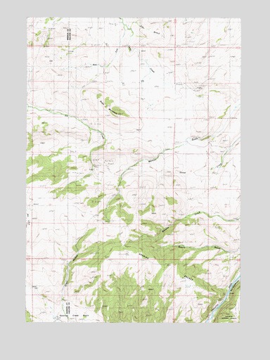
Ruby Mountain, MT USGS Topographic Map
Click on map above to begin viewing in our Map Viewer.

This topographic map contains these locations and features:
Feature Name Type Latitude Longitude GNIS ID View Map
02S03E34CA__01 WellWellN45.6185°W111.3430°810593View Map
02S03E35AC__01 WellWellN45.6222°W111.3172°810617View Map
03S04E08AD__01 WellWellN45.5930°W111.2513°810351View Map
Bozeman Corundum MineMineN45.6180°W111.2813°803005View Map
Browns GulchValleyN45.5427°W111.2511°780454View Map
East Branch Camp CreekStreamN45.6202°W111.3155°782784View Map
Elk CreekStreamN45.5785°W111.3333°783051View Map
Elk Creek Corundum MineMineN45.5633°W111.3341°802995View Map
Green HollowValleyN45.5083°W111.3550°784279View Map
Harmon School (historical)SchoolN45.5916°W111.3008°1738054View Map
Harringer BridgeBridgeN45.5222°W111.2502°1737915View Map
Kirk Wildlife Refuge Fishing Access SiteLocaleN45.5055°W111.2652°1744516View Map
Merritt GulchValleyN45.5697°W111.2963°787190View Map
Ruby MountainSummitN45.5855°W111.3247°789839View Map
Spanish BreaksCliffN45.5233°W111.2944°791123View Map
Spanish Creek BasinBasinN45.5022°W111.3519°791125View Map
West Fork Camp CreekStreamN45.6219°W111.3191°792993View Map

Note: Coordinates in the location and feature list above are referenced to NAD83 datum.


Copyright (C) 2008-2024 Ryan Niemi / Sunset Dynamics ... All Rights Reserved