TopoQuest Logo
Do you find TopoQuest useful?
Help keep TopoQuest running and adding new maps/features by donating!
Bitcoin:  19c7KJd3qBynnjoSw5npx9KScwjBe4ifkT
Litecoin:  LXs6TkuXGGXo1vDsWCkWVdjQX94eUKd6ui
Home View Maps Find Maps Find Places Resources & Links


Roxie, Mississippi Topographic Map

USGS Map Title: Roxie, MS
USGS Map MRC: 31091E1
DRG (GeoTIFF) Download: o31091e1.tif


Neighboring USGS Topographic Map Quads:


  Church Hill, MS  
31091F2
 

  Fayette, MS  
31091F1
 

  Gin Branch, MS  
31090F8
 

  Cranfield, MS  
31091E2
 

  Roxie, MS  
31091E1
 

  Kirby, MS  
31090E8
 

  Jeannette, MS  
31091D2
 

  Knoxville, MS  
31091D1
 

  Meadville, MS  
31090D8


Map MRC Location:

N32°
W92°
N32°
W91°
H8 H7 H6 H5 H4 H3 H2 H1
G8 G7 G6 G5 G4 G3 G2 G1
F8 F7 F6 F5 F4 F3 F2 F1
E8 E7 E6 E5 E4 E3 E2 E1
D8 D7 D6 D5 D4 D3 D2 D1
C8 C7 C6 C5 C4 C3 C2 C1
B8 B7 B6 B5 B4 B3 B2 B1
A8 A7 A6 A5 A4 A3 A2 A1
N31°
W92°
N31°
W91°

Roxie, MS USGS 1:24K Topographic Map Preview:
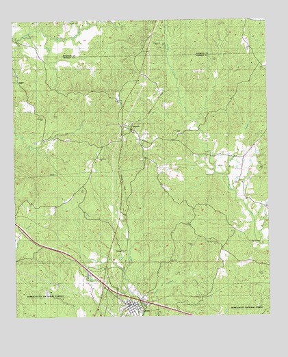
Roxie, MS USGS Topographic Map
Click on map above to begin viewing in our Map Viewer.

This topographic map contains these locations and features:
Feature Name Type Latitude Longitude GNIS ID View Map
Armstrong CemeteryCemeteryN31.6229°W91.0234°692413View Map
Beech Grove CemeteryCemeteryN31.5310°W91.0090°692524View Map
Beech Grove ChurchChurchN31.5282°W91.0251°692525View Map
Bethlehem ChurchChurchN31.5663°W91.0826°692570View Map
Carnes BranchStreamN31.5596°W91.0212°692842View Map
Central SchoolSchoolN31.5666°W91.0145°692871View Map
Daughters TempleChurchN31.5991°W91.1223°693056View Map
Dupree CemeteryCemeteryN31.5271°W91.0465°693140View Map
Friendship CemeteryCemeteryN31.5835°W91.1098°693269View Map
Fulton CemeteryCemeteryN31.5541°W91.0912°693275View Map
Guice CemeteryCemeteryN31.5846°W91.1048°693381View Map
HamburgPopulated PlaceN31.5788°W91.0668°693401View Map
Hamburg CemeteryCemeteryN31.5752°W91.0645°707576View Map
Haram BranchStreamN31.5035°W91.0618°693408View Map
Hayes CreekStreamN31.6193°W91.1079°693433View Map
Holly CemeteryCemeteryN31.6043°W91.0009°693508View Map
King CemeteryCemeteryN31.5393°W91.0390°693658View Map
Morgan Creek Oil FieldOilfieldN31.5349°W91.0407°705546View Map
Mount Carmel CemeteryCemeteryN31.5774°W91.0437°694052View Map
Mundy CemeteryCemeteryN31.5724°W91.0632°707590View Map
Old Beech Grove CemeteryCemeteryN31.5307°W91.0257°694256View Map
Old Rose Hill CemeteryCemeteryN31.6143°W91.0537°694267View Map
Oldenburg Oil FieldOilfieldN31.5629°W91.0040°705551View Map
OrangePopulated PlaceN31.5277°W91.0726°694276View Map
Pine Grove ChurchChurchN31.5232°W91.0487°694382View Map
Portersville (historical)LocaleN31.5363°W91.1223°705202View Map
Prophet CemeteryCemeteryN31.5299°W91.0373°694479View Map
Rose Hill ChurchChurchN31.6179°W91.0573°694611View Map
RoxiePopulated PlaceN31.5046°W91.0690°694621View Map
Roxie Attendance CenterSchoolN31.5071°W91.0718°705204View Map
Roxie CemeteryCemeteryN31.5035°W91.0640°707604View Map
Roxie Post OfficePost OfficeN31.5055°W91.0664°2768789View Map
Roxie Volunteer Fire DepartmentBuildingN31.5057°W91.0677°2667869View Map
Saint Paul CemeteryCemeteryN31.6240°W91.0934°694660View Map
Smiley CemeteryCemeteryN31.5174°W91.0029°694818View Map
South Morgan Creek Oil FieldOilfieldN31.5174°W91.0362°705554View Map
Town of RoxieCivilN31.5046°W91.0675°2407253View Map
Wildwood SpringSpringN31.5654°W91.0654°705210View Map
Williams CemeteryCemeteryN31.5904°W91.0709°695185View Map

Note: Coordinates in the location and feature list above are referenced to NAD83 datum.


Copyright (C) 2008-2024 Ryan Niemi / Sunset Dynamics ... All Rights Reserved