TopoQuest Logo
Do you find TopoQuest useful?
Help keep TopoQuest running and adding new maps/features by donating!
Bitcoin:  19c7KJd3qBynnjoSw5npx9KScwjBe4ifkT
Litecoin:  LXs6TkuXGGXo1vDsWCkWVdjQX94eUKd6ui
Home View Maps Find Maps Find Places Resources & Links


Robbinston, Maine Topographic Map

USGS Map Title: Robbinston, ME
USGS Map MRC: 45067A1
DRG (GeoTIFF) Download: o45067a1.tif


Neighboring USGS Topographic Map Quads:


  Devils Head, ME  
45067B2


  Red Beach, ME  
45067A2
 

  Robbinston, ME  
45067A1


  Pembroke, ME  
44067H2


Map MRC Location:

N46°
W68°
N46°
W67°
H8 H7 H6 H5 H4 H3 H2 H1
G8 G7 G6 G5 G4 G3 G2 G1
F8 F7 F6 F5 F4 F3 F2 F1
E8 E7 E6 E5 E4 E3 E2 E1
D8 D7 D6 D5 D4 D3 D2 D1
C8 C7 C6 C5 C4 C3 C2 C1
B8 B7 B6 B5 B4 B3 B2 B1
A8 A7 A6 A5 A4 A3 A2 A1
N45°
W68°
N45°
W67°

Robbinston, ME USGS 1:24K Topographic Map Preview:
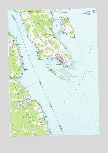
Robbinston, ME USGS Topographic Map
Click on map above to begin viewing in our Map Viewer.

This topographic map contains these locations and features:
Feature Name Type Latitude Longitude GNIS ID View Map
Back District ChurchChurchN45.0015°W67.0900°561407View Map
Brewer CemeteryCemeteryN45.0809°W67.1219°562937View Map
Brooks BluffCliffN45.0906°W67.1133°563014View Map
Brooks CoveBayN45.0945°W67.1167°563016View Map
Gin CoveBayN45.0237°W67.0791°566816View Map
Hinton PointCapeN45.0979°W67.1169°568106View Map
Lewis CoveBayN45.0354°W67.0995°581447View Map
Liberty PointCapeN45.0662°W67.1050°569546View Map
Loring CoveBayN45.0165°W67.0758°570393View Map
Mill CoveBayN45.0570°W67.1133°571323View Map
Mill PointCapeN45.0595°W67.1094°571333View Map
Morrison's AirportAirportN45.0002°W67.0751°582205View Map
North PerryPopulated PlaceN45.0304°W67.1080°572381View Map
Passamaquoddy BayBayN45.0234°W67.0672°573046View Map
Perry Elementary SchoolSchoolN45.0111°W67.0959°2738123View Map
Pottle BrookStreamN45.0342°W67.1105°573730View Map
RobbinstonPopulated PlaceN45.0781°W67.1094°574293View Map
Robbinston Grade SchoolSchoolN45.0627°W67.1154°2738124View Map
Robbinston Post OfficePost OfficeN45.0926°W67.1217°2789369View Map
Robbinston Volunteer Fire DepartmentBuildingN45.0633°W67.1143°2552711View Map
Saint Croix RiverStreamN45.0751°W67.0953°574697View Map
Shore SchoolSchoolN45.0087°W67.0761°575431View Map
South RobbinstonPopulated PlaceN45.0573°W67.1200°575900View Map
Western StreamStreamN45.0581°W67.1180°578269View Map

Note: Coordinates in the location and feature list above are referenced to NAD83 datum.


Copyright (C) 2008-2024 Ryan Niemi / Sunset Dynamics ... All Rights Reserved