TopoQuest Logo
Do you find TopoQuest useful?
Help keep TopoQuest running and adding new maps/features by donating!
Bitcoin:  19c7KJd3qBynnjoSw5npx9KScwjBe4ifkT
Litecoin:  LXs6TkuXGGXo1vDsWCkWVdjQX94eUKd6ui
Home View Maps Find Maps Find Places Resources & Links


Richardson Springs NW, California Topographic Map

USGS Map Title: Richardson Springs NW, CA
USGS Map MRC: 39121H8
DRG (GeoTIFF) Download: o39121h8.tif


Neighboring USGS Topographic Map Quads:


  Los Molinos, CA  
40122A1
 

  Acorn Hollow, CA  
40121A8
 

  Deer Creek Flat, CA  
40121A7
 

  Vina, CA  
39122H1
 

  Richardson Springs NW, CA  
39121H8
 

  Campbell Mound, CA  
39121H7
 

  Foster Island, CA  
39122G1
 

  Nord, CA  
39121G8
 

  Richardson Springs, CA  
39121G7


Map MRC Location:

N40°
W122°
N40°
W121°
H8 H7 H6 H5 H4 H3 H2 H1
G8 G7 G6 G5 G4 G3 G2 G1
F8 F7 F6 F5 F4 F3 F2 F1
E8 E7 E6 E5 E4 E3 E2 E1
D8 D7 D6 D5 D4 D3 D2 D1
C8 C7 C6 C5 C4 C3 C2 C1
B8 B7 B6 B5 B4 B3 B2 B1
A8 A7 A6 A5 A4 A3 A2 A1
N39°
W122°
N39°
W121°

Richardson Springs NW, CA USGS 1:24K Topographic Map Preview:
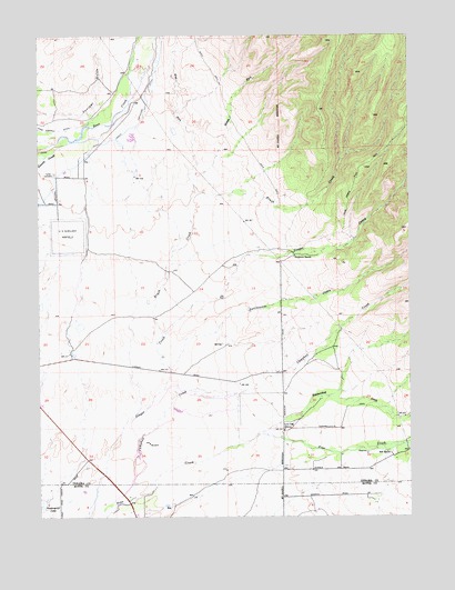
Richardson Springs NW, CA USGS Topographic Map
Click on map above to begin viewing in our Map Viewer.

This topographic map contains these locations and features:
Feature Name Type Latitude Longitude GNIS ID View Map
Bell RanchLocaleN39.8918°W121.8828°218989View Map
Brush CreekStreamN39.9202°W121.9614°219929View Map
Campbell CreekStreamN39.8757°W121.9794°1655098View Map
Carter CemeteryCemeteryN39.9640°W121.9955°220653View Map
Cone Kimball DitchCanalN39.9754°W121.9942°221443View Map
Deer Creek Flat TrailTrailN39.9613°W121.8941°1655099View Map
Deer Creek Irrigation DitchCanalN39.9760°W121.9697°233775View Map
Deer Creek Ranch AirportAirportN39.9503°W121.9957°1654096View Map
Juniper GulchValleyN39.9799°W121.9939°226391View Map
Live Oak SchoolSchoolN39.8977°W121.9183°227428View Map
McKenzie RanchLocaleN39.9185°W121.9900°1670247View Map
Middle Fork Brush CreekStreamN39.9596°W121.9478°234286View Map
Rattlesnake CreekStreamN39.9127°W121.9564°265204View Map
Stephens RanchLocaleN39.9429°W121.9147°235448View Map
Vandergrift LakeLakeN39.8793°W121.9996°237026View Map
West Fork Brush CreekStreamN39.9610°W121.9483°237466View Map
Zimmershed CreekStreamN39.8957°W121.9275°269395View Map

Note: Coordinates in the location and feature list above are referenced to NAD83 datum.


Copyright (C) 2008-2024 Ryan Niemi / Sunset Dynamics ... All Rights Reserved