TopoQuest Logo
Do you find TopoQuest useful?
Help keep TopoQuest running and adding new maps/features by donating!
Bitcoin:  19c7KJd3qBynnjoSw5npx9KScwjBe4ifkT
Litecoin:  LXs6TkuXGGXo1vDsWCkWVdjQX94eUKd6ui
Home View Maps Find Maps Find Places Resources & Links


Foster Island, California Topographic Map

USGS Map Title: Foster Island, CA
USGS Map MRC: 39122G1
DRG (GeoTIFF) Download: o39122g1.tif


Neighboring USGS Topographic Map Quads:


  Corning, CA  
39122H2
 

  Vina, CA  
39122H1
 

  Richardson Springs NW, CA  
39121H8
 

  Kirkwood, CA  
39122G2
 

  Foster Island, CA  
39122G1
 

  Nord, CA  
39121G8
 

  Orland, CA  
39122F2
 

  Hamilton City, CA  
39122F1
 

  Ord Ferry, CA  
39121F8


Map MRC Location:

N40°
W123°
N40°
W122°
H8 H7 H6 H5 H4 H3 H2 H1
G8 G7 G6 G5 G4 G3 G2 G1
F8 F7 F6 F5 F4 F3 F2 F1
E8 E7 E6 E5 E4 E3 E2 E1
D8 D7 D6 D5 D4 D3 D2 D1
C8 C7 C6 C5 C4 C3 C2 C1
B8 B7 B6 B5 B4 B3 B2 B1
A8 A7 A6 A5 A4 A3 A2 A1
N39°
W123°
N39°
W122°

Foster Island, CA USGS 1:24K Topographic Map Preview:
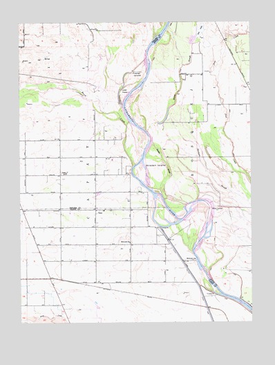
Foster Island, CA USGS Topographic Map
Click on map above to begin viewing in our Map Viewer.

This topographic map contains these locations and features:
Feature Name Type Latitude Longitude GNIS ID View Map
BosquejoCivilN39.8321°W122.0314°233536View Map
Burch CreekStreamN39.8146°W122.0647°220175View Map
CapayPopulated PlaceN39.7965°W122.0844°1655867View Map
CapayCivilN39.7665°W122.0678°240221View Map
Capay Assembly of God ChurchChurchN39.7760°W122.0850°1702519View Map
Capay Community Friends ChurchChurchN39.8115°W122.0853°1702508View Map
Capay Fire Protection DistrictBuildingN39.7995°W122.0849°2621794View Map
Capay Joint Union Elementary SchoolSchoolN39.7978°W122.0844°1702520View Map
Capay SchoolSchoolN39.8118°W122.1003°220572View Map
Country Bible ChurchChurchN39.7971°W122.0661°1702527View Map
Dicus SloughStreamN39.8293°W122.0564°222369View Map
Emery and Mitchell IslandIslandN39.7790°W122.0250°1666777View Map
Foster IslandIslandN39.8513°W122.0628°223728View Map
Goose Lake (historical)LakeN39.8738°W122.0136°1666780View Map
Hoodlum ChuteChannelN39.8268°W122.0680°1666119View Map
Jackstaff BendBendN39.8202°W122.0686°1666123View Map
Lower Foster IslandIslandN39.8443°W122.0686°227769View Map
McIntosh IslandIslandN39.7824°W122.0333°1702563View Map
McIntosh LandingLocaleN39.7757°W122.0308°1656156View Map
McIntosh SchoolSchoolN39.7829°W122.0664°228381View Map
Missouri BendBendN39.8346°W122.0583°1666794View Map
Snaden IslandIslandN39.8135°W122.0519°234740View Map
Snaden SloughStreamN39.7993°W122.0355°234741View Map
Soto LakeReservoirN39.8712°W122.0280°234900View Map
Sour Grass CreekStreamN39.8432°W122.0900°234914View Map
Wilson IslandIslandN39.8032°W122.0483°1666806View Map
Wilson LandingLocaleN39.7968°W122.0222°1656411View Map

Note: Coordinates in the location and feature list above are referenced to NAD83 datum.


Copyright (C) 2008-2024 Ryan Niemi / Sunset Dynamics ... All Rights Reserved