TopoQuest Logo
Do you find TopoQuest useful?
Help keep TopoQuest running and adding new maps/features by donating!
Bitcoin:  19c7KJd3qBynnjoSw5npx9KScwjBe4ifkT
Litecoin:  LXs6TkuXGGXo1vDsWCkWVdjQX94eUKd6ui
Home View Maps Find Maps Find Places Resources & Links


Rhyse, Missouri Topographic Map

USGS Map Title: Rhyse, MO
USGS Map MRC: 37091E6
DRG (GeoTIFF) Download: o37091e6.tif


Neighboring USGS Topographic Map Quads:


  Edgar Springs, MO  
37091F7
 

  Anutt, MO  
37091F6
 

  Salem, MO  
37091F5
 

  Maples, MO  
37091E7
 

  Rhyse, MO  
37091E6
 

  Darien, MO  
37091E5
 

  Licking, MO  
37091D7
 

  Montauk, MO  
37091D6
 

  Cedargrove, MO  
37091D5


Map MRC Location:

N38°
W92°
N38°
W91°
H8 H7 H6 H5 H4 H3 H2 H1
G8 G7 G6 G5 G4 G3 G2 G1
F8 F7 F6 F5 F4 F3 F2 F1
E8 E7 E6 E5 E4 E3 E2 E1
D8 D7 D6 D5 D4 D3 D2 D1
C8 C7 C6 C5 C4 C3 C2 C1
B8 B7 B6 B5 B4 B3 B2 B1
A8 A7 A6 A5 A4 A3 A2 A1
N37°
W92°
N37°
W91°

Rhyse, MO USGS 1:24K Topographic Map Preview:
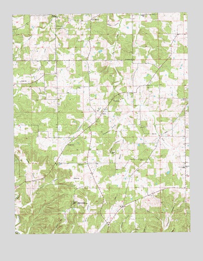
Rhyse, MO USGS Topographic Map
Click on map above to begin viewing in our Map Viewer.

This topographic map contains these locations and features:
Feature Name Type Latitude Longitude GNIS ID View Map
Berry CemeteryCemeteryN37.5561°W91.6521°713993View Map
Bethlehem SchoolSchoolN37.5756°W91.6777°714110View Map
Blue HollowValleyN37.5017°W91.6438°738192View Map
Campbell BranchStreamN37.5864°W91.6735°738188View Map
Campbell CemeteryCemeteryN37.5506°W91.7121°742091View Map
Coon Den HollowValleyN37.5912°W91.7363°738187View Map
Dry Fork CemeteryCemeteryN37.5756°W91.6263°742090View Map
Dry Fork ChurchChurchN37.5753°W91.6251°717115View Map
Fudge Family CemeteryCemeteryN37.5299°W91.7310°2725621View Map
Fudge HollowValleyN37.5553°W91.7360°718275View Map
Grave HollowValleyN37.5237°W91.7377°738191View Map
Green Forest CemeteryCemeteryN37.5383°W91.6289°2725623View Map
Green Forest SchoolSchoolN37.5378°W91.6290°718788View Map
Humes CreekStreamN37.5714°W91.6660°719990View Map
Johnson CemeteryCemeteryN37.5467°W91.6799°720355View Map
Johnson HollowValleyN37.5545°W91.6735°738190View Map
JoyPopulated PlaceN37.5145°W91.6743°740975View Map
Joy ChurchChurchN37.5412°W91.6604°720443View Map
Kissock CemeteryCemeteryN37.5870°W91.7446°720653View Map
Kissock CreekStreamN37.6220°W91.7218°720654View Map
Leeds School (historical)SchoolN37.5359°W91.6751°720892View Map
Montauk Rural Fire DepartmentBuildingN37.5232°W91.6882°2621373View Map
Montauk State Public Hunting AreaLocaleN37.5167°W91.7077°742094View Map
Mount Herman School (historical)SchoolN37.6200°W91.7107°722760View Map
Mount Hermon CemeteryCemeteryN37.6174°W91.7151°2702107View Map
Mount Hermon ChurchChurchN37.6178°W91.7146°742088View Map
Mount Pleasant School (historical)SchoolN37.5778°W91.7260°722871View Map
Mund DamDamN37.6050°W91.6852°765261View Map
New Harmony ChurchChurchN37.5981°W91.6646°723209View Map
Oakland SchoolSchoolN37.6206°W91.6654°723673View Map
Pilot Grove ChurchChurchN37.6245°W91.6627°724346View Map
RangerPopulated PlaceN37.5584°W91.7315°740147View Map
RhysePopulated PlaceN37.5692°W91.6863°725242View Map
Robnett CemeteryCemeteryN37.5753°W91.6788°742089View Map
Skiles SpringSpringN37.6237°W91.7193°738185View Map
Smoky HollowValleyN37.6228°W91.6740°738186View Map
Smoky HollowPopulated PlaceN37.6223°W91.6929°726645View Map
Swanson BranchStreamN37.5645°W91.6726°738189View Map
Township of TexasCivilN37.5630°W91.6767°766610View Map
Wallace CemeteryCemeteryN37.5314°W91.7079°742093View Map
White CemeteryCemeteryN37.5392°W91.7010°742092View Map
Woolford CemeteryCemeteryN37.6236°W91.6551°729141View Map
Zion ChurchChurchN37.5400°W91.7204°735931View Map
Zion School (historical)SchoolN37.5339°W91.7274°729256View Map

Note: Coordinates in the location and feature list above are referenced to NAD83 datum.


Copyright (C) 2008-2024 Ryan Niemi / Sunset Dynamics ... All Rights Reserved