TopoQuest Logo
Do you find TopoQuest useful?
Help keep TopoQuest running and adding new maps/features by donating!
Bitcoin:  19c7KJd3qBynnjoSw5npx9KScwjBe4ifkT
Litecoin:  LXs6TkuXGGXo1vDsWCkWVdjQX94eUKd6ui
Home View Maps Find Maps Find Places Resources & Links


Darien, Missouri Topographic Map

USGS Map Title: Darien, MO
USGS Map MRC: 37091E5
DRG (GeoTIFF) Download: o37091e5.tif


Neighboring USGS Topographic Map Quads:


  Anutt, MO  
37091F6
 

  Salem, MO  
37091F5
 

  Short Bend, MO  
37091F4
 

  Rhyse, MO  
37091E6
 

  Darien, MO  
37091E5
 

  Doss, MO  
37091E4
 

  Montauk, MO  
37091D6
 

  Cedargrove, MO  
37091D5
 

  Gladden, MO  
37091D4


Map MRC Location:

N38°
W92°
N38°
W91°
H8 H7 H6 H5 H4 H3 H2 H1
G8 G7 G6 G5 G4 G3 G2 G1
F8 F7 F6 F5 F4 F3 F2 F1
E8 E7 E6 E5 E4 E3 E2 E1
D8 D7 D6 D5 D4 D3 D2 D1
C8 C7 C6 C5 C4 C3 C2 C1
B8 B7 B6 B5 B4 B3 B2 B1
A8 A7 A6 A5 A4 A3 A2 A1
N37°
W92°
N37°
W91°

Darien, MO USGS 1:24K Topographic Map Preview:
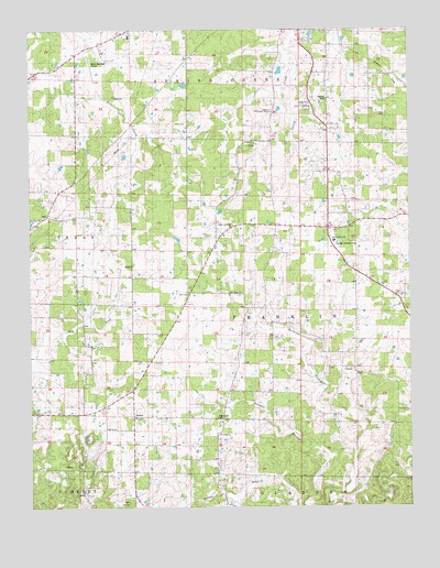
Darien, MO USGS Topographic Map
Click on map above to begin viewing in our Map Viewer.

This topographic map contains these locations and features:
Feature Name Type Latitude Longitude GNIS ID View Map
Cage CemeteryCemeteryN37.5234°W91.5638°742095View Map
Cage SchoolSchoolN37.5237°W91.5651°715182View Map
Corinth Baptist Church CemeteryCemeteryN37.5194°W91.5633°2725617View Map
Corinth ChurchChurchN37.5189°W91.5635°716317View Map
CusterPopulated PlaceN37.5364°W91.5196°716611View Map
DarienPopulated PlaceN37.5200°W91.5924°716666View Map
Dent CountyCivilN37.6066°W91.5079°758487View Map
Dent County FarmLocaleN37.6239°W91.5263°741506View Map
Dry Fork School (historical)SchoolN37.5773°W91.6190°717116View Map
Hobson School (historical)SchoolN37.5320°W91.6088°719654View Map
JackPopulated PlaceN37.5762°W91.6213°735668View Map
Jamison Full Gospel TempleChurchN37.6034°W91.5451°742100View Map
Jamison SchoolSchoolN37.6031°W91.5454°720257View Map
KFPS-AM (Salem)TowerN37.6050°W91.5465°759252View Map
Love CemeteryCemeteryN37.6078°W91.5971°742101View Map
New HopeLocaleN37.5570°W91.5593°735979View Map
New Hope ChurchChurchN37.5556°W91.5593°742096View Map
New Hope SchoolSchoolN37.5550°W91.5601°723268View Map
Oak Hill R-1 SchoolSchoolN37.5695°W91.5249°742098View Map
Pleasant View School (historical)SchoolN37.5723°W91.5088°735794View Map
Salem Apostolic ChurchChurchN37.5737°W91.5582°742097View Map
Salem Memorial AirportAirportN37.6176°W91.6052°758930View Map
South Ozark School (historical)SchoolN37.5325°W91.5093°726774View Map
Stagner CemeteryCemeteryN37.6067°W91.5271°742099View Map
Township of FranklinCivilN37.5493°W91.5171°766601View Map
West Whiteoak SchoolSchoolN37.6056°W91.5871°735909View Map

Note: Coordinates in the location and feature list above are referenced to NAD83 datum.


Copyright (C) 2008-2024 Ryan Niemi / Sunset Dynamics ... All Rights Reserved