TopoQuest Logo
Do you find TopoQuest useful?
Help keep TopoQuest running and adding new maps/features by donating!
Bitcoin:  19c7KJd3qBynnjoSw5npx9KScwjBe4ifkT
Litecoin:  LXs6TkuXGGXo1vDsWCkWVdjQX94eUKd6ui
Home View Maps Find Maps Find Places Resources & Links


Renfroe, Mississippi Topographic Map

USGS Map Title: Renfroe, MS
USGS Map MRC: 32089G4
DRG (GeoTIFF) Download: o32089g4.tif


Neighboring USGS Topographic Map Quads:


  Singleton, MS  
32089H5
 

  Zama, MS  
32089H4
 

  Four Corners, MS  
32089H3
 

  Conway, MS  
32089G5
 

  Renfroe, MS  
32089G4
 

  Edinburg, MS  
32089G3
 

  Carthage, MS  
32089F5
 

  McAfee, MS  
32089F4
 

  Madden, MS  
32089F3


Map MRC Location:

N33°
W90°
N33°
W89°
H8 H7 H6 H5 H4 H3 H2 H1
G8 G7 G6 G5 G4 G3 G2 G1
F8 F7 F6 F5 F4 F3 F2 F1
E8 E7 E6 E5 E4 E3 E2 E1
D8 D7 D6 D5 D4 D3 D2 D1
C8 C7 C6 C5 C4 C3 C2 C1
B8 B7 B6 B5 B4 B3 B2 B1
A8 A7 A6 A5 A4 A3 A2 A1
N32°
W90°
N32°
W89°

Renfroe, MS USGS 1:24K Topographic Map Preview:
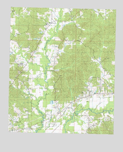
Renfroe, MS USGS Topographic Map
Click on map above to begin viewing in our Map Viewer.

This topographic map contains these locations and features:
Feature Name Type Latitude Longitude GNIS ID View Map
Antioch CemeteryCemeteryN32.8257°W89.3862°707060View Map
Antioch ChurchChurchN32.8254°W89.3848°666313View Map
Atkins CemeteryCemeteryN32.8487°W89.4934°666416View Map
Battle BluffPopulated PlaceN32.7849°W89.4167°707062View Map
Battle BranchStreamN32.8224°W89.4526°666571View Map
Beckham BranchStreamN32.7737°W89.4028°666740View Map
Cobbs CreekStreamN32.8104°W89.4573°668635View Map
Collier School (historical)SchoolN32.7751°W89.4242°707077View Map
Coon CreekStreamN32.8643°W89.4428°668801View Map
CoosaPopulated PlaceN32.8424°W89.4223°691786View Map
County Line ChurchChurchN32.7754°W89.4306°668873View Map
Edinburg School (historical)SchoolN32.8076°W89.3903°707087View Map
Edinburg Volunteer Fire DepartmentBuildingN32.7871°W89.4096°2665844View Map
GoshenPopulated PlaceN32.7621°W89.4959°707103View Map
Goshen CemeteryCemeteryN32.7596°W89.4901°707104View Map
Goshen ChurchChurchN32.7604°W89.4912°670545View Map
Goshen School (historical)SchoolN32.7607°W89.4915°707105View Map
Gray CemeteryCemeteryN32.7643°W89.4406°670629View Map
Harrell BranchStreamN32.7812°W89.4645°670962View Map
Harrell CemeteryCemeteryN32.8051°W89.4781°707110View Map
Holiness Church (historical)ChurchN32.8582°W89.4565°707113View Map
Horne BranchStreamN32.8535°W89.4440°671459View Map
Indian BranchStreamN32.7660°W89.4251°671671View Map
Leake Memorial GardensCemeteryN32.7543°W89.4751°691094View Map
Lee LakeStreamN32.7876°W89.4567°672383View Map
LutherPopulated PlaceN32.8168°W89.4809°707118View Map
Mary Bethel ChurchChurchN32.7712°W89.4798°673208View Map
MidwayPopulated PlaceN32.8076°W89.4409°692071View Map
Midway Baptist ChurchChurchN32.8085°W89.4412°707124View Map
Midway CemeteryCemeteryN32.8079°W89.4412°707125View Map
Mill BranchStreamN32.8132°W89.4556°673583View Map
Mount Charity ChurchChurchN32.8707°W89.4976°673976View Map
Mount Olive ChurchChurchN32.7904°W89.3995°674138View Map
New Prospect ChurchChurchN32.7585°W89.4003°674805View Map
Pearl HillPopulated PlaceN32.7890°W89.4042°707132View Map
Pearl Hill ChurchChurchN32.7929°W89.4059°675539View Map
Pearl Hill School (historical)SchoolN32.7940°W89.4065°707133View Map
Pickins CreekStreamN32.8304°W89.4956°675711View Map
Pole Bridge BranchStreamN32.7768°W89.4662°676176View Map
R and R Farm Ponds DamDamN32.8285°W89.4851°681683View Map
Rance Johnston Catfish Pond DamDamN32.7885°W89.4267°681651View Map
Reformation CemeteryCemeteryN32.8179°W89.4867°707141View Map
Reformation Cumberland Presbyterian ChurchChurchN32.8182°W89.4873°676588View Map
Reformation School (historical)SchoolN32.8185°W89.4873°707142View Map
Reformation Volunteer Fire DepartmentBuildingN32.8018°W89.4880°2665816View Map
RenfroePopulated PlaceN32.8596°W89.4512°676601View Map
Renfroe Baptist ChurchChurchN32.8590°W89.4567°707146View Map
Renfroe ChurchChurchN32.8593°W89.4565°691097View Map
Renfroe School (historical)SchoolN32.8582°W89.4562°707147View Map
Smith Pond DamDamN32.7785°W89.4484°681645View Map
Standing Cypress CreekStreamN32.7715°W89.3878°685006View Map
Stewart CemeteryCemeteryN32.7904°W89.4140°678282View Map
SunrisePopulated PlaceN32.7707°W89.4390°678431View Map
Sunrise Baptist ChurchChurchN32.7721°W89.4406°707163View Map
Sunrise CemeteryCemeteryN32.7718°W89.4403°707164View Map
Sunrise ChurchChurchN32.7715°W89.4403°691093View Map
Supervisor District 1CivilN32.8316°W89.4081°711948View Map
WillistonPopulated PlaceN32.7621°W89.3917°707179View Map
Zion Hill CemeteryCemeteryN32.8446°W89.4178°707182View Map
Zion Hill Primitive Baptist ChurchChurchN32.8432°W89.4187°707184View Map

Note: Coordinates in the location and feature list above are referenced to NAD83 datum.


Copyright (C) 2008-2024 Ryan Niemi / Sunset Dynamics ... All Rights Reserved