TopoQuest Logo
Do you find TopoQuest useful?
Help keep TopoQuest running and adding new maps/features by donating!
Bitcoin:  19c7KJd3qBynnjoSw5npx9KScwjBe4ifkT
Litecoin:  LXs6TkuXGGXo1vDsWCkWVdjQX94eUKd6ui
Home View Maps Find Maps Find Places Resources & Links


Red Cinder, California Topographic Map

USGS Map Title: Red Cinder, CA
USGS Map MRC: 40121D2
DRG (GeoTIFF) Download: o40121d2.tif


Neighboring USGS Topographic Map Quads:


  Prospect Peak, CA  
40121E3
 

  Bogard Buttes, CA  
40121E2
 

  Pine Creek Valley, CA  
40121E1
 

  Mount Harkness, CA  
40121D3
 

  Red Cinder, CA  
40121D2
 

  Swain Mountain, CA  
40121D1
 

  Stover Mountain, CA  
40121C3
 

  Chester, CA  
40121C2
 

  Westwood West, CA  
40121C1


Map MRC Location:

N41°
W122°
N41°
W121°
H8 H7 H6 H5 H4 H3 H2 H1
G8 G7 G6 G5 G4 G3 G2 G1
F8 F7 F6 F5 F4 F3 F2 F1
E8 E7 E6 E5 E4 E3 E2 E1
D8 D7 D6 D5 D4 D3 D2 D1
C8 C7 C6 C5 C4 C3 C2 C1
B8 B7 B6 B5 B4 B3 B2 B1
A8 A7 A6 A5 A4 A3 A2 A1
N40°
W122°
N40°
W121°

Red Cinder, CA USGS 1:24K Topographic Map Preview:
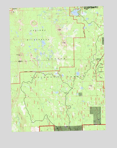
Red Cinder, CA USGS Topographic Map
Click on map above to begin viewing in our Map Viewer.

This topographic map contains these locations and features:
Feature Name Type Latitude Longitude GNIS ID View Map
Beauty LakeLakeN40.4533°W121.2103°218939View Map
Betty LakeLakeN40.4873°W121.1483°219100View Map
Black Cinder RockSummitN40.4524°W121.2375°219348View Map
Bond ValleyValleyN40.4428°W121.1344°219630View Map
Caribou WildernessReserveN40.4889°W121.2142°1665844View Map
Cooper SwampSwampN40.4928°W121.1526°254773View Map
Cummings SpringSpringN40.4602°W121.1489°221911View Map
Cypress LakeLakeN40.4866°W121.1881°221955View Map
Dillon CreekStreamN40.3796°W121.1730°222390View Map
Echo LakeLakeN40.4324°W121.1616°222956View Map
Emerald LakeLakeN40.4965°W121.1851°223177View Map
Evelyn LakeLakeN40.4470°W121.2151°223290View Map
Hay MeadowSwampN40.4328°W121.1907°225045View Map
Heckle RanchLocaleN40.4141°W121.1775°225112View Map
Hidden LakesLakeN40.4501°W121.1975°225248View Map
Indian MeadowSwampN40.4379°W121.1916°225887View Map
Long LakeLakeN40.4638°W121.2067°227582View Map
North CaribouSummitN40.4770°W121.1860°229620View Map
North Divide LakeLakeN40.4956°W121.2051°229632View Map
Posey LakeLakeN40.4576°W121.2170°230975View Map
Red CinderSummitN40.4959°W121.2469°273238View Map
Rim LakeLakeN40.4928°W121.1862°231592View Map
Robbers SpringSpringN40.4563°W121.1252°231672View Map
Rock SpringSpringN40.3971°W121.1664°274884View Map
Rocky Knoll CampgroundLocaleN40.4991°W121.1564°231774View Map
Shotoverin LakeLakeN40.4813°W121.1450°233060View Map
Silver Beach Picnic AreaLocaleN40.4971°W121.1597°1802897View Map
Silver Bowl CampgroundLocaleN40.4993°W121.1641°1665905View Map
Silver LakeLakeN40.4942°W121.1631°277448View Map
South CaribouSummitN40.4637°W121.1804°234949View Map
South Divide LakeLakeN40.4918°W121.2091°234956View Map
Star ButteSummitN40.4200°W121.1458°235386View Map
Star LakeLakeN40.4179°W121.1570°235391View Map
The HoleSwampN40.4279°W121.1322°255133View Map
Trail LakeLakeN40.4785°W121.1517°236511View Map

Note: Coordinates in the location and feature list above are referenced to NAD83 datum.


Copyright (C) 2008-2024 Ryan Niemi / Sunset Dynamics ... All Rights Reserved